Po Klong Garai hill
The Cham tower complex stands on a small hill near the Tháp Chàm area. On the map it is a compact green patch marking one of the best-preserved Cham sites in Vietnam.
Nunap assingata plakatia minimalistiusoq · VN
11.5643° N / 108.9886° E
A low coastal city by a river mouth and the South China Sea, with Cham towers on its western hill



Illoqarfik ataaseq, misigisat tallimat
Stiili toqqaruk illumi qanoq isikkoqarnersoq takuniassallugu. Stiilit tamaasa akiisa assigiipput — naqitat, qaammatitat imaluunniit HD-filit.
 Pikselit tamakkerlugit · 24 × 36″ naqitat filii
Naqitamut erseqqissoq
Tamanna naqitat filiata 100%-ia ilaannaanga. Poster tamaasa — naqitat, qaammatitallu imaluunniit aalajangersimasumik ikkussat — serverivitsinni 300 DPI-mik, 7,200 × 10,800 pikselinnut tikillugu, suliarineqarput, taamaattumik aqquserpiit mikinerpaaqisut 24 × 36″-imi naqitami erseqqissuarlutik takuneqarsinnaapput.
Sarfamiippoq


Nunap assinga
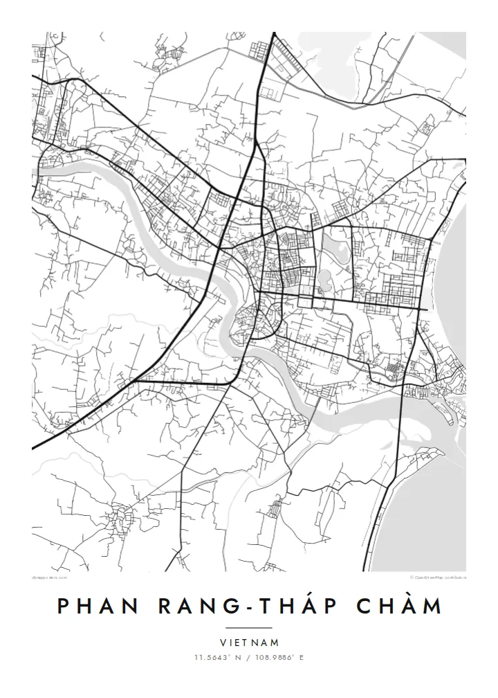
Phan Rang-Tháp Chàm lies in the former Ninh Thuận province, now part of Khánh Hòa, on one of the driest stretches of the Vietnamese coast. The city spreads across flat ground between the Dinh River and the sea. A central grid of streets gives way at the edges to irrigated fields and the vineyards the area is known for.
The double name reflects two parts of one city. Phan Rang is the older commercial centre near the coast. Tháp Chàm, to the west, takes its name from the Cham towers of Po Klong Garai, built around the turn of the fourteenth century on a low hill. The region's Cham heritage remains visible in its temples, villages and festivals.
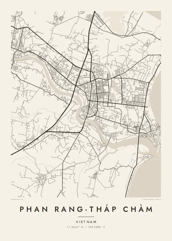
A Phan Rang-Tháp Chàm map poster shows a city stretched between river, railway and sea. It holds a dense core, the long, smooth curve of Ninh Chữ beach to the north-east and the open, sun-baked farmland beyond. In black and white the calm coastline and simple grid make an unusually clear, balanced composition.
The Cham tower complex stands on a small hill near the Tháp Chàm area. On the map it is a compact green patch marking one of the best-preserved Cham sites in Vietnam.
North-east of the centre, the shore curves in a long, smooth bay lined with beachfront roads, one of the cleanest lines in the composition.
The Dinh River runs past the south of the city to the sea. Irrigated fields and vineyards line it, standing out in an otherwise very dry landscape.
Nammineq ilusilersoruk
Ulloq, ateq imaluunniit oqaaseqaatitit ilanngukkit, ilusaa, angissusaa imaluunniit sammivia allanngortiguk.
Akeqanngitsoq takuniassaq qaffasissuseq appasinnerusoq ilisarnaataqarluni. Naqitat aamma HD filit 300 DPI-mik, 7,200 × 10,800 px-nut tikillugu, ilisarnaataqanngitsumik suliarineqarput.
Sooq Phan Rang-Tháp Chàm
This map suits people with roots in the region's Cham or Kinh communities, travellers who drove the coast road between Nha Trang and Phan Thiết, or anyone who remembers the grapes, the wind and the sea. Its open, airy layout fits a bright, uncluttered room.
Set your own title and subtitle, add a date and edit the coordinates line. The Sand style echoes the dry coastal landscape, and Classic black & white, Noir, Paper and Blueprint are also available. Choose the $9 HD bundle in six sizes or a matte print with an optional frame.
Phan Rang-Tháp Chàm posteri tunisaqarfigiuk| Naqitap angissusia | Erseqqissusia | Fiilit |
|---|---|---|
| 30 × 40 cm11.8 × 15.7″ | 3,543 × 4,724 px | PNG · PDF |
| 29.7 × 42 cm (A3)11.7 × 16.5″ | 3,508 × 4,961 px | PNG · PDF |
| 42 × 59.4 cm (A2)16.5 × 23.4″ | 4,961 × 7,016 px | PNG · PDF |
| 45.7 × 61 cm18 × 24″ | 5,400 × 7,200 px | PNG · PDF |
| 50 × 70 cm19.7 × 27.6″ | 5,906 × 8,268 px | PNG · PDF |
| 61 × 91.4 cm24 × 36″ | 7,200 × 10,800 px | PNG · PDF |
Sanilliussigaanni takutitsineq akeqanngitsoq 900 px-inik silissuseqarpoq, nalunaaqutaqarpoq skærmimilu takuneqarnissaanut naatsorsuussaalluni. HD-fiilit sammivimmi tamarmi 8-riaammik erseqqinnerusinnaapput plakatitullu angissusilimmi tamarmi kusanartumik naqiterneqarsinnaallutik.
Qupperneq qulaani stiili toqqaruk, taavalu Poster Naqitat toqqarlugu — angissusia, kissaatigigukku qaammatitaaleraluarlutit — imaluunniit Digital HD Filit toqqaruk. Akiliuteqarnissaq ataatsimik pisarpoq, akiliutigineqareerpat tunisassat qupperneraat immiaassaaq.
Naqinneqarpoq assigiinngitsumik pitsaasumik 200 gsm-imik matte-mik paapimi, angissusit arfinillit ilaanni, 30 × 40 cm-miit 24 × 36″-mut. Naqitat posterit $39-miit aallartissapput, assartuineq ilanngullugu.
Aap. Qaammatit qernertumik, qaqortumik, naturimik eegimik imaluunniit qernertumik qisummik pilersorlugu toqqaruk. Igalaaq qisuutinnavianngitsoq ilaalluni tunniunneqarpoq, aammalu illumut qaleriiffigineqarnissamut piareersimavoq. Qaammatitat posterit $99-miit aallartissapput, assartuineq ilanngullugu.
Nunani 60+-ni nassiussineq akeqanngilaq. Posteri tamaasa nunani 30+-ni naqitsiviit ilaanni qanittoq naqitsivigaa, ullunillu 3–7-ni sulisarfiusuni tikittarpoq. Pisinnaaneq aamma malinnaaffigineq Pisiatta atorlugit malinnaaffigisinnaavat. Nunat ilaanni sapaatit-akunneri 2–5 atorneqartarput, nunanilu suliffissanut suli nassiussinngisatsinni, akiliinnginnermi nittartakkap oqaluuttarpaatit.
Tikinneranit ullut 14-ni ingerlanngata ammasumik assiliaq nassiutigiuk, naqissaanngitsoq nutaamik naqinniassavarput imaluunniit akiliutit utertissavatit.
Aap. Qupperami editorimi, qulequtaq, qulequtaa ataani allaassutaq aamma sumiiffiup killiffiginera allanngortikkit kissaatigisatit malillugit, stiilillu angissusiallu toqqarlugit. Naqitat, qaammatitat aamma digitalit tunisassat tamarmik ilinnut sanaartorsimasoq atorput.
$9-mik akilerlugu 300 DPI PNG-mik aamma naqinnissamut piareersimasumik PDF-imik, angissusit arfinillit tamaasa, ilisarnaataqanngitsumik, sumiluunniit naqinniarnissamut pisaqassaatit. Suli isumaqanngiluit? Siullermik ilisarnaatilik akeqanngitsoq takuniassaq aallaqqaataani ikkussigit.
Qanittuni
