River confluence
The Pho Chhu and Mo Chhu, often called the father and mother rivers, join just below the dzong and continue down the valley as a single, wider channel.
Nunap assingata plakatia minimalistiusoq · BT
27.5914° N / 89.8774° E
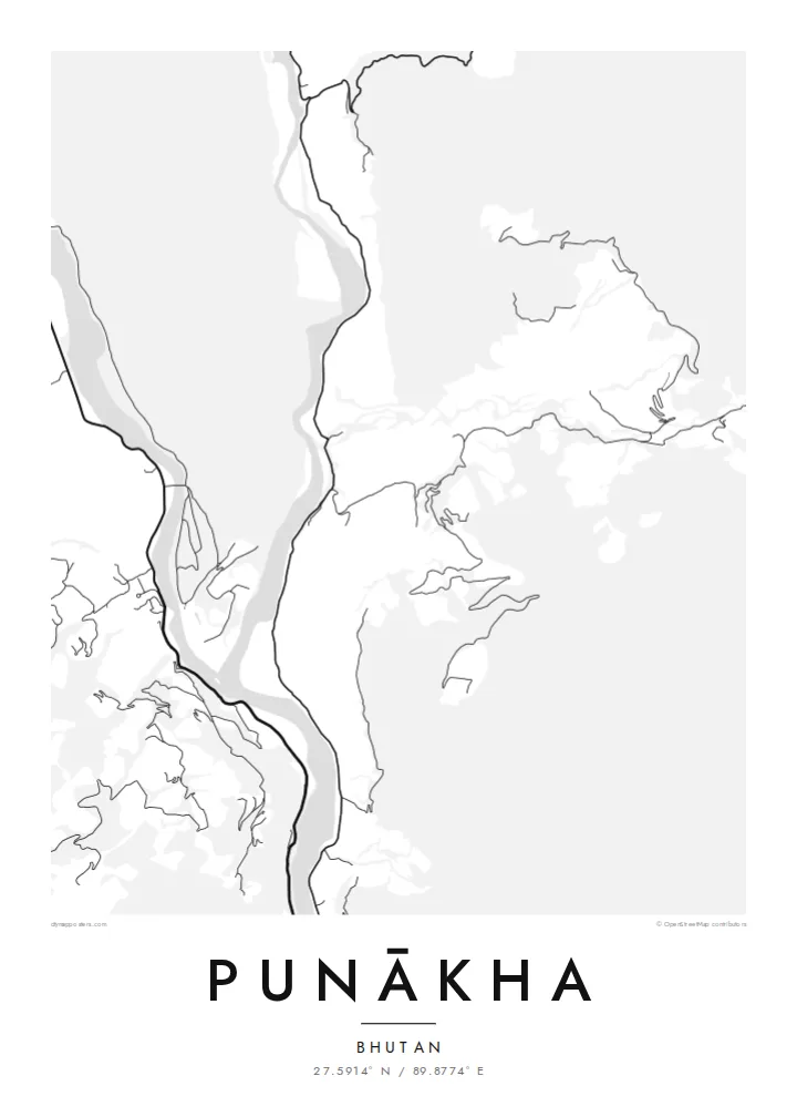
Two glacial rivers meeting on a warm valley floor, with a fortress set on the point of land where they join.


Illoqarfik ataaseq, misigisat tallimat
Stiili toqqaruk illumi qanoq isikkoqarnersoq takuniassallugu. Stiilit tamaasa akiisa assigiipput — naqitat, qaammatitat imaluunniit HD-filit.
 Pikselit tamakkerlugit · 24 × 36″ naqitat filii
Naqitamut erseqqissoq
Tamanna naqitat filiata 100%-ia ilaannaanga. Poster tamaasa — naqitat, qaammatitallu imaluunniit aalajangersimasumik ikkussat — serverivitsinni 300 DPI-mik, 7,200 × 10,800 pikselinnut tikillugu, suliarineqarput, taamaattumik aqquserpiit mikinerpaaqisut 24 × 36″-imi naqitami erseqqissuarlutik takuneqarsinnaapput.
Sarfamiippoq


Nunap assinga
Punākha sits low for Bhutan, in a broad valley at around 1,200 metres where the Pho Chhu and the Mo Chhu flow together. From above, the two rivers make up most of the picture: pale ribbons braiding across gravel bars, then merging into one channel that heads south. Roads keep to the valley sides, and houses gather on the few flat terraces the slopes allow.
On the narrow spit between the rivers stands Punākha Dzong. This fortress-monastery was the seat of government while Punākha served as Bhutan's capital, a role it held until the 1950s, and it is still the winter residence of the country's central monastic body. On the map the dzong is a compact block pressed against the water, reached by a covered bridge across the Mo Chhu.
A Punākha map poster keeps that geography plain. There is no dense grid to fill the frame, so the rivers, the valley road and the scattered lanes of the modern town carry the drawing. The result is quieter than most city maps and closer to a landscape study, with the confluence as its natural centre of gravity.
The Pho Chhu and Mo Chhu, often called the father and mother rivers, join just below the dzong and continue down the valley as a single, wider channel.
The fortress fills the tip of land between the two rivers. Its position makes it one of the most recognisable shapes on any map of the valley.
Near the dzong, a long pedestrian suspension bridge crosses the Pho Chhu. It is a thin, taut line on the map linking the paths and villages on either bank.
Nammineq ilusilersoruk
Ulloq, ateq imaluunniit oqaaseqaatitit ilanngukkit, ilusaa, angissusaa imaluunniit sammivia allanngortiguk.
Akeqanngitsoq takuniassaq qaffasissuseq appasinnerusoq ilisarnaataqarluni. Naqitat aamma HD filit 300 DPI-mik, 7,200 × 10,800 px-nut tikillugu, ilisarnaataqanngitsumik suliarineqarput.
Sooq Punākha
People who have walked or travelled through western Bhutan often want something that recalls the whole valley rather than a single photograph. A map of Punākha does this with line alone: two rivers, one fortress and a road following the water. It suits a study, a hallway or any corner where detail can be read slowly.
You can set your own title and subtitle, and replace the coordinates line with a date or a note about the journey. There are five styles: Classic black & white, Noir, Paper, Blueprint and Sand. Paper and Sand suit the softer valley light. Download the HD files for $9 or order a matte print, framed or unframed.
Punākha posteri tunisaqarfigiuk| Naqitap angissusia | Erseqqissusia | Fiilit |
|---|---|---|
| 30 × 40 cm11.8 × 15.7″ | 3,543 × 4,724 px | PNG · PDF |
| 29.7 × 42 cm (A3)11.7 × 16.5″ | 3,508 × 4,961 px | PNG · PDF |
| 42 × 59.4 cm (A2)16.5 × 23.4″ | 4,961 × 7,016 px | PNG · PDF |
| 45.7 × 61 cm18 × 24″ | 5,400 × 7,200 px | PNG · PDF |
| 50 × 70 cm19.7 × 27.6″ | 5,906 × 8,268 px | PNG · PDF |
| 61 × 91.4 cm24 × 36″ | 7,200 × 10,800 px | PNG · PDF |
Sanilliussigaanni takutitsineq akeqanngitsoq 900 px-inik silissuseqarpoq, nalunaaqutaqarpoq skærmimilu takuneqarnissaanut naatsorsuussaalluni. HD-fiilit sammivimmi tamarmi 8-riaammik erseqqinnerusinnaapput plakatitullu angissusilimmi tamarmi kusanartumik naqiterneqarsinnaallutik.
Qupperneq qulaani stiili toqqaruk, taavalu Poster Naqitat toqqarlugu — angissusia, kissaatigigukku qaammatitaaleraluarlutit — imaluunniit Digital HD Filit toqqaruk. Akiliuteqarnissaq ataatsimik pisarpoq, akiliutigineqareerpat tunisassat qupperneraat immiaassaaq.
Naqinneqarpoq assigiinngitsumik pitsaasumik 200 gsm-imik matte-mik paapimi, angissusit arfinillit ilaanni, 30 × 40 cm-miit 24 × 36″-mut. Naqitat posterit $39-miit aallartissapput, assartuineq ilanngullugu.
Aap. Qaammatit qernertumik, qaqortumik, naturimik eegimik imaluunniit qernertumik qisummik pilersorlugu toqqaruk. Igalaaq qisuutinnavianngitsoq ilaalluni tunniunneqarpoq, aammalu illumut qaleriiffigineqarnissamut piareersimavoq. Qaammatitat posterit $99-miit aallartissapput, assartuineq ilanngullugu.
Nunani 60+-ni nassiussineq akeqanngilaq. Posteri tamaasa nunani 30+-ni naqitsiviit ilaanni qanittoq naqitsivigaa, ullunillu 3–7-ni sulisarfiusuni tikittarpoq. Pisinnaaneq aamma malinnaaffigineq Pisiatta atorlugit malinnaaffigisinnaavat. Nunat ilaanni sapaatit-akunneri 2–5 atorneqartarput, nunanilu suliffissanut suli nassiussinngisatsinni, akiliinnginnermi nittartakkap oqaluuttarpaatit.
Tikinneranit ullut 14-ni ingerlanngata ammasumik assiliaq nassiutigiuk, naqissaanngitsoq nutaamik naqinniassavarput imaluunniit akiliutit utertissavatit.
Aap. Qupperami editorimi, qulequtaq, qulequtaa ataani allaassutaq aamma sumiiffiup killiffiginera allanngortikkit kissaatigisatit malillugit, stiilillu angissusiallu toqqarlugit. Naqitat, qaammatitat aamma digitalit tunisassat tamarmik ilinnut sanaartorsimasoq atorput.
$9-mik akilerlugu 300 DPI PNG-mik aamma naqinnissamut piareersimasumik PDF-imik, angissusit arfinillit tamaasa, ilisarnaataqanngitsumik, sumiluunniit naqinniarnissamut pisaqassaatit. Suli isumaqanngiluit? Siullermik ilisarnaatilik akeqanngitsoq takuniassaq aallaqqaataani ikkussigit.
Qanittuni
