Arroyo de las Vacas
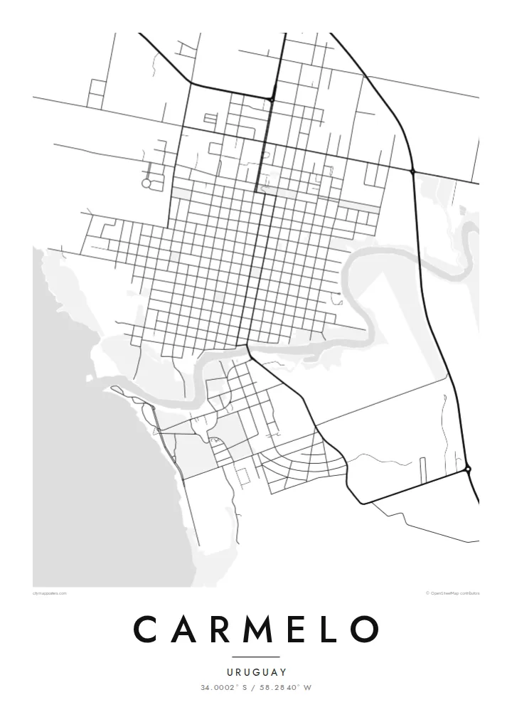
The creek curves along the edge of town before reaching the Río de la Plata. It separates the grid from the green land opposite and gives the map its main curve.
ផូស្ទ័រផែនទីបែបសាមញ្ញ · អ៊ុយរូហ្គាយ
34.0002° S / 58.2840° W
A riverside grid on the Río de la Plata, split by a creek and joined by an old swing bridge.


ទីក្រុងមួយ អារម្មណ៍ប្រាំ
ចុចលើម៉ូតណាមួយ ដើម្បីមើលវានៅលើជញ្ជាំង។ គ្រប់ម៉ូតទាំងអស់មានតម្លៃដូចគ្នា — មិនថាបោះពុម្ព ធ្វើស៊ុម ឬជាឯកសារ HD។
 ភីកសែលពិតប្រាកដ · ឯកសារបោះពុម្ព 24 × 36″
ច្បាស់ល្អសម្រាប់បោះពុម្ព
នេះជារូបភាពពង្រីក 100% នៃឯកសារបោះពុម្ពពិតប្រាកដ។ ផ្ទាំងគ្រប់សន្លឹក — មិនថាបោះពុម្ព ធ្វើស៊ុម ឬទាញយក — ត្រូវបានបង្កើតនៅលើម៉ាស៊ីនមេរបស់យើងក្នុងគុណភាព 300 DPI រហូតដល់ 7,200 × 10,800 ភីកសែល ដូច្នេះសូម្បីតែផ្លូវតូចបំផុតក៏នៅតែច្បាស់នៅលើក្រដាសបោះពុម្ពទំហំ 24 × 36″។
នៅលើជញ្ជាំង


ផែនទី
Carmelo sits in the department of Colonia, where the Arroyo de las Vacas meets the wide, brown estuary of the Río de la Plata. The town was founded in 1816 under José Gervasio Artigas. Its plan follows the regular Spanish colonial grid, with square blocks running inland from the waterfront and a central plaza not far from the creek.
The creek is the defining line on the map. It separates the town from the green ground to the south and is crossed by an early twentieth-century swing bridge, the first of its kind in Uruguay and still a local emblem. Boats moor along the arroyo, and launches leave for the Argentine delta across the water.
The Carmelo map poster shows this meeting of grid, creek and estuary with unusual clarity. Streets end cleanly at the shoreline, the arroyo winds out toward the river, and the farmland beyond turns into open space. It is a balanced, legible composition for anyone who knows this quiet corner of western Uruguay.
The creek curves along the edge of town before reaching the Río de la Plata. It separates the grid from the green land opposite and gives the map its main curve.
The historic bridge over the arroyo turns on a pivot to let boats through. It marks the one place where the town's main road crosses the water.
Square blocks laid out in the early nineteenth century run in orderly rows from the plaza toward the river, a pattern that reads crisply in fine black lines.
ធ្វើឱ្យជារបស់អ្នក
បន្ថែមកាលបរិច្ឆេទ ឈ្មោះ ឬឃ្លាផ្ទាល់ខ្លួន ប្ដូររចនាប័ទ្ម ទំហំ ឬទិសដៅ។
គំរូឥតគិតថ្លៃមានគុណភាពទាប និងមានស្លាកសញ្ញាទឹក។ ការបោះពុម្ព និងឯកសារ HD ត្រូវបានបង្កើតក្នុងគុណភាព 300 DPI រហូតដល់ 7,200 × 10,800 px ដោយគ្មានស្លាកសញ្ញាទឹក។
ហេតុអ្វី Carmelo
Carmelo draws visitors for its wineries, its calm riverside and the boats to the Paraná delta. For them, and for Uruguayan families with roots here, a map of the town is a simple record of a place that moves more slowly than the capital.
You can edit the title, subtitle and coordinates line, so the poster can carry a name, a wedding date or the year of a trip. Choose Classic black & white, Noir, Paper, Blueprint or Sand. Check the free 900 px preview first, then buy the HD files for $9 or a printed poster.
កម្មង់ផ្ទាំង Carmelo| ទំហំបោះពុម្ព | គុណភាពបង្ហាញ | ឯកសារ |
|---|---|---|
| 30 × 40 cm (11.8 × 15.7″) | 3,543 × 4,724 px | PNG · PDF |
| 29.7 × 42 cm (A3, 11.7 × 16.5″) | 3,508 × 4,961 px | PNG · PDF |
| 42 × 59.4 cm (A2, 16.5 × 23.4″) | 4,961 × 7,016 px | PNG · PDF |
| 45.7 × 61 cm (18 × 24″) | 5,400 × 7,200 px | PNG · PDF |
| 50 × 70 cm (19.7 × 27.6″) | 5,906 × 8,268 px | PNG · PDF |
| 61 × 91.4 cm (24 × 36″) | 7,200 × 10,800 px | PNG · PDF |
ដើម្បីប្រៀបធៀប កំណែមើលជាមុនឥតគិតថ្លៃមានទទឹង 900 px មានស្លាកទឹក និងសម្រាប់មើលលើអេក្រង់។ ឯកសារ HD មានគុណភាពបង្ហាញខ្ពស់ជាងរហូតដល់ 8 ដងគ្រប់ទិស ហើយបោះពុម្ពបានច្បាស់ល្អក្នុងទំហំផូស្ទ័រពេញ។
ជ្រើសរើសម៉ូតនៅផ្នែកខាងលើទំព័រ បន្ទាប់មកជ្រើសរើស ផ្ទាំងបោះពុម្ព — ជ្រើសទំហំ និងស៊ុម (បើចង់) — ឬ ឯកសារឌីជីថល HD។ ការទូទាត់ធ្វើតែមួយជំហាន ហើយទំព័រការកម្មង់របស់អ្នកនឹងធ្វើបច្ចុប្បន្នភាពភ្លាមៗបន្ទាប់ពីទូទាត់ជោគជ័យ។
វាត្រូវបានបោះពុម្ពលើក្រដាសមាត់ខ្នាតខ្ពស់ 200 gsm ប្រភេទស្រអាប់ ក្នុងទំហំចំនួនប្រាំមួយ ចាប់ពី 30 × 40 សម ដល់ 24 × 36″។ ផ្ទាំងបោះពុម្ពមានតម្លៃចាប់ពី $39 រួមការដឹកជញ្ជូន។
បាន។ ជ្រើសរើសស៊ុមឈើសុទ្ធពណ៌ខ្មៅ ស ឈើអុកធម្មជាតិ ឬឈើងងឹត។ វាមកជាមួយកញ្ចក់ធន់នឹងការបែកបាក់ និងអាចព្យួរបានភ្លាមៗ។ ផ្ទាំងមានស៊ុមមានតម្លៃចាប់ពី $99 រួមការដឹកជញ្ជូន។
ការដឹកជញ្ជូនឥតគិតថ្លៃទូទាំងពិភពលោក។ ប៉ុស្ទ័រនីមួយៗត្រូវបានបោះពុម្ពដោយដៃគូបោះពុម្ពដែលនៅជិតបំផុតរបស់យើងក្នុងជាង 30 ប្រទេស ហើយជាទូទៅមកដល់ក្នុងរយៈពេល 3–7 ថ្ងៃធ្វើការ។ អ្នកអាចតាមដានស្ថានភាព និងលេខតាមដានក្នុងផ្នែក ការបញ្ជាទិញរបស់ខ្ញុំ។ ប្រទេសមួយចំនួនត្រូវការពេល 2–5 សប្តាហ៍ ហើយប្រសិនបើយើងមិនទាន់ដឹកជញ្ជូនទៅកន្លែងណា គេហទំព័រនឹងប្រាប់អ្នកមុនពេលអ្នកទូទាត់។
ផ្ញើរូបថតមកយើងក្នុងរយៈពេល 14 ថ្ងៃបន្ទាប់ពីទទួលបាន ហើយយើងនឹងបោះពុម្ពជូនថ្មីដោយឥតគិតថ្លៃ ឬសងប្រាក់វិញ។
បាន។ នៅក្នុងកម្មវិធីកែសម្រួលលើទំព័រនេះ អ្នកអាចផ្លាស់ប្តូរចំណងជើង ចំណងជើងរង និងបន្ទាត់កូអរដោនេទៅជាអ្វីក៏បាន រួចជ្រើសរើសម៉ូត និងទំហំ។ ការកម្មង់ទាំងបោះពុម្ព ស៊ុម និងឌីជីថល សុទ្ធតែប្រើប្រាស់រចនាបថពិតប្រាកដតាមអ្នករចនា។
ក្នុងតម្លៃ $9 អ្នកនឹងទទួលបានឯកសារ PNG និង PDF ត្រៀមបោះពុម្ព គុណភាព 300 DPI ក្នុងទំហំទាំងប្រាំមួយ ដោយគ្មានស្លាកសញ្ញាទឹក សម្រាប់បោះពុម្ពនៅគ្រប់ទីកន្លែង។ មិនទាន់ប្រាកដ? ទាញយកគំរូឥតគិតថ្លៃដែលមានស្លាកសញ្ញាទឹកសាកមើលជាមុនសិន។
