Kiir River
The river, also called Bahr el-Arab, runs across the plain south of the town. It is central to grazing, farming and seasonal movement throughout the region.
미니멀 지도 포스터 · 수단
9.5953° N / 28.4349° E
A town on the flat, seasonally flooded plains between Sudan and South Sudan, near the river the region depends on


하나의 도시, 다섯 가지 분위기
스타일을 선택하면 벽에 걸린 모습을 볼 수 있어요. 모든 스타일은 인쇄, 액자, HD 파일 어떤 방식이든 가격이 같습니다.
 실제 픽셀 · 24 × 36″ 인쇄 파일
선명한 인쇄 품질
실제 인쇄 파일을 100% 크기로 잘라낸 이미지입니다. 인쇄, 액자, 다운로드 등 모든 포스터는 저희 서버에서 300 DPI, 최대 7,200 × 10,800픽셀로 렌더링되어 24 × 36″ 인쇄물에서도 가장 좁은 골목길까지 선명하게 보입니다.
인테리어 속에서


지도 소개
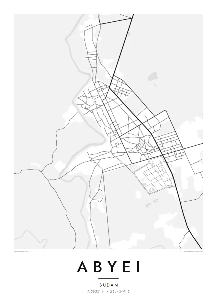
Abyei lies in a flat savannah region on the border between Sudan and South Sudan, and it is known internationally for the unresolved question of which country it belongs to. The area has its own special administrative status, and a United Nations peacekeeping force has been stationed there since 2011. It is home to the Ngok Dinka, and Misseriya herders move through it seasonally with their cattle.
On a map, the landscape is almost entirely level. The Kiir River, also called the Bahr el-Arab, crosses the region to the south of the town, and seasonal watercourses and low-lying wetlands spread across the plain in the rainy months. The town is a compact cluster of streets and compounds, with tracks leading outward across open country.
An Abyei map poster doesn't claim to settle anything. It records a place that many people call home and that others know only from the news: a town, its roads and the waterways that shape life around it. For people from Abyei, for aid workers and for peacekeepers who have served there, the map holds a personal meaning that goes beyond politics.
The river, also called Bahr el-Arab, runs across the plain south of the town. It is central to grazing, farming and seasonal movement throughout the region.
Abyei itself appears as a tight group of streets and compounds. It stands out sharply against the large, open country around it.
Unpaved routes lead away from the town in several directions. They connect it to villages, grazing lands and the wider region.
나만의 포스터로
날짜, 이름 또는 원하는 문구를 추가하고 스타일, 사이즈, 방향을 바꿔 보세요.
무료 미리보기는 저해상도이며 워터마크가 있습니다. 인쇄물과 HD 파일은 300 DPI, 최대 7,200 × 10,800px로 워터마크 없이 렌더링됩니다.
왜 Abyei인가
For people from Abyei living elsewhere, and for those who have worked or served there, this map is a way of keeping the place in view on its own terms: as streets, a river and a home, not a headline.
Write the title and subtitle as you see fit, including a name, a date or a dedication, and edit the coordinates line. Choose from Classic black & white, Noir, Paper, Blueprint and Sand. Sand suits the savannah.
Abyei 포스터 주문하기| 인쇄 사이즈 | 해상도 | 파일 |
|---|---|---|
| 30 × 40 cm (11.8 × 15.7″) | 3,543 × 4,724 px | PNG · PDF |
| 29.7 × 42 cm (A3, 11.7 × 16.5″) | 3,508 × 4,961 px | PNG · PDF |
| 42 × 59.4 cm (A2, 16.5 × 23.4″) | 4,961 × 7,016 px | PNG · PDF |
| 45.7 × 61 cm (18 × 24″) | 5,400 × 7,200 px | PNG · PDF |
| 50 × 70 cm (19.7 × 27.6″) | 5,906 × 8,268 px | PNG · PDF |
| 61 × 91.4 cm (24 × 36″) | 7,200 × 10,800 px | PNG · PDF |
참고로 무료 미리보기는 가로 900 px에 워터마크가 포함된 화면용 이미지입니다. HD 파일은 가로세로 각각 최대 8배의 해상도로, 포스터 원본 크기로도 깔끔하게 인쇄됩니다.
페이지 상단에서 스타일을 선택한 다음, 인쇄 포스터(사이즈, 원하면 액자까지)나 디지털 HD 파일 중 하나를 고르세요. 결제는 한 단계로 끝나며, 결제가 완료되는 즉시 주문 페이지가 업데이트됩니다.
프리미엄 200 gsm 무광 용지에 인쇄되며, 30 × 40 cm부터 24 × 36″까지 6가지 사이즈 중에서 고를 수 있습니다. 인쇄 포스터는 배송비 포함 {printFrom}부터 시작합니다.
네, 가능합니다. 블랙, 화이트, 내추럴 오크, 다크 우드 중 원목 액자를 선택할 수 있습니다. 강화 아크릴이 포함되어 있어 바로 걸 수 있습니다. 액자 포스터는 배송비 포함 {framedFrom}부터 시작합니다.
전 세계 무료 배송입니다. 각 포스터는 30여 개국에 있는 인쇄 파트너 중 가장 가까운 곳에서 인쇄되며, 보통 영업일 기준 3~7일 내에 도착합니다. 주문 현황과 배송 조회는 '내 주문'에서 확인할 수 있습니다.
배송 후 14일 이내에 사진을 보내주시면 무료로 재인쇄해 드리거나 환불해 드립니다.
네, 가능합니다. 이 페이지의 편집기에서 제목, 부제목, 좌표 줄을 원하는 대로 바꾸고 스타일과 사이즈를 선택하세요. 인쇄, 액자, 디지털 주문 모두 고객님이 만든 디자인 그대로 제작됩니다.
$9에 300 DPI PNG과 인쇄 가능한 PDF 파일을 6가지 사이즈 모두, 워터마크 없이 받아 어디서든 인쇄할 수 있습니다. 아직 고민 중이시라면 워터마크가 있는 무료 미리보기를 먼저 다운로드해 보세요.
