Baie des Anges
Nice's wide bay follows a smooth arc lined by the Promenade des Anglais, with the old town and the port tucked behind the castle hill at its eastern end.
미니멀 지도 포스터 · 프랑스
43.9525° N / 7.5436° E
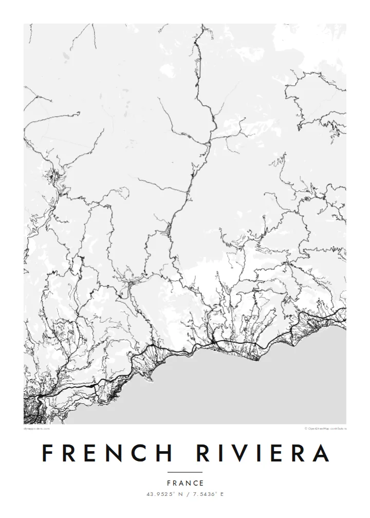
A curving shoreline of bays and rocky capes, with Cannes, Antibes, Nice and Monaco strung between the mountains and the sea


하나의 도시, 다섯 가지 분위기
스타일을 선택하면 벽에 걸린 모습을 볼 수 있어요. 모든 스타일은 인쇄, 액자, HD 파일 어떤 방식이든 가격이 같습니다.
 실제 픽셀 · 24 × 36″ 인쇄 파일
선명한 인쇄 품질
실제 인쇄 파일을 100% 크기로 잘라낸 이미지입니다. 인쇄, 액자, 다운로드 등 모든 포스터는 저희 서버에서 300 DPI, 최대 7,200 × 10,800픽셀로 렌더링되어 24 × 36″ 인쇄물에서도 가장 좁은 골목길까지 선명하게 보입니다.
인테리어 속에서


지도 소개
The French Riviera, or Côte d'Azur, runs along the Mediterranean in the far southeast of France, up to the Italian border. From above it is a series of wide bays separated by rocky capes: the Baie des Anges at Nice, Cap d'Antibes, Cap Ferrat and Cap Martin. Behind them the land rises quickly into the foothills of the Alps, which push the towns down toward the water.
The coast became a winter resort for wealthy British and Russian visitors in the nineteenth century, which is why the seafront at Nice is still called the Promenade des Anglais. Cannes holds its international film festival along the Croisette, and the principality of Monaco fills a tight pocket of coast between Nice and Menton.
A French Riviera map poster shows three distinct layers: the long curve of the seafront promenades, the dense street networks of the cities, and the corniche roads cut higher up the slope. East of Nice, the Basse, Moyenne and Grande Corniche run roughly parallel one above another, while west of Cannes the red rocks of the Estérel give the shore a jagged edge.
Nice's wide bay follows a smooth arc lined by the Promenade des Anglais, with the old town and the port tucked behind the castle hill at its eastern end.
Between Nice and Menton three roads run at different heights along the slope, and their near-parallel lines stack up one above another over the coast.
Cap d'Antibes and Cap Ferrat push into the sea as rounded peninsulas, their quiet villa roads contrasting with the denser cities on either side.
나만의 포스터로
날짜, 이름 또는 원하는 문구를 추가하고 스타일, 사이즈, 방향을 바꿔 보세요.
무료 미리보기는 저해상도이며 워터마크가 있습니다. 인쇄물과 HD 파일은 300 DPI, 최대 7,200 × 10,800px로 워터마크 없이 렌더링됩니다.
왜 French Riviera인가
It suits anyone who has lived on the coast, spent summers there or remembers one particular town. Set the title to Nice, Côte d'Azur or a place of your own, add a date in the subtitle, and move the coordinates to the spot that matters.
Noir gives the Mediterranean a night-time depth, while Sand suits the warm light of the coast. Classic black & white, Paper and Blueprint complete the five styles. Printed posters come on matte paper and ship from partners in more than 30 countries.
French Riviera 포스터 주문하기| 인쇄 사이즈 | 해상도 | 파일 |
|---|---|---|
| 30 × 40 cm11.8 × 15.7″ | 3,543 × 4,724 px | PNG · PDF |
| 29.7 × 42 cm (A3)11.7 × 16.5″ | 3,508 × 4,961 px | PNG · PDF |
| 42 × 59.4 cm (A2)16.5 × 23.4″ | 4,961 × 7,016 px | PNG · PDF |
| 45.7 × 61 cm18 × 24″ | 5,400 × 7,200 px | PNG · PDF |
| 50 × 70 cm19.7 × 27.6″ | 5,906 × 8,268 px | PNG · PDF |
| 61 × 91.4 cm24 × 36″ | 7,200 × 10,800 px | PNG · PDF |
참고로 무료 미리보기는 가로 900 px에 워터마크가 포함된 화면용 이미지입니다. HD 파일은 가로세로 각각 최대 8배의 해상도로, 포스터 원본 크기로도 깔끔하게 인쇄됩니다.
페이지 상단에서 스타일을 선택한 다음, 인쇄 포스터(사이즈, 원하면 액자까지)나 디지털 HD 파일 중 하나를 고르세요. 결제는 한 단계로 끝나며, 결제가 완료되는 즉시 주문 페이지가 업데이트됩니다.
프리미엄 200 gsm 무광 용지에 인쇄되며, 30 × 40 cm부터 24 × 36″까지 6가지 사이즈 중에서 고를 수 있습니다. 인쇄 포스터는 배송비 포함 $39부터 시작합니다.
네, 가능합니다. 블랙, 화이트, 내추럴 오크, 다크 우드 중 원목 액자를 선택할 수 있습니다. 강화 아크릴이 포함되어 있어 바로 걸 수 있습니다. 액자 포스터는 배송비 포함 $99부터 시작합니다.
60개국 이상으로 무료 배송됩니다. 포스터는 30개국 이상에 있는 제휴 인쇄소 중 가장 가까운 곳에서 인쇄되어 보통 영업일 기준 3~7일 안에 도착합니다. 진행 상황과 배송 추적은 '내 주문'에서 확인하실 수 있습니다. 일부 국가는 2~5주가 걸리며, 아직 배송하지 않는 국가는 결제 전에 사이트에서 안내해 드립니다.
배송 후 14일 이내에 사진을 보내주시면 무료로 재인쇄해 드리거나 환불해 드립니다.
네, 가능합니다. 이 페이지의 편집기에서 제목, 부제목, 좌표 줄을 원하는 대로 바꾸고 스타일과 사이즈를 선택하세요. 인쇄, 액자, 디지털 주문 모두 고객님이 만든 디자인 그대로 제작됩니다.
$9에 300 DPI PNG과 인쇄 가능한 PDF 파일을 6가지 사이즈 모두, 워터마크 없이 받아 어디서든 인쇄할 수 있습니다. 아직 고민 중이시라면 워터마크가 있는 무료 미리보기를 먼저 다운로드해 보세요.
