Euphrates riverfront
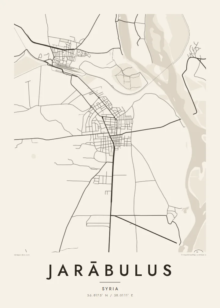
The Euphrates runs broad along the eastern side of the town, its banks lined with fields and floodplain. On the poster, the river gives the whole composition its weight and direction.
미니멀 지도 포스터 · 시리아
36.8175° N / 38.0111° E
A town on the west bank of the Euphrates at the Turkish border, beside the ancient mound of Carchemish




하나의 도시, 다섯 가지 분위기
스타일을 선택하면 벽에 걸린 모습을 볼 수 있어요. 모든 스타일은 인쇄, 액자, HD 파일 어떤 방식이든 가격이 같습니다.
 실제 픽셀 · 24 × 36″ 인쇄 파일
선명한 인쇄 품질
실제 인쇄 파일을 100% 크기로 잘라낸 이미지입니다. 인쇄, 액자, 다운로드 등 모든 포스터는 저희 서버에서 300 DPI, 최대 7,200 × 10,800픽셀로 렌더링되어 24 × 36″ 인쇄물에서도 가장 좁은 골목길까지 선명하게 보입니다.
인테리어 속에서


지도 소개
Jarābulus stands on the western bank of the Euphrates in northern Syria, directly on the border with Turkey. On the map, the river dominates: a wide band running north to south along the town's eastern edge. The border meets the water just north of the built-up area, so the town sits in a corner formed by a river and a frontier.
Just north of the town lies Carchemish, one of the major cities of the ancient Near East, whose ruins straddle the border. Before the First World War, Leonard Woolley led excavations there, and a young T. E. Lawrence was on the team. Nearby, the historic Baghdad Railway crosses the Euphrates on a long bridge, a clear straight stroke on any map of the area.
The town itself is compact. Its streets sit back from the riverbank, and roads lead south and west into the farmland of the Aleppo countryside. A Jarābulus map poster reduces all of this to a few essential lines: river, rail, border and town. It is a small place whose position has made it significant for thousands of years.
The Euphrates runs broad along the eastern side of the town, its banks lined with fields and floodplain. On the poster, the river gives the whole composition its weight and direction.
The ancient city lies just north of the modern streets, on the river near the border. It is one of the oldest urban sites in the region.
The historic Baghdad Railway crosses the Euphrates near the town on a long bridge. Its straight line across the water is one of the clearest features of the local map.
나만의 포스터로
날짜, 이름 또는 원하는 문구를 추가하고 스타일, 사이즈, 방향을 바꿔 보세요.
무료 미리보기는 저해상도이며 워터마크가 있습니다. 인쇄물과 HD 파일은 300 DPI, 최대 7,200 × 10,800px로 워터마크 없이 렌더링됩니다.
왜 Jarābulus인가
For people from Jarābulus, including the many who now live elsewhere, a map of the town holds on to a specific place by the river. It also suits anyone drawn to the archaeology of Carchemish or the long history of the upper Euphrates.
Add a title in your own words, a subtitle, a date and the coordinates line, and pick Classic black & white, Noir, Paper, Blueprint or Sand. The $9 digital files cover six sizes from 30×40 cm to 24×36″, each as a 300 DPI PNG and a print-ready PDF.
Jarābulus 포스터 주문하기| 인쇄 사이즈 | 해상도 | 파일 |
|---|---|---|
| 30 × 40 cm (11.8 × 15.7″) | 3,543 × 4,724 px | PNG · PDF |
| 29.7 × 42 cm (A3, 11.7 × 16.5″) | 3,508 × 4,961 px | PNG · PDF |
| 42 × 59.4 cm (A2, 16.5 × 23.4″) | 4,961 × 7,016 px | PNG · PDF |
| 45.7 × 61 cm (18 × 24″) | 5,400 × 7,200 px | PNG · PDF |
| 50 × 70 cm (19.7 × 27.6″) | 5,906 × 8,268 px | PNG · PDF |
| 61 × 91.4 cm (24 × 36″) | 7,200 × 10,800 px | PNG · PDF |
참고로 무료 미리보기는 가로 900 px에 워터마크가 포함된 화면용 이미지입니다. HD 파일은 가로세로 각각 최대 8배의 해상도로, 포스터 원본 크기로도 깔끔하게 인쇄됩니다.
페이지 상단에서 스타일을 선택한 다음, 인쇄 포스터(사이즈, 원하면 액자까지)나 디지털 HD 파일 중 하나를 고르세요. 결제는 한 단계로 끝나며, 결제가 완료되는 즉시 주문 페이지가 업데이트됩니다.
프리미엄 200 gsm 무광 용지에 인쇄되며, 30 × 40 cm부터 24 × 36″까지 6가지 사이즈 중에서 고를 수 있습니다. 인쇄 포스터는 배송비 포함 $39부터 시작합니다.
네, 가능합니다. 블랙, 화이트, 내추럴 오크, 다크 우드 중 원목 액자를 선택할 수 있습니다. 강화 아크릴이 포함되어 있어 바로 걸 수 있습니다. 액자 포스터는 배송비 포함 $99부터 시작합니다.
배송비는 전 세계 무료입니다. 포스터는 30개국 이상에 있는 제작 파트너 중 가장 가까운 곳에서 인쇄되며, 보통 영업일 기준 3~7일 안에 도착합니다. 진행 상황과 배송 조회는 '내 주문'에서 확인하실 수 있습니다. 일부 국가는 2~5주가 걸리고, 아직 배송하지 않는 국가는 결제 전에 사이트에서 안내해 드립니다.
배송 후 14일 이내에 사진을 보내주시면 무료로 재인쇄해 드리거나 환불해 드립니다.
네, 가능합니다. 이 페이지의 편집기에서 제목, 부제목, 좌표 줄을 원하는 대로 바꾸고 스타일과 사이즈를 선택하세요. 인쇄, 액자, 디지털 주문 모두 고객님이 만든 디자인 그대로 제작됩니다.
$9에 300 DPI PNG과 인쇄 가능한 PDF 파일을 6가지 사이즈 모두, 워터마크 없이 받아 어디서든 인쇄할 수 있습니다. 아직 고민 중이시라면 워터마크가 있는 무료 미리보기를 먼저 다운로드해 보세요.
