Mavis Grind
At this narrow isthmus, the waters of the North Sea and the Atlantic nearly meet. It is the thinnest point of the island, and on the map the coastline almost touches.
미니멀 지도 포스터 · 영국
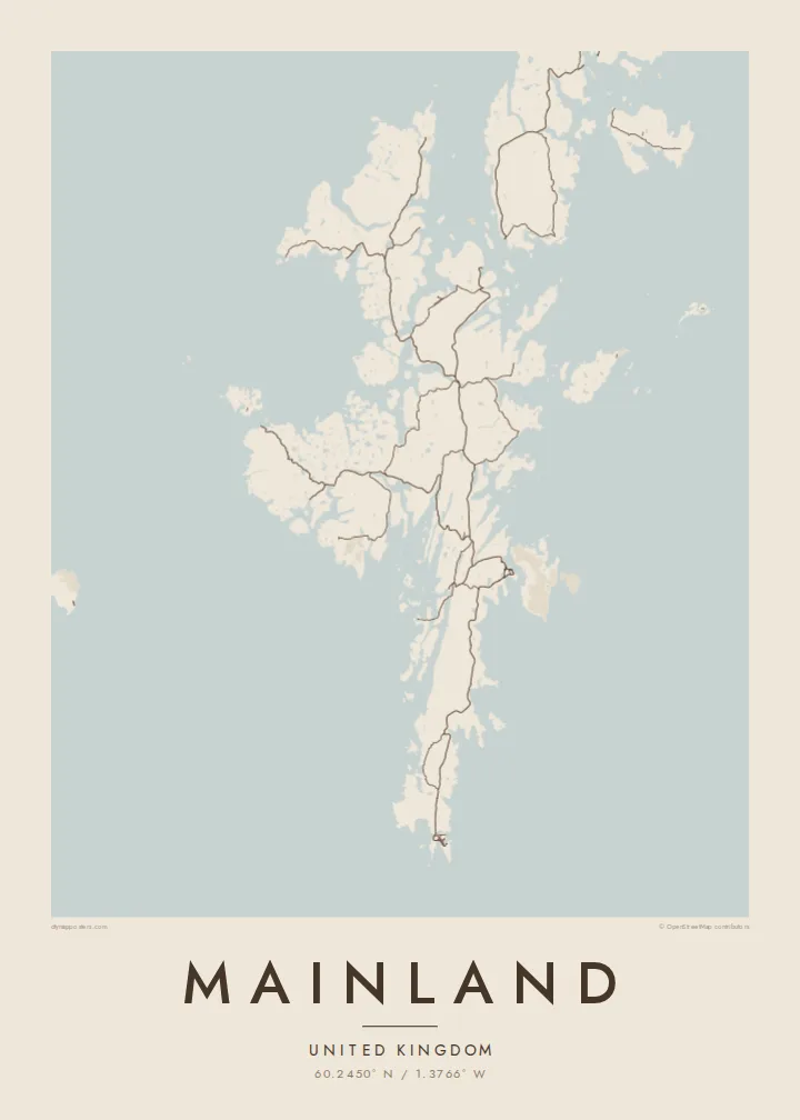
60.2450° N / 1.3766° W
The largest Shetland island, a long, ragged spine of land so cut by voes that the sea is never far away


하나의 도시, 다섯 가지 분위기
스타일을 선택하면 벽에 걸린 모습을 볼 수 있어요. 모든 스타일은 인쇄, 액자, HD 파일 어떤 방식이든 가격이 같습니다.
 실제 픽셀 · 24 × 36″ 인쇄 파일
선명한 인쇄 품질
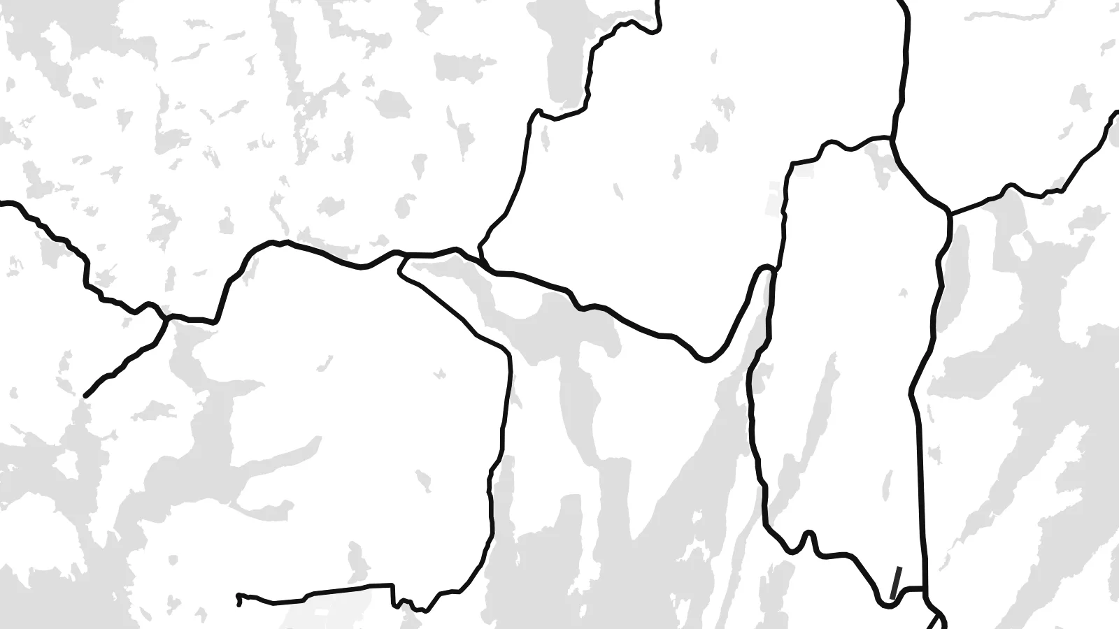
실제 인쇄 파일을 100% 크기로 잘라낸 이미지입니다. 인쇄, 액자, 다운로드 등 모든 포스터는 저희 서버에서 300 DPI, 최대 7,200 × 10,800픽셀로 렌더링되어 24 × 36″ 인쇄물에서도 가장 좁은 골목길까지 선명하게 보입니다.
인테리어 속에서


지도 소개
Shetland's Mainland is long and narrow, running north to south, and its coastline is extraordinarily indented. Long inlets called voes cut deep into it from both sides, so the island often seems to be made of several peninsulas held together by thin necks of land. Main roads follow these narrow strips and join scattered crofting settlements, bays and harbours from Sumburgh in the south to the northern headlands.
Lerwick, the capital of Shetland, lies on the east coast facing Bressay. Each winter it hosts the Up Helly Aa fire festival. At Mavis Grind, the land narrows so much that the North Sea and the Atlantic are separated by only a short strip of ground. Near the southern tip, the settlement site at Jarlshof shows thousands of years of continuous occupation.
A Mainland map poster is a study in coastline. Voes, sounds and islands intertwine, and the outline is almost as long as a much larger landmass. Lerwick's harbour streets form the densest cluster. The rest is a pattern of roads, lochs and bays that makes Shetland's geography unusually clear.
At this narrow isthmus, the waters of the North Sea and the Atlantic nearly meet. It is the thinnest point of the island, and on the map the coastline almost touches.
Shetland's capital stretches along its sheltered harbour on the east coast, facing the island of Bressay. It has the densest street pattern on the island.
Long, fjord-like inlets cut into the island from both sides. They break it into peninsulas and give the poster its intricate, branching outline.
나만의 포스터로
날짜, 이름 또는 원하는 문구를 추가하고 스타일, 사이즈, 방향을 바꿔 보세요.
무료 미리보기는 저해상도이며 워터마크가 있습니다. 인쇄물과 HD 파일은 300 DPI, 최대 7,200 × 10,800px로 워터마크 없이 렌더링됩니다.
왜 Mainland인가
Shetlanders living elsewhere, and visitors who came for the birds, the light and Up Helly Aa, find in this outline a very recognisable image of home or of a journey. The ragged coast looks especially striking in Noir, with the land picked out in light lines.
Add your own title and subtitle, a family name or the date of a crossing, and choose from Classic black & white, Noir, Paper, Blueprint or Sand. Download the HD files for $9 or order a matte print with an optional frame.
Mainland 포스터 주문하기| 인쇄 사이즈 | 해상도 | 파일 |
|---|---|---|
| 30 × 40 cm (11.8 × 15.7″) | 3,543 × 4,724 px | PNG · PDF |
| 29.7 × 42 cm (A3, 11.7 × 16.5″) | 3,508 × 4,961 px | PNG · PDF |
| 42 × 59.4 cm (A2, 16.5 × 23.4″) | 4,961 × 7,016 px | PNG · PDF |
| 45.7 × 61 cm (18 × 24″) | 5,400 × 7,200 px | PNG · PDF |
| 50 × 70 cm (19.7 × 27.6″) | 5,906 × 8,268 px | PNG · PDF |
| 61 × 91.4 cm (24 × 36″) | 7,200 × 10,800 px | PNG · PDF |
참고로 무료 미리보기는 가로 900 px에 워터마크가 포함된 화면용 이미지입니다. HD 파일은 가로세로 각각 최대 8배의 해상도로, 포스터 원본 크기로도 깔끔하게 인쇄됩니다.
페이지 상단에서 스타일을 선택한 다음, 인쇄 포스터(사이즈, 원하면 액자까지)나 디지털 HD 파일 중 하나를 고르세요. 결제는 한 단계로 끝나며, 결제가 완료되는 즉시 주문 페이지가 업데이트됩니다.
프리미엄 200 gsm 무광 용지에 인쇄되며, 30 × 40 cm부터 24 × 36″까지 6가지 사이즈 중에서 고를 수 있습니다. 인쇄 포스터는 배송비 포함 $39부터 시작합니다.
네, 가능합니다. 블랙, 화이트, 내추럴 오크, 다크 우드 중 원목 액자를 선택할 수 있습니다. 강화 아크릴이 포함되어 있어 바로 걸 수 있습니다. 액자 포스터는 배송비 포함 $99부터 시작합니다.
배송비는 전 세계 무료입니다. 포스터는 30개국 이상에 있는 제작 파트너 중 가장 가까운 곳에서 인쇄되며, 보통 영업일 기준 3~7일 안에 도착합니다. 진행 상황과 배송 조회는 '내 주문'에서 확인하실 수 있습니다. 일부 국가는 2~5주가 걸리고, 아직 배송하지 않는 국가는 결제 전에 사이트에서 안내해 드립니다.
배송 후 14일 이내에 사진을 보내주시면 무료로 재인쇄해 드리거나 환불해 드립니다.
네, 가능합니다. 이 페이지의 편집기에서 제목, 부제목, 좌표 줄을 원하는 대로 바꾸고 스타일과 사이즈를 선택하세요. 인쇄, 액자, 디지털 주문 모두 고객님이 만든 디자인 그대로 제작됩니다.
$9에 300 DPI PNG과 인쇄 가능한 PDF 파일을 6가지 사이즈 모두, 워터마크 없이 받아 어디서든 인쇄할 수 있습니다. 아직 고민 중이시라면 워터마크가 있는 무료 미리보기를 먼저 다운로드해 보세요.
