Naka River
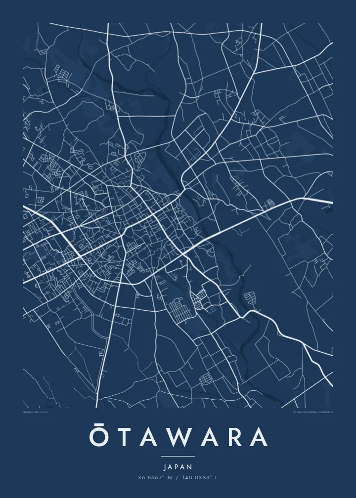
A wide, clear river crosses the city from north to south. Its channel and gravel bars form a strong, flowing line through the centre of the composition.
미니멀 지도 포스터 · 일본
36.8667° N / 140.0333° E
A northern Tochigi city spread across the Nasu plain, crossed by the clear Naka River and its tributaries.



하나의 도시, 다섯 가지 분위기
스타일을 선택하면 벽에 걸린 모습을 볼 수 있어요. 모든 스타일은 인쇄, 액자, HD 파일 어떤 방식이든 가격이 같습니다.
 실제 픽셀 · 24 × 36″ 인쇄 파일
선명한 인쇄 품질
실제 인쇄 파일을 100% 크기로 잘라낸 이미지입니다. 인쇄, 액자, 다운로드 등 모든 포스터는 저희 서버에서 300 DPI, 최대 7,200 × 10,800픽셀로 렌더링되어 24 × 36″ 인쇄물에서도 가장 좁은 골목길까지 선명하게 보입니다.
인테리어 속에서


지도 소개
Ōtawara lies in the north of Tochigi Prefecture, on the broad, gently sloping plain that stretches out from the Nasu highlands. From above, the city is a mix of a compact central district, farmland divided into neat rice-paddy blocks, and villages along the rivers. Mountains rise to the north and east, so the map moves from dense streets to open fields to forested slopes.
The Naka River is the strongest line in the frame. It runs through the city from north to south and is known for its clear water and its ayu, sweetfish that anglers come to catch each summer. Smaller rivers join it across the plain, and the long, braided channels give the rural areas a natural, flowing structure.
In 2005 Ōtawara merged with the neighbouring towns of Kurobane and Yuzukami, which added hill country to the east. Kurobane has a literary connection: the poet Bashō stayed there during the journey he described in The Narrow Road to the Deep North. An Ōtawara map poster shows the city's range, from urban blocks to paddy grids and river valleys.
A wide, clear river crosses the city from north to south. Its channel and gravel bars form a strong, flowing line through the centre of the composition.
Around the urban core, rice fields are laid out in regular rectangles. On the poster this becomes a quiet, repeating pattern that frames the town.
East of the plain the land rises into wooded hills, where roads follow narrow valleys. The sparser linework gives the eastern edge of the map a calm openness.
나만의 포스터로
날짜, 이름 또는 원하는 문구를 추가하고 스타일, 사이즈, 방향을 바꿔 보세요.
무료 미리보기는 저해상도이며 워터마크가 있습니다. 인쇄물과 HD 파일은 300 DPI, 최대 7,200 × 10,800px로 워터마크 없이 렌더링됩니다.
왜 Ōtawara인가
Ōtawara suits a map because its landscape is so legible: a river, a plain and the hills around it. Anyone who grew up here, fished the Naka or has family in northern Tochigi will recognise it instantly, even without a single label.
Customise the title with Latin or Japanese text, add a subtitle or date, and edit the coordinates. Five styles are available, from Noir to Paper. Buy the HD files for $9 or order a matte print from a partner near you.
Ōtawara 포스터 주문하기| 인쇄 사이즈 | 해상도 | 파일 |
|---|---|---|
| 30 × 40 cm11.8 × 15.7″ | 3,543 × 4,724 px | PNG · PDF |
| 29.7 × 42 cm (A3)11.7 × 16.5″ | 3,508 × 4,961 px | PNG · PDF |
| 42 × 59.4 cm (A2)16.5 × 23.4″ | 4,961 × 7,016 px | PNG · PDF |
| 45.7 × 61 cm18 × 24″ | 5,400 × 7,200 px | PNG · PDF |
| 50 × 70 cm19.7 × 27.6″ | 5,906 × 8,268 px | PNG · PDF |
| 61 × 91.4 cm24 × 36″ | 7,200 × 10,800 px | PNG · PDF |
참고로 무료 미리보기는 가로 900 px에 워터마크가 포함된 화면용 이미지입니다. HD 파일은 가로세로 각각 최대 8배의 해상도로, 포스터 원본 크기로도 깔끔하게 인쇄됩니다.
페이지 상단에서 스타일을 선택한 다음, 인쇄 포스터(사이즈, 원하면 액자까지)나 디지털 HD 파일 중 하나를 고르세요. 결제는 한 단계로 끝나며, 결제가 완료되는 즉시 주문 페이지가 업데이트됩니다.
프리미엄 200 gsm 무광 용지에 인쇄되며, 30 × 40 cm부터 24 × 36″까지 6가지 사이즈 중에서 고를 수 있습니다. 인쇄 포스터는 배송비 포함 $39부터 시작합니다.
네, 가능합니다. 블랙, 화이트, 내추럴 오크, 다크 우드 중 원목 액자를 선택할 수 있습니다. 강화 아크릴이 포함되어 있어 바로 걸 수 있습니다. 액자 포스터는 배송비 포함 $99부터 시작합니다.
60개국 이상으로 무료 배송됩니다. 포스터는 30개국 이상에 있는 제휴 인쇄소 중 가장 가까운 곳에서 인쇄되어 보통 영업일 기준 3~7일 안에 도착합니다. 진행 상황과 배송 추적은 '내 주문'에서 확인하실 수 있습니다. 일부 국가는 2~5주가 걸리며, 아직 배송하지 않는 국가는 결제 전에 사이트에서 안내해 드립니다.
배송 후 14일 이내에 사진을 보내주시면 무료로 재인쇄해 드리거나 환불해 드립니다.
네, 가능합니다. 이 페이지의 편집기에서 제목, 부제목, 좌표 줄을 원하는 대로 바꾸고 스타일과 사이즈를 선택하세요. 인쇄, 액자, 디지털 주문 모두 고객님이 만든 디자인 그대로 제작됩니다.
$9에 300 DPI PNG과 인쇄 가능한 PDF 파일을 6가지 사이즈 모두, 워터마크 없이 받아 어디서든 인쇄할 수 있습니다. 아직 고민 중이시라면 워터마크가 있는 무료 미리보기를 먼저 다운로드해 보세요.
