The numbered lines
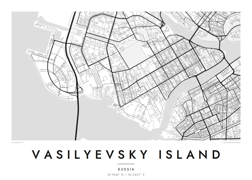
Parallel streets run across the island from north to south, and each side of a street has its own line number. The result is one of the clearest grids on any European map.
미니멀 지도 포스터 · 러시아
59.9364° N / 30.2427° E
A wedge of land splitting the Neva in St Petersburg, laid out in numbered lines crossed by three long avenues.


하나의 도시, 다섯 가지 분위기
스타일을 선택하면 벽에 걸린 모습을 볼 수 있어요. 모든 스타일은 인쇄, 액자, HD 파일 어떤 방식이든 가격이 같습니다.
 실제 픽셀 · 24 × 36″ 인쇄 파일
선명한 인쇄 품질
실제 인쇄 파일을 100% 크기로 잘라낸 이미지입니다. 인쇄, 액자, 다운로드 등 모든 포스터는 저희 서버에서 300 DPI, 최대 7,200 × 10,800픽셀로 렌더링되어 24 × 36″ 인쇄물에서도 가장 좁은 골목길까지 선명하게 보입니다.
인테리어 속에서


지도 소개
Vasilyevsky Island is the largest island in St Petersburg's delta. It lies between the Bolshaya Neva and the Malaya Neva, across the river from the Winter Palace. Its eastern tip, the Strelka, points straight at the heart of the city. The western shore opens onto the Gulf of Finland, where newer districts have been built on reclaimed land.
The island has one of the most distinctive street plans in Europe. It was laid out as a grid in the early eighteenth century, and its north–south streets are still called lines, with each side of a street numbered separately. Three avenues, Bolshoy, Sredny and Maly, cross the grid from east to west. At the Strelka, the former Stock Exchange stands between two red Rostral Columns.
A Vasilyevsky Island map poster sets that strict grid against the soft curves of the river, with bridges reaching across to the Admiralty side and to the Petrograd Side. It is a favourite for anyone who studied at the university on the embankment, walked the Strelka at night, or simply loves a city plan that reads like a diagram.
Parallel streets run across the island from north to south, and each side of a street has its own line number. The result is one of the clearest grids on any European map.
The island's eastern point splits the Neva into two arms. The Rostral Columns and the old Stock Exchange face the Winter Palace across the water.
The Bolshoy, Sredny and Maly avenues cross the grid from east to west and give the plan its strong horizontal structure between the two branches of the Neva.
나만의 포스터로
날짜, 이름 또는 원하는 문구를 추가하고 스타일, 사이즈, 방향을 바꿔 보세요.
무료 미리보기는 저해상도이며 워터마크가 있습니다. 인쇄물과 HD 파일은 300 DPI, 최대 7,200 × 10,800px로 워터마크 없이 렌더링됩니다.
왜 Vasilyevsky Island인가
People hang Vasilyevsky Island because they lived on one of its lines, studied there, or remember watching the bridges open at night from the Strelka. Even without a personal link, the grid set against the river is one of the most satisfying city shapes to frame.
Add a title such as a street address or a line number, a subtitle and your own coordinates, then choose from five styles. Noir and Blueprint suit the geometric plan well. HD digital files cost $9, and printed posters on matte paper ship from partners in more than 30 countries.
Vasilyevsky Island 포스터 주문하기| 인쇄 사이즈 | 해상도 | 파일 |
|---|---|---|
| 30 × 40 cm11.8 × 15.7″ | 3,543 × 4,724 px | PNG · PDF |
| 29.7 × 42 cm (A3)11.7 × 16.5″ | 3,508 × 4,961 px | PNG · PDF |
| 42 × 59.4 cm (A2)16.5 × 23.4″ | 4,961 × 7,016 px | PNG · PDF |
| 45.7 × 61 cm18 × 24″ | 5,400 × 7,200 px | PNG · PDF |
| 50 × 70 cm19.7 × 27.6″ | 5,906 × 8,268 px | PNG · PDF |
| 61 × 91.4 cm24 × 36″ | 7,200 × 10,800 px | PNG · PDF |
참고로 무료 미리보기는 가로 900 px에 워터마크가 포함된 화면용 이미지입니다. HD 파일은 가로세로 각각 최대 8배의 해상도로, 포스터 원본 크기로도 깔끔하게 인쇄됩니다.
페이지 상단에서 스타일을 선택한 다음, 인쇄 포스터(사이즈, 원하면 액자까지)나 디지털 HD 파일 중 하나를 고르세요. 결제는 한 단계로 끝나며, 결제가 완료되는 즉시 주문 페이지가 업데이트됩니다.
프리미엄 200 gsm 무광 용지에 인쇄되며, 30 × 40 cm부터 24 × 36″까지 6가지 사이즈 중에서 고를 수 있습니다. 인쇄 포스터는 배송비 포함 $39부터 시작합니다.
네, 가능합니다. 블랙, 화이트, 내추럴 오크, 다크 우드 중 원목 액자를 선택할 수 있습니다. 강화 아크릴이 포함되어 있어 바로 걸 수 있습니다. 액자 포스터는 배송비 포함 $99부터 시작합니다.
60개국 이상으로 무료 배송됩니다. 포스터는 30개국 이상에 있는 제휴 인쇄소 중 가장 가까운 곳에서 인쇄되어 보통 영업일 기준 3~7일 안에 도착합니다. 진행 상황과 배송 추적은 '내 주문'에서 확인하실 수 있습니다. 일부 국가는 2~5주가 걸리며, 아직 배송하지 않는 국가는 결제 전에 사이트에서 안내해 드립니다.
배송 후 14일 이내에 사진을 보내주시면 무료로 재인쇄해 드리거나 환불해 드립니다.
네, 가능합니다. 이 페이지의 편집기에서 제목, 부제목, 좌표 줄을 원하는 대로 바꾸고 스타일과 사이즈를 선택하세요. 인쇄, 액자, 디지털 주문 모두 고객님이 만든 디자인 그대로 제작됩니다.
$9에 300 DPI PNG과 인쇄 가능한 PDF 파일을 6가지 사이즈 모두, 워터마크 없이 받아 어디서든 인쇄할 수 있습니다. 아직 고민 중이시라면 워터마크가 있는 무료 미리보기를 먼저 다운로드해 보세요.
