Penn's five squares
City Hall at the centre and four squares placed symmetrically around it are still visible as open spaces in the grid, a direct trace of the 1682 plan.
Minimalistesche Kaarteposter · Vereenegt Staaten
39.9524° N / 75.1636° W
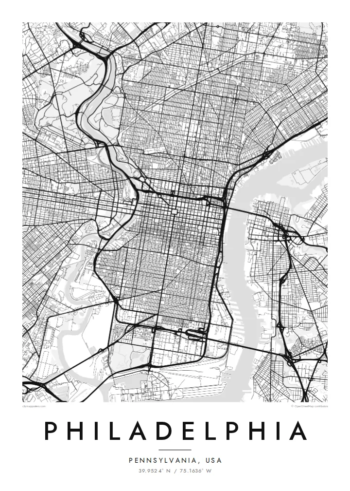
William Penn's orderly grid between two rivers, anchored by City Hall and cut by a single diagonal parkway.


Eng Stad, fënnef Stëmmungen
Tipp op e Stil fir en un der Wand ze gesinn. All Stil kascht d'selwecht — gedréckt, geframt oder als HD-Dateien.
 Richteg Pixel · 24 × 36″ Print-Datei
Gestach schaarf
Dëst ass en 100%-Ausschnitt vun der richteger Print-Datei. All Poster — gedréckt, geframt oder erofgeluede — gëtt op eise Serveren mat 300 DPI gerendert, bis zu 7,200 × 10,800 Pixel, sou datt och déi klengst Stroossen op engem 24 × 36″-Print scharf bleiwen.
un der Mauer


D'Kaart
Philadelphia began as one of the first planned cities in America. In 1682 William Penn and his surveyor Thomas Holme laid out a rectangular grid stretching between the Delaware River on the east and the Schuylkill on the west, with five public squares placed at regular points. That plan still governs Center City, and it is easy to trace on a map today.
Broad Street and Market Street cross at the central square, where City Hall now stands, and four smaller squares, Rittenhouse, Washington, Logan and Franklin, sit in each quadrant. Near the Delaware, Independence Hall marks where the Declaration of Independence and the Constitution were debated and signed. Beyond the original grid, later neighbourhoods tilt and bend to follow old roads and the rivers.
The Benjamin Franklin Parkway breaks the pattern with a deliberate diagonal from City Hall to the Philadelphia Museum of Art, beyond which Fairmount Park follows the Schuylkill and the Wissahickon Creek for miles. A Philadelphia map poster frames all of this: the strict grid, the two rivers and the green valleys winding out toward the northwest.
City Hall at the centre and four squares placed symmetrically around it are still visible as open spaces in the grid, a direct trace of the 1682 plan.
The only major diagonal in Center City runs northwest from City Hall to the art museum, a wide boulevard modelled on Parisian avenues.
One of the largest urban park systems in the country follows the Schuylkill and Wissahickon Creek, drawing long green corridors through the northwestern neighbourhoods.
Maacht en zu Ärem eegenen
Setzt en Datum, en Numm oder eng eegen Zeil derbäi, wiesselt Stil, Gréisst oder Orientéierung.
D'gratis Preview ass a niddereger Opléisung mat enger Waassermark. Prints an HD-Dateien gi mat 300 DPI gerendert, bis zu 7,200 × 10,800 px, ouni Waassermark.
Firwat Philadelphia
Philadelphians tend to identify strongly with their neighbourhood, whether that is Fishtown, South Philly, Germantown or Rittenhouse. A map of the city lets you show the whole grid while pointing to one corner of it, a first apartment, a rowhouse or the place you met someone.
Personalise the title, the subtitle and the coordinates line with a street, a name or a date. Choose Classic black & white, Noir, Paper, Blueprint or Sand. Printed posters ship from partners in more than 30 countries, with an optional wooden frame.
Bestell den Philadelphia-Poster| Drockgréisst | Opléisung | Dateien |
|---|---|---|
| 30 × 40 cm (11.8 × 15.7″) | 3,543 × 4,724 px | PNG · PDF |
| 29.7 × 42 cm (A3, 11.7 × 16.5″) | 3,508 × 4,961 px | PNG · PDF |
| 42 × 59.4 cm (A2, 16.5 × 23.4″) | 4,961 × 7,016 px | PNG · PDF |
| 45.7 × 61 cm (18 × 24″) | 5,400 × 7,200 px | PNG · PDF |
| 50 × 70 cm (19.7 × 27.6″) | 5,906 × 8,268 px | PNG · PDF |
| 61 × 91.4 cm (24 × 36″) | 7,200 × 10,800 px | PNG · PDF |
Zum Verglach: Déi gratis Virschau ass 900 px breet, huet e Waasserzeechen an ass fir de Bildschierm geduecht. D'HD-Dateien hunn a jiddwer Richtung bis zu 8× d'Opléisung a loossen sech och a voller Postergréisst propper drécken.
Wiel e Stil uewen op der Säit aus, duerno entscheed dech fir Gedréckte Poster — eng Gréisst a, wann s de wëlls, e Kader — oder Digital HD-Dateien. D'Keess ass an engem Schrëtt gemaach, an deng Bestellungssäit gëtt aktualiséiert soubal d'Bezuelung duerch ass.
Hie gëtt op héichwäertegt mattes 200-g/m²-Pabeier gedréckt, an enger vu sechs Gréissten, vun 30 × 40 cm bis 24 × 36″. Gedréckte Poster fänken bei $39 un, Liwwerung inklusiv.
Jo. Wiel e Kader aus massivem Holz a schwaarz, wäiss, natierlecher Eech oder donkelem Holz. Hien huet eng bruchsécher Verglasung a ka sou opgehaange ginn. Geframte Poster fänken bei $99 un, Liwwerung inklusiv.
De Versand ass weltwäit gratis. All Poster gëtt vum nootste vun eise Dréckpartner an 30+ Länner gedréckt a kënnt normalerweis bannent 3–7 Wochendeeg un. De Status an d'Tracking fënns du ënner Meng Bestellungen. A puer Länner brauchen 2–5 Woche, a wou mir nach net liwweren, seet dir de Site dat, ier du bezuels.
Schéck eis bannent 14 Deeg no der Liwwerung e Foto, a mir drécken en gratis nach eng Kéier oder erstatten dir de Präis.
Jo. Am Editor op dëser Säit kanns de den Titel, den Ënnertitel an d'Koordinatenzeil op alles änneren, wat s de wëlls, a e Stil an eng Gréisst auswielen. Gedréckt, geframt a digital Bestellungen benotzen alleguer genau däi Design.
Fir $9 kriss de 300 DPI PNG- an drockprett PDF-Dateien a all sechs Gréissten, ouni Waassermarken, fir iwwerall ze drécken. Nach net sécher? Lued fir d'éischt eng gratis Preview mat Waassermark erof.
An der Géigend
