Indented coastline
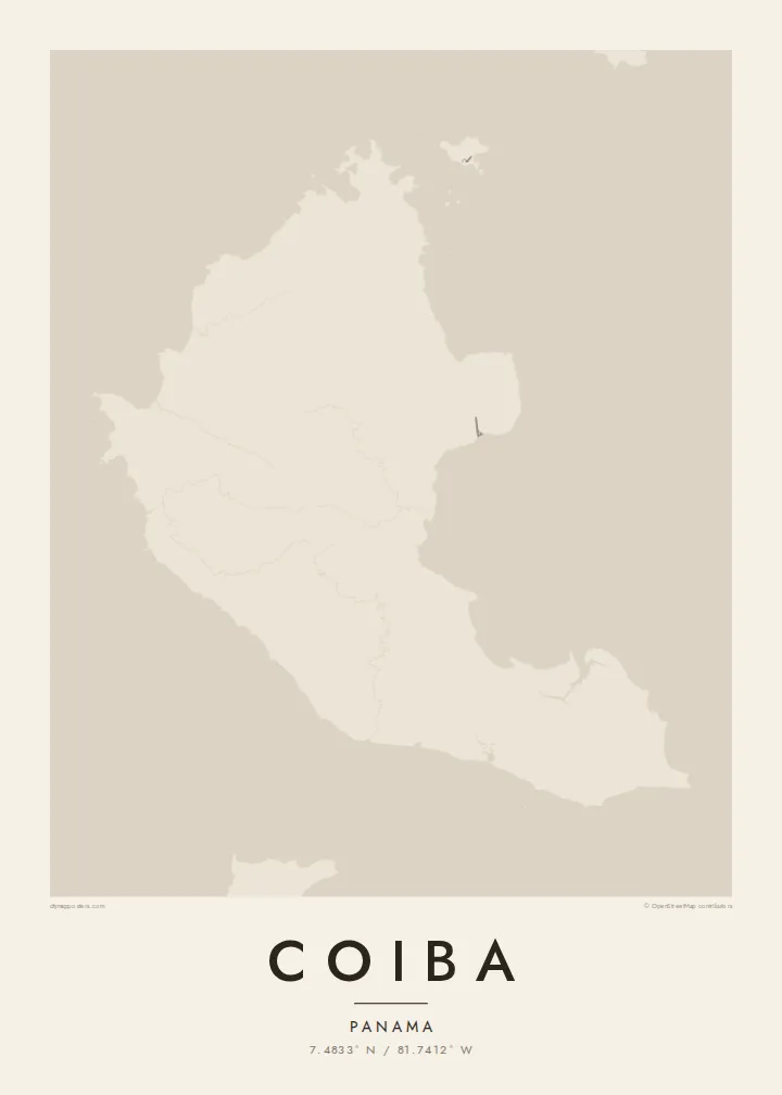
The coast bends into a series of bays and headlands. On the poster it gives the island's long outline a detailed, organic edge against the open sea.
ໂປສເຕີແຜນທີ່ແບບມິນິມອລ · ພານາມາ
7.4833° N / 81.7412° W
A large, forested Pacific island off Panama, its long indented coast almost free of roads and surrounded by open ocean.




ເມືອງດຽວ, ຫ້າບັນຍາກາດ
ແຕະເລືອກສະໄຕລ໌ເພື່ອເບິ່ງຢູ່ເທິງຝາ. ທຸກສະໄຕລ໌ລາຄາເທົ່າກັນ — ພິມ, ໃສ່ກອບ ຫຼື ເປັນໄຟລ໌ HD.
 ພິກເຊວຈິງ · ໄຟລ໌ພິມ 24 × 36″
ຄົມຊັດພ້ອມພິມ
ນີ້ແມ່ນພາບຕັດ 100% ຈາກໄຟລ໌ພິມຕົວຈິງ. ໂປສເຕີທຸກໃບ — ພິມ, ໃສ່ກອບ ຫຼື ດາວໂຫຼດ — ຖືກສ້າງຢູ່ເຊີບເວີຂອງພວກເຮົາທີ່ 300 DPI, ສູງເຖິງ 7,200 × 10,800 ພິກເຊວ, ດັ່ງນັ້ນເສັ້ນທາງນ້ອຍທີ່ສຸດກໍ່ຍັງຄົມຊັດເມື່ອພິມຂະໜາດ 24 × 36″.
ຢູ່ເທິງຝາ


ແຜນທີ່
Coiba lies in the Gulf of Chiriquí off the Pacific coast of Panama, and it is often cited as the largest island in Central America. Its shape is long and irregular, with a coastline of bays, headlands and small offshore islets. Most of the island is covered by tropical forest, and from above the land appears almost untouched, with only a handful of tracks and clearings.
For much of the twentieth century the island was a penal colony, operating from 1919 until 2004. That long isolation kept most of it free of development. Today it forms the heart of Coiba National Park, a UNESCO World Heritage site since 2005, known for its marine life, its coral reefs and the forest that still covers much of the island.
A Coiba map poster is shaped almost entirely by nature. There is no town grid, only a coastline, a few tracks and islands scattered in the water around it. The result is an outline map with real presence, suited to divers, biologists and anyone who has travelled to this remote corner of the Pacific.
The coast bends into a series of bays and headlands. On the poster it gives the island's long outline a detailed, organic edge against the open sea.
Tropical forest covers most of the land, with almost no roads. The interior appears as a broad open space, making the coastline the main feature of the map.
Smaller islands lie around Coiba within the national park. They add scattered forms to the composition and hint at the wider protected waters around it.
ເຮັດໃຫ້ເປັນຂອງທ່ານ
ເພີ່ມວັນທີ, ຊື່ ຫຼື ຂໍ້ຄວາມຂອງທ່ານເອງ, ປ່ຽນສະໄຕລ໌, ຂະໜາດ ຫຼື ທິດທາງ.
ຕົວຢ່າງຟຣີມີຄວາມລະອຽດຕ່ຳ ແລະ ມີລາຍນ້ຳ. ໂປສເຕີພິມ ແລະ ໄຟລ໌ HD ຖືກສ້າງທີ່ 300 DPI, ສູງເຖິງ 7,200 × 10,800 px, ບໍ່ມີລາຍນ້ຳ.
ເປັນຫຍັງຕ້ອງ Coiba
Coiba is a place many people dream of reaching, and fewer ever do. For divers, researchers and travellers who made the boat journey, a poster of the island marks a rare experience in one of the most protected places on the Pacific coast.
Personalise the title and subtitle, add the date of an expedition, and set your own coordinates line. Choose from Classic black & white, Noir, Paper, Blueprint and Sand. Printed posters come on matte paper, and HD files are available in six sizes for $9.
ສັ່ງໂປສເຕີ Coiba| ຂະໜາດພິມ | ຄວາມລະອຽດ | ໄຟລ໌ |
|---|---|---|
| 30 × 40 cm11.8 × 15.7″ | 3,543 × 4,724 px | PNG · PDF |
| 29.7 × 42 cm (A3)11.7 × 16.5″ | 3,508 × 4,961 px | PNG · PDF |
| 42 × 59.4 cm (A2)16.5 × 23.4″ | 4,961 × 7,016 px | PNG · PDF |
| 45.7 × 61 cm18 × 24″ | 5,400 × 7,200 px | PNG · PDF |
| 50 × 70 cm19.7 × 27.6″ | 5,906 × 8,268 px | PNG · PDF |
| 61 × 91.4 cm24 × 36″ | 7,200 × 10,800 px | PNG · PDF |
ເພື່ອປຽບທຽບ, ຕົວຢ່າງຟຣີກວ້າງ 900 px, ມີລາຍນ້ຳ ແລະ ເໝາະສຳລັບໜ້າຈໍ. ໄຟລ໌ HD ມີຄວາມລະອຽດສູງກວ່າເຖິງ 8 ເທົ່າໃນແຕ່ລະດ້ານ ແລະ ພິມອອກມາຄົມຊັດເຕັມຂະໜາດໂປສເຕີ.
ເລືອກສະໄຕລ໌ຢູ່ເທິງສຸດຂອງໜ້າ ຈາກນັ້ນເລືອກ Printed Poster — ຂະໜາດ ແລະ ຖ້າຕ້ອງການ ກອບຮູບ — ຫຼື Digital HD Files. ການຊຳລະເງິນມີພຽງຂັ້ນຕອນດຽວ ແລະ ໜ້າຄຳສັ່ງຊື້ຂອງທ່ານຈະອັບເດດທັນທີທີ່ຊຳລະເງິນສຳເລັດ.
ພິມໃສ່ເຈ້ຍດ້ານພຣີມຽມ 200 gsm ໃນໜຶ່ງໃນຫົກຂະໜາດ, ຈາກ 30 × 40 cm ຫາ 24 × 36″. ໂປສເຕີພິມເລີ່ມຕົ້ນທີ່ $39, ລວມຄ່າສົ່ງ.
ໄດ້. ເລືອກກອບໄມ້ແທ້ສີດຳ, ສີຂາວ, ໄມ້ໂອກທຳມະຊາດ ຫຼື ໄມ້ສີເຂັ້ມ. ມາພ້ອມກະຈົກກັນແຕກ ແລະ ພ້ອມແຂວນໄດ້ທັນທີ. ໂປສເຕີໃສ່ກອບເລີ່ມຕົ້ນທີ່ $99, ລວມຄ່າສົ່ງ.
ຈັດສົ່ງຟຣີໄປ 60+ ປະເທດ. ໂປສເຕີແຕ່ລະອັນຖືກພິມໂດຍຄູ່ຮ່ວມງານພິມທີ່ຢູ່ໃກ້ທີ່ສຸດໃນ 30+ ປະເທດ ແລະ ປົກກະຕິຈະຮອດພາຍໃນ 3–7 ວັນທຳການ. ທ່ານສາມາດຕິດຕາມສະຖານະ ແລະ ເລກພັດສະດຸໄດ້ທີ່ ຄຳສັ່ງຊື້ຂອງຂ້ອຍ. ບາງປະເທດໃຊ້ເວລາ 2–5 ອາທິດ, ແລະ ຖ້າປະເທດໃດທີ່ເຮົາຍັງບໍ່ໄດ້ຈັດສົ່ງໄປ, ເວັບໄຊຈະແຈ້ງໃຫ້ທ່ານຮູ້ກ່ອນຊຳລະເງິນ.
ສົ່ງຮູບຖ່າຍໃຫ້ພວກເຮົາພາຍໃນ 14 ວັນຫຼັງໄດ້ຮັບສິນຄ້າ ແລ້ວພວກເຮົາຈະພິມໃຫ້ໃໝ່ຟຣີ ຫຼື ຄືນເງິນໃຫ້ທ່ານ.
ໄດ້. ໃນຕົວແກ້ໄຂຢູ່ໜ້ານີ້ ປ່ຽນຫົວຂໍ້, ຫົວຂໍ້ຍ່ອຍ ແລະ ແຖວພິກັດເປັນຫຍັງກໍ່ໄດ້ຕາມໃຈມັກ ແລ້ວເລືອກສະໄຕລ໌ ແລະ ຂະໜາດ. ຄຳສັ່ງຊື້ແບບພິມ, ໃສ່ກອບ ແລະ ດິຈິຕອລ ຈະໃຊ້ດີໄຊນ໌ຂອງທ່ານທັງໝົດ.
ໃນລາຄາ $9 ທ່ານຈະໄດ້ຮັບໄຟລ໌ PNG ແລະ PDF ພ້ອມພິມທີ່ 300 DPI ໃນທັງຫົກຂະໜາດ, ບໍ່ມີລາຍນ້ຳ, ພິມທີ່ໃດກໍ່ໄດ້. ຍັງບໍ່ແນ່ໃຈບໍ? ດາວໂຫຼດຕົວຢ່າງທີ່ມີລາຍນ້ຳຟຣີກ່ອນ.
