Gore Creek corridor
The creek runs the length of town beside Interstate 70, and the two lines together set the east-west grain of the whole map, from the Vail Pass approach down toward West Vail.
ໂປສເຕີແຜນທີ່ແບບມິນິມອລ · ສະຫະລັດ
39.6438° N / 106.3888° W
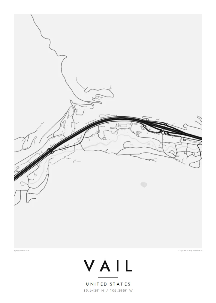
A long, narrow town pulled east to west along Gore Creek and the interstate, the ski mountain rising to its south.


ເມືອງດຽວ, ຫ້າບັນຍາກາດ
ແຕະເລືອກສະໄຕລ໌ເພື່ອເບິ່ງຢູ່ເທິງຝາ. ທຸກສະໄຕລ໌ລາຄາເທົ່າກັນ — ພິມ, ໃສ່ກອບ ຫຼື ເປັນໄຟລ໌ HD.
 ພິກເຊວຈິງ · ໄຟລ໌ພິມ 24 × 36″
ຄົມຊັດພ້ອມພິມ
ນີ້ແມ່ນພາບຕັດ 100% ຈາກໄຟລ໌ພິມຕົວຈິງ. ໂປສເຕີທຸກໃບ — ພິມ, ໃສ່ກອບ ຫຼື ດາວໂຫຼດ — ຖືກສ້າງຢູ່ເຊີບເວີຂອງພວກເຮົາທີ່ 300 DPI, ສູງເຖິງ 7,200 × 10,800 ພິກເຊວ, ດັ່ງນັ້ນເສັ້ນທາງນ້ອຍທີ່ສຸດກໍ່ຍັງຄົມຊັດເມື່ອພິມຂະໜາດ 24 × 36″.
ຢູ່ເທິງຝາ


ແຜນທີ່
From above, Vail barely has a width. The town follows the floor of the Gore Creek valley for several miles, squeezed between steep slopes, with Interstate 70 running the full length of it. Frontage roads, roundabouts and the thin line of the creek all run in parallel, so the map reads as a set of stretched bands rather than a grid, broken only where the village cores cluster at the base of the lifts.
Vail opened as a ski area in 1962 on what had been grazing land, founded by a group that included Pete Seibert, a veteran of the 10th Mountain Division, which trained at nearby Camp Hale during the Second World War. The pedestrian lanes of Vail Village were laid out with Alpine towns in mind, and they still show up on the map as a knot of short, curving streets among the straight valley lines.
A Vail map poster keeps that contrast legible: the dense little villages of Vail Village and Lionshead, the long parallel ribbons of road and water, and the empty space where the mountain climbs toward the Back Bowls. It is a quiet, graphic picture of a place most people remember in terms of snow and light, redrawn as lines on paper.
The creek runs the length of town beside Interstate 70, and the two lines together set the east-west grain of the whole map, from the Vail Pass approach down toward West Vail.
The original village core is a tight cluster of short, bending pedestrian streets and a covered bridge over Gore Creek, noticeably finer in texture than anything else in the valley.
South of the ridge the mountain opens into wide, treeless bowls. On a street map they appear as open ground, a calm counterweight to the busy valley floor below.
ເຮັດໃຫ້ເປັນຂອງທ່ານ
ເພີ່ມວັນທີ, ຊື່ ຫຼື ຂໍ້ຄວາມຂອງທ່ານເອງ, ປ່ຽນສະໄຕລ໌, ຂະໜາດ ຫຼື ທິດທາງ.
ຕົວຢ່າງຟຣີມີຄວາມລະອຽດຕ່ຳ ແລະ ມີລາຍນ້ຳ. ໂປສເຕີພິມ ແລະ ໄຟລ໌ HD ຖືກສ້າງທີ່ 300 DPI, ສູງເຖິງ 7,200 × 10,800 px, ບໍ່ມີລາຍນ້ຳ.
ເປັນຫຍັງຕ້ອງ Vail
For many people Vail is tied to a specific week: a first trip, an annual family tradition, a season spent working the lifts. A map of the valley brings that back without resorting to a photo, and it sits comfortably in a hallway, a cabin or a city apartment far from the mountains.
You can set your own title and subtitle, adjust the coordinates line to mark a lodge or a year, and choose from five styles: Classic black & white, Noir, Paper, Blueprint or Sand. Download the HD files for $9 or order a matte print, framed in wood if you like.
ສັ່ງໂປສເຕີ Vail| ຂະໜາດພິມ | ຄວາມລະອຽດ | ໄຟລ໌ |
|---|---|---|
| 30 × 40 cm (11.8 × 15.7″) | 3,543 × 4,724 px | PNG · PDF |
| 29.7 × 42 cm (A3, 11.7 × 16.5″) | 3,508 × 4,961 px | PNG · PDF |
| 42 × 59.4 cm (A2, 16.5 × 23.4″) | 4,961 × 7,016 px | PNG · PDF |
| 45.7 × 61 cm (18 × 24″) | 5,400 × 7,200 px | PNG · PDF |
| 50 × 70 cm (19.7 × 27.6″) | 5,906 × 8,268 px | PNG · PDF |
| 61 × 91.4 cm (24 × 36″) | 7,200 × 10,800 px | PNG · PDF |
ເພື່ອປຽບທຽບ, ຕົວຢ່າງຟຣີກວ້າງ 900 px, ມີລາຍນ້ຳ ແລະ ເໝາະສຳລັບໜ້າຈໍ. ໄຟລ໌ HD ມີຄວາມລະອຽດສູງກວ່າເຖິງ 8 ເທົ່າໃນແຕ່ລະດ້ານ ແລະ ພິມອອກມາຄົມຊັດເຕັມຂະໜາດໂປສເຕີ.
ເລືອກສະໄຕລ໌ຢູ່ເທິງສຸດຂອງໜ້າ ຈາກນັ້ນເລືອກ Printed Poster — ຂະໜາດ ແລະ ຖ້າຕ້ອງການ ກອບຮູບ — ຫຼື Digital HD Files. ການຊຳລະເງິນມີພຽງຂັ້ນຕອນດຽວ ແລະ ໜ້າຄຳສັ່ງຊື້ຂອງທ່ານຈະອັບເດດທັນທີທີ່ຊຳລະເງິນສຳເລັດ.
ພິມໃສ່ເຈ້ຍດ້ານພຣີມຽມ 200 gsm ໃນໜຶ່ງໃນຫົກຂະໜາດ, ຈາກ 30 × 40 cm ຫາ 24 × 36″. ໂປສເຕີພິມເລີ່ມຕົ້ນທີ່ {printFrom}, ລວມຄ່າສົ່ງ.
ໄດ້. ເລືອກກອບໄມ້ແທ້ສີດຳ, ສີຂາວ, ໄມ້ໂອກທຳມະຊາດ ຫຼື ໄມ້ສີເຂັ້ມ. ມາພ້ອມກະຈົກກັນແຕກ ແລະ ພ້ອມແຂວນໄດ້ທັນທີ. ໂປສເຕີໃສ່ກອບເລີ່ມຕົ້ນທີ່ {framedFrom}, ລວມຄ່າສົ່ງ.
ຄ່າສົ່ງຟຣີທົ່ວໂລກ. ໂປສເຕີແຕ່ລະໃບຖືກພິມໂດຍຄູ່ຮ່ວມງານພິມທີ່ໃກ້ທ່ານທີ່ສຸດໃນຫຼາຍກວ່າ 30 ປະເທດ ແລະ ໂດຍປົກກະຕິຈະມາຮອດພາຍໃນ 3–7 ວັນທຳການ. ທ່ານສາມາດຕິດຕາມສະຖານະ ແລະ ການຈັດສົ່ງໄດ້ທີ່ My Orders.
ສົ່ງຮູບຖ່າຍໃຫ້ພວກເຮົາພາຍໃນ 14 ວັນຫຼັງໄດ້ຮັບສິນຄ້າ ແລ້ວພວກເຮົາຈະພິມໃຫ້ໃໝ່ຟຣີ ຫຼື ຄືນເງິນໃຫ້ທ່ານ.
ໄດ້. ໃນຕົວແກ້ໄຂຢູ່ໜ້ານີ້ ປ່ຽນຫົວຂໍ້, ຫົວຂໍ້ຍ່ອຍ ແລະ ແຖວພິກັດເປັນຫຍັງກໍ່ໄດ້ຕາມໃຈມັກ ແລ້ວເລືອກສະໄຕລ໌ ແລະ ຂະໜາດ. ຄຳສັ່ງຊື້ແບບພິມ, ໃສ່ກອບ ແລະ ດິຈິຕອລ ຈະໃຊ້ດີໄຊນ໌ຂອງທ່ານທັງໝົດ.
ໃນລາຄາ $9 ທ່ານຈະໄດ້ຮັບໄຟລ໌ PNG ແລະ PDF ພ້ອມພິມທີ່ 300 DPI ໃນທັງຫົກຂະໜາດ, ບໍ່ມີລາຍນ້ຳ, ພິມທີ່ໃດກໍ່ໄດ້. ຍັງບໍ່ແນ່ໃຈບໍ? ດາວໂຫຼດຕົວຢ່າງທີ່ມີລາຍນ້ຳຟຣີກ່ອນ.
