Irrigation canals
A network of canals runs through the valley, drawn as fine lines that divide the farmland and give the poster much of its texture.
Minimālistisks kartes plakāts · Argentīna
39.0333° S / 67.5833° W
A Patagonian fruit-growing city on the Río Negro, its grid surrounded by irrigation canals, orchards and poplar windbreaks



Viena pilsēta, pieci noskaņojumi
Pieskaries stilam, lai redzētu to uz sienas. Visi stili maksā vienādi — drukāts, ierāmēts vai kā HD faili.
 Reālie pikseļi · 24 × 36″ drukas fails
Asa izdruka
Šis ir 100% izgriezums no reālā drukas faila. Katrs plakāts — drukāts, ierāmēts vai lejupielādēts — tiek renderēts mūsu serveros ar 300 DPI izšķirtspēju, līdz 7,200 × 10,800 pikseļiem, tāpēc pat vismazākās ieliņas paliek asas uz 24 × 36″ izdruka.
Uz sienas


Karte
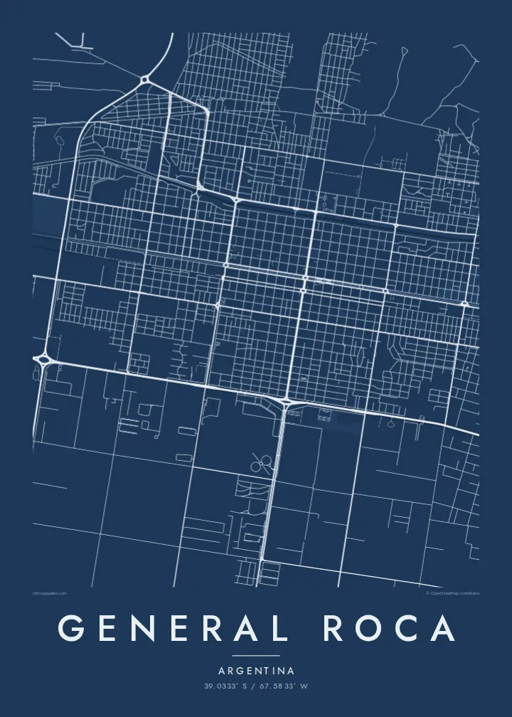
General Roca lies in the Alto Valle of the Río Negro in northern Patagonia, Argentina. From above, the city has a regular grid at its centre, and beyond it the land is divided into long, narrow orchard plots separated by irrigation canals and rows of poplars planted as windbreaks. The river runs to the south, bordered by a strip of greenery.
The city grew from a military fort founded in 1879 and became one of the main centres of the valley's fruit industry, which produces apples and pears for export. The irrigation system, built in the early twentieth century, made that possible by turning dry steppe into cultivated land. The contrast with the arid plateau to the north is sharp.
A General Roca map poster shows this ordered agricultural landscape: the town grid, the fine lines of the canals and the long, parallel plots extending in every direction. It is a map where human work on the land is visible in every line, and it makes a strong, structured print.
A network of canals runs through the valley, drawn as fine lines that divide the farmland and give the poster much of its texture.
Long, narrow fields of apple and pear trees surround the city, arranged in regular strips that create a strong rhythm around the grid.
The river runs along the southern side of the valley, a curving line with a green border that frames the city and its cultivated land.
Padariet to savu
Pievienojiet datumu, vārdu vai savu tekstu, mainiet stilu, izmēru vai orientāciju.
Bezmaksas priekšskatījumam ir zema izšķirtspēja un ūdenszīme. Drukas un HD faili tiek renderēti ar 300 DPI izšķirtspēju, līdz 7,200 × 10,800 px, bez ūdenszīmes.
Kāpēc General Roca
General Roca is home to families who have worked the valley's orchards for generations. A map of the city and its fields is a meaningful keepsake, and a good gift for someone who has moved to Buenos Aires or abroad.
Personalise the title, subtitle and coordinates line to make it your own. The print comes in five styles: Classic black & white, Noir, Paper, Blueprint and Sand.
Pasūtīt General Roca plakātu| Drukas izmērs | Izšķirtspēja | Faili |
|---|---|---|
| 30 × 40 cm (11.8 × 15.7″) | 3,543 × 4,724 px | PNG · PDF |
| 29.7 × 42 cm (A3, 11.7 × 16.5″) | 3,508 × 4,961 px | PNG · PDF |
| 42 × 59.4 cm (A2, 16.5 × 23.4″) | 4,961 × 7,016 px | PNG · PDF |
| 45.7 × 61 cm (18 × 24″) | 5,400 × 7,200 px | PNG · PDF |
| 50 × 70 cm (19.7 × 27.6″) | 5,906 × 8,268 px | PNG · PDF |
| 61 × 91.4 cm (24 × 36″) | 7,200 × 10,800 px | PNG · PDF |
Salīdzinājumam: bezmaksas priekšskatījums ir 900 px plats, ar ūdenszīmi un paredzēts ekrāniem. HD failiem ir līdz 8× lielāka izšķirtspēja katrā virzienā, un tie tīri izdrukājas pilnā plakāta izmērā.
Izvēlies stilu lapas augšā, tad izvēlies Drukāts plakāts — izmēru un, ja vēlies, rāmi — vai Digitālie HD faili. Norēķins aizņem vienu soli, un tavas pasūtījuma lapa atjaunojas, tiklīdz maksājums ir veiksmīgs.
Tas tiek drukāts uz augstas kvalitātes 200 g/m² matēta papīra vienā no sešiem izmēriem, sākot no 30 × 40 cm līdz 24 × 36″. Drukāti plakāti maksā jau no $39, piegāde iekļauta.
Jā. Izvēlies masīvkoka rāmi melnā, baltā, dabiskā ozola vai tumša koka tonī. Tas nāk ar necaurlaužamu stiklojumu un ir gatavs pakarināšanai. Ierāmēti plakāti maksā jau no $99, piegāde iekļauta.
Piegāde visā pasaulē ir bezmaksas. Katru plakātu izdrukā tuvākais no mūsu poligrāfijas partneriem vairāk nekā 30 valstīs, un tas parasti ierodas 3–7 darbadienās. Statusu un sūtījuma izsekošanu varat apskatīt sadaļā Mani pasūtījumi. Uz dažām valstīm piegāde aizņem 2–5 nedēļas, bet, ja uz kādu valsti vēl nepiegādājam, vietne par to paziņos pirms apmaksas.
Nosūti mums fotoattēlu 14 dienu laikā pēc piegādes, un mēs to bez maksas pārdrukāsim vai atmaksāsim naudu.
Jā. Šīs lapas redaktorā vari mainīt virsrakstu, apakšvirsrakstu un koordinātu rindu pēc savas izvēles, kā arī izvēlēties stilu un izmēru. Drukātie, ierāmētie un digitālie pasūtījumi izmanto tieši tavu dizainu.
Par $9 tu saņem 300 DPI PNG un drukai gatavus PDF failus visos sešos izmēros, bez ūdenszīmes, drukāšanai jebkur. Vēl neesi pārliecināts? Vispirms lejupielādē bezmaksas priekšskatījumu ar ūdenszīmi.
