The Presqu'île
The peninsula between the Rhône and Saône holds a dense, elongated centre with Place Bellecour at its heart, framed on both sides by quays and a steady rhythm of bridges.
Minimālistisks kartes plakāts · Francija
45.7491° N / 4.8479° E
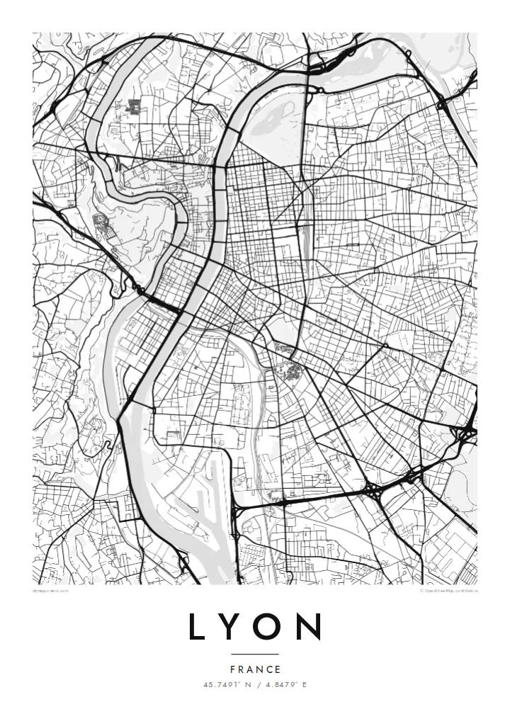
Two rivers, two hills and a narrow peninsula between them: the Rhône and Saône give Lyon one of France's clearest city maps.


Viena pilsēta, pieci noskaņojumi
Pieskaries stilam, lai redzētu to uz sienas. Visi stili maksā vienādi — drukāts, ierāmēts vai kā HD faili.
 Reālie pikseļi · 24 × 36″ drukas fails
Asa izdruka
Šis ir 100% izgriezums no reālā drukas faila. Katrs plakāts — drukāts, ierāmēts vai lejupielādēts — tiek renderēts mūsu serveros ar 300 DPI izšķirtspēju, līdz 7,200 × 10,800 pikseļiem, tāpēc pat vismazākās ieliņas paliek asas uz 24 × 36″ izdruka.
Uz sienas


Karte
Lyon is built where the Saône meets the Rhône, and the two rivers give the city an unusually legible shape. Between them runs the Presqu'île, a long, narrow peninsula that holds the historic commercial centre, Place Bellecour and the Hôtel de Ville. At its southern tip, the former docklands of Confluence have been rebuilt as a modern district where the two rivers meet.
West of the Saône, Fourvière hill rises steeply above Vieux Lyon. Its basilica can be seen from across the city, and its slopes hold the remains of Roman Lugdunum, once a capital of Gaul. North of the Presqu'île, the Croix-Rousse hill was home to the silk weavers, whose covered passageways, the traboules, still run through buildings and courtyards. The historic centre is a UNESCO World Heritage Site.
East of the Rhône the city opens into a broader grid, and Parc de la Tête d'Or, one of the largest urban parks in France, curves along the riverbank. A Lyon map poster shows all of this at once: bridges linking the banks, hills pressing against the old town and the orderly east bank spreading toward the plain.
The peninsula between the Rhône and Saône holds a dense, elongated centre with Place Bellecour at its heart, framed on both sides by quays and a steady rhythm of bridges.
On the west bank, the medieval streets of Vieux Lyon are squeezed between the Saône and the steep slope of Fourvière, where winding roads climb to the basilica.
The large park on the left bank of the Rhône shows as a broad open area with a lake, a clear green anchor against the regular blocks of the east side.
Padariet to savu
Pievienojiet datumu, vārdu vai savu tekstu, mainiet stilu, izmēru vai orientāciju.
Bezmaksas priekšskatījumam ir zema izšķirtspēja un ūdenszīme. Drukas un HD faili tiek renderēti ar 300 DPI izšķirtspēju, līdz 7,200 × 10,800 px, bez ūdenszīmes.
Kāpēc Lyon
People come to Lyon to study, eat and work, and many stay longer than planned. A map of its rivers and hills is a quiet reminder of an apartment on the Croix-Rousse slope, a café on the Presqu'île or a first job near Part-Dieu station.
Set the title and subtitle to anything you like, from an arrondissement to the day you arrived, and edit the coordinates line. Each of the five styles, Classic black & white, Noir, Paper, Blueprint and Sand, shows Lyon's rivers differently. HD files cost $9, and prints ship from partners in 30+ countries.
Pasūtīt Lyon plakātu| Drukas izmērs | Izšķirtspēja | Faili |
|---|---|---|
| 30 × 40 cm (11.8 × 15.7″) | 3,543 × 4,724 px | PNG · PDF |
| 29.7 × 42 cm (A3, 11.7 × 16.5″) | 3,508 × 4,961 px | PNG · PDF |
| 42 × 59.4 cm (A2, 16.5 × 23.4″) | 4,961 × 7,016 px | PNG · PDF |
| 45.7 × 61 cm (18 × 24″) | 5,400 × 7,200 px | PNG · PDF |
| 50 × 70 cm (19.7 × 27.6″) | 5,906 × 8,268 px | PNG · PDF |
| 61 × 91.4 cm (24 × 36″) | 7,200 × 10,800 px | PNG · PDF |
Salīdzinājumam: bezmaksas priekšskatījums ir 900 px plats, ar ūdenszīmi un paredzēts ekrāniem. HD failiem ir līdz 8× lielāka izšķirtspēja katrā virzienā, un tie tīri izdrukājas pilnā plakāta izmērā.
Izvēlies stilu lapas augšā, tad izvēlies Drukāts plakāts — izmēru un, ja vēlies, rāmi — vai Digitālie HD faili. Norēķins aizņem vienu soli, un tavas pasūtījuma lapa atjaunojas, tiklīdz maksājums ir veiksmīgs.
Tas tiek drukāts uz augstas kvalitātes 200 g/m² matēta papīra vienā no sešiem izmēriem, sākot no 30 × 40 cm līdz 24 × 36″. Drukāti plakāti maksā jau no $39, piegāde iekļauta.
Jā. Izvēlies masīvkoka rāmi melnā, baltā, dabiskā ozola vai tumša koka tonī. Tas nāk ar necaurlaužamu stiklojumu un ir gatavs pakarināšanai. Ierāmēti plakāti maksā jau no $99, piegāde iekļauta.
Piegāde visā pasaulē ir bezmaksas. Katru plakātu izdrukā tuvākais no mūsu poligrāfijas partneriem vairāk nekā 30 valstīs, un tas parasti ierodas 3–7 darbadienās. Statusu un sūtījuma izsekošanu varat apskatīt sadaļā Mani pasūtījumi. Uz dažām valstīm piegāde aizņem 2–5 nedēļas, bet, ja uz kādu valsti vēl nepiegādājam, vietne par to paziņos pirms apmaksas.
Nosūti mums fotoattēlu 14 dienu laikā pēc piegādes, un mēs to bez maksas pārdrukāsim vai atmaksāsim naudu.
Jā. Šīs lapas redaktorā vari mainīt virsrakstu, apakšvirsrakstu un koordinātu rindu pēc savas izvēles, kā arī izvēlēties stilu un izmēru. Drukātie, ierāmētie un digitālie pasūtījumi izmanto tieši tavu dizainu.
Par $9 tu saņem 300 DPI PNG un drukai gatavus PDF failus visos sešos izmēros, bez ūdenszīmes, drukāšanai jebkur. Vēl neesi pārliecināts? Vispirms lejupielādē bezmaksas priekšskatījumu ar ūdenszīmi.
