Ginza grid
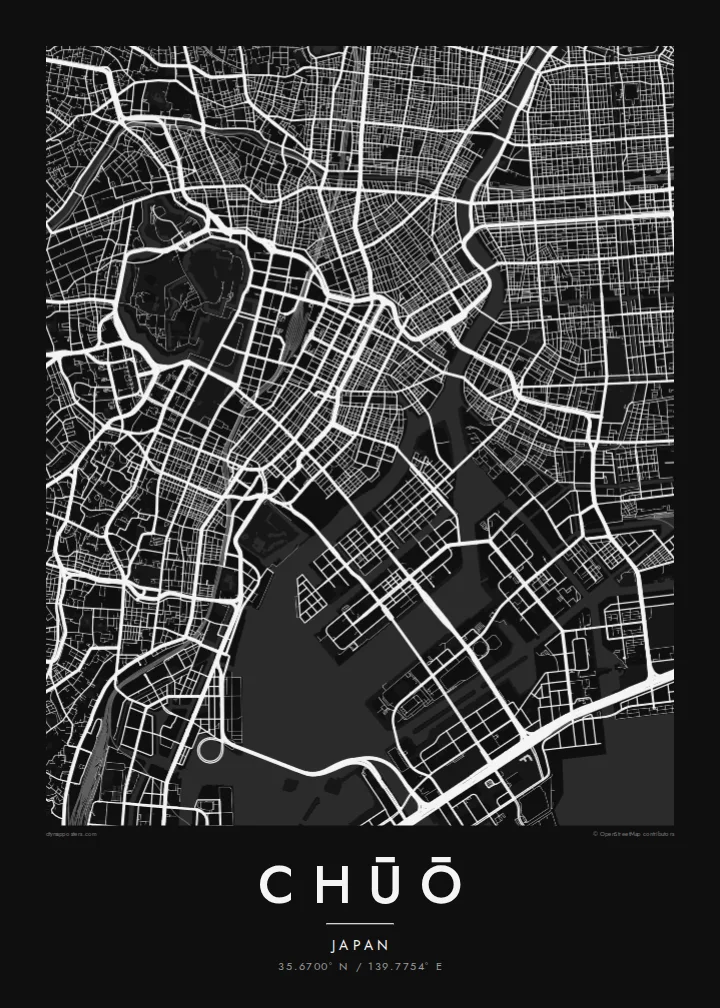
Ginza's regular blocks and main avenues form one of the most orderly street patterns in Tokyo. On the map it sits between former canal routes.
Poster in mab ejjab eļap an kōkaan · Japan
35.6700° N / 139.7754° E
Tokyo's historic commercial heart between the Imperial moats and the Sumida, extending onto reclaimed islands in the bay



Juon jikin kweilok, ļalem eñjake
Jibburi juon style ñan lo e ilo wall. Aolep style ej jokutok wōt āinwōt juon — mede, likūt ilo frame ak ñan bōk āinwōt HD files.
 Pixels eo eṃool · 24 × 36″ file in mede
Alikkar ñan prin
Menin juon crop 100% jān file in mede eo eṃool. Aolep poster — meej, likūt ilo frame ak load — rej kōṃṃane ilo server ko am ilo 300 DPI, ñan 7,200 × 10,800 pixel, bwe lanes ko re dik wōt rej pād im alikkar ilo mede eo 24 × 36″.
Ioon kiin


Mab eo
Chūō is one of Tokyo's central wards, lying between the area around the Imperial Palace and Tokyo Bay. It includes Nihonbashi, the old merchant district, and Ginza, famous for department stores and shopping. In the Edo period, the Nihonbashi bridge was the starting point of the main roads out of the city, and road distances in Japan are still measured from a marker there.
The ward's map is shaped by water. The Sumida River runs along its eastern side, and canals and old moats once surrounded the commercial districts. Some of these are now covered by expressways. To the southeast, the islands of Tsukishima, Kachidoki and Harumi were built on reclaimed land in the bay and are now filled with apartment towers.
A Chūō map poster shows the tight grid of Ginza and Nihonbashi, the wide Sumida, and the geometric outlines of the reclaimed islands. Few parts of Tokyo show so clearly how the city has grown out into the water. It makes a precise and detailed print for anyone who has worked, shopped or lived in the centre of Tokyo.
Ginza's regular blocks and main avenues form one of the most orderly street patterns in Tokyo. On the map it sits between former canal routes.
The old merchant district around the famous bridge, which served as the Edo-period starting point for the main roads leading out of the city.
Tsukishima, Kachidoki and Harumi extend into Tokyo Bay as angular blocks of reclaimed land, connected to the rest of the city by long bridges.
Kōmmane bwe en aṃ
Kōbaiki juon raan, juon etan ak juon naan eo aṃ, ukōt wāween, joñan ak ooj.
Preview eo ejjeḷọk oṇāān ej resolution edik im ewor watermark. Poster ko rej mede im HD files rej kōṃṃane ilo 300 DPI, ñan 7,200 × 10,800 px, ejjeḷọk watermark.
Etke Chūō
For many people, Chūō is the part of Tokyo where they worked, stayed or walked on their first visit. The map puts Ginza, Nihonbashi and the Sumida together in one clear view.
You can personalise the title, subtitle and coordinates, for example with an office address or the year of a trip. Choose one of five styles: Classic black & white, Noir, Paper, Blueprint or Sand. Noir suits the dense grid especially well.
Order poster Chūō| Joñan prin | Resolution | File ko |
|---|---|---|
| 30 × 40 cm11.8 × 15.7″ | 3,543 × 4,724 px | PNG · PDF |
| 29.7 × 42 cm (A3)11.7 × 16.5″ | 3,508 × 4,961 px | PNG · PDF |
| 42 × 59.4 cm (A2)16.5 × 23.4″ | 4,961 × 7,016 px | PNG · PDF |
| 45.7 × 61 cm18 × 24″ | 5,400 × 7,200 px | PNG · PDF |
| 50 × 70 cm19.7 × 27.6″ | 5,906 × 8,268 px | PNG · PDF |
| 61 × 91.4 cm24 × 36″ | 7,200 × 10,800 px | PNG · PDF |
Ñan keidi, preview eo ejjeļọk wōnāān ej 900 px an depakpak, ewōr watermark im ej ñan screen wōt. File HD ko rej ñan 8× an alikkar ilo aolep tu im rej prin emmanḷọk ilo joñan poster eo aolepen.
Kāālōt juon style i tōp in page eo, innām kāālōt Poster eṃōj Mede — juon size im, eḷaññe kwōj kōṇaan, juon frame — ak Digital HD Files. Checkout ej juon wōt buñtōn, im page in order eo aṃ enaaj kāāl ñe payment eo ej dedeḷọk.
Emej ilo bok premium 200 gsm matte, ilo juon iaan jiljino size, jān 30 × 40 cm ñan 24 × 36″. Poster ko rej mede rej jino jān $39, jipañ in kadikdik ej pād ilo wōt.
Aet. Kāālōt juon frame wōjke pen ilo black, white, oak ereo ak wōjke marok. Ej itok ippān kilaj ejjab bwilọk im pojak ñan totouk. Poster ko ilo frame rej jino jān $99, jipañ in kadikdik ej pād ilo wōt.
Jāntōn ejjeļo̧k̦ ñan āeļōn̄ ko 60+. Kajjojo poster ej pãleejeḷ ilo juon ian ro jet rejjar bwe ren pãleejeḷ ilo āeļōn̄ ko 30+, im ekkã an tōpar ilo raan ko 3–7 an jerbal. Kwomaroñ lale wāween im tracking ilo My Orders. Jet āeļōn̄ rej aikuj 2–5 wiik, im ijoko jejjeļo̧k̦ ñan jāgià, ļaiboro̧ ej ba ñan eok mokta jān am pay.
Jilkinwōj juon pija ilowaan 14 raan jān an itok, im kōmnaaj mede juon alen ejjeḷọk oṇāān ak kōṃṃan refund ñan eok.
Aet. Ilo editor eo ilo page in, ukōt title eo, subtitle eo im coordinates ñan jabdewōt kwōj kōṇaan, im kāālōt juon style im size. Order ko mede, ilo frame im digital rej kōjerbal wōt design eo aṃ eṃool.
Kōn $9 kwōj bōk 300 DPI PNG im PDF files pojak ñan mede ilo aolep jiljino size, ejjeḷọk watermark, ñan mede ijoko jabdewōt. Ejjañin lukkuun alikkar ippaṃ? Load juon preview eo ejjeḷọk oṇāān kōn watermark ṃokta.
Ekkepaake
