Heian-era grid
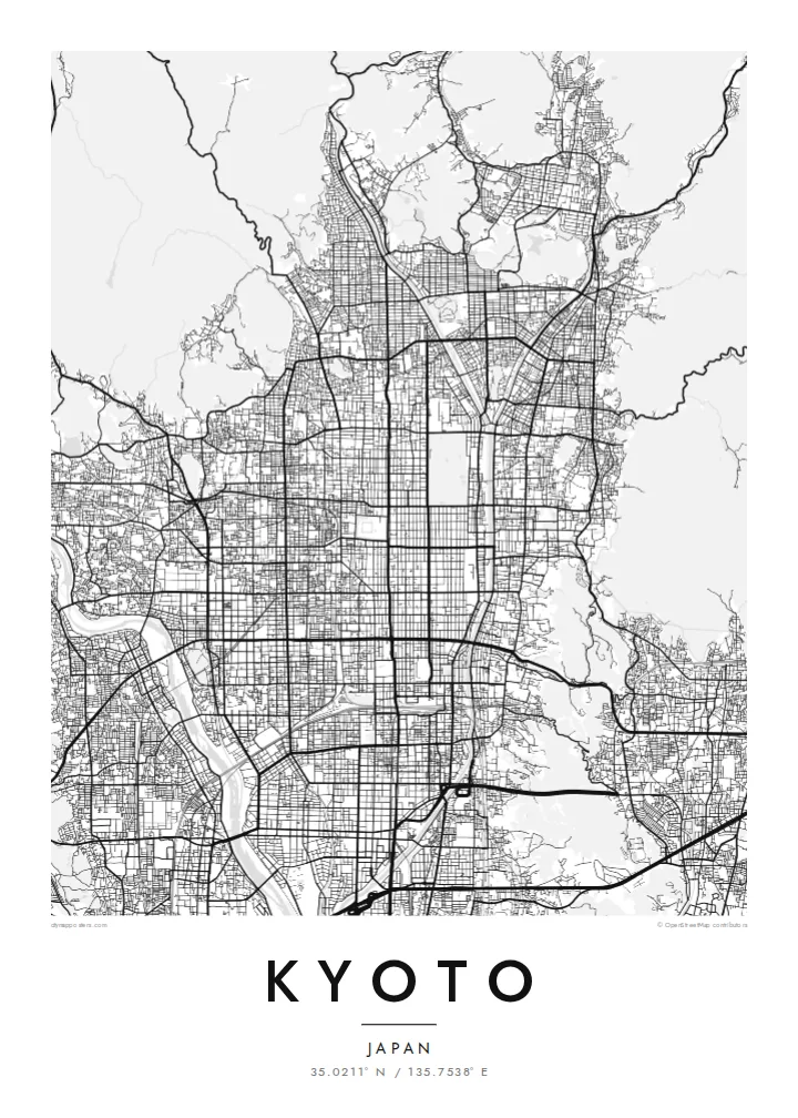
The regular grid of streets in central Kyoto dates back to the city's founding. It is laid out along a north–south axis and reads with rare clarity from above.
Poster in mab ejjab eļap an kōkaan · Japan
35.0211° N / 135.7538° E
An ancient grid laid across a valley floor, bounded by wooded mountains and traced by the Kamo River


Juon jikin kweilok, ļalem eñjake
Jibburi juon style ñan lo e ilo wall. Aolep style ej jokutok wōt āinwōt juon — mede, likūt ilo frame ak ñan bōk āinwōt HD files.
 Pixels eo eṃool · 24 × 36″ file in mede
Alikkar ñan prin
Menin juon crop 100% jān file in mede eo eṃool. Aolep poster — meej, likūt ilo frame ak load — rej kōṃṃane ilo server ko am ilo 300 DPI, ñan 7,200 × 10,800 pixel, bwe lanes ko re dik wōt rej pād im alikkar ilo mede eo 24 × 36″.
Ioon kiin


Mab eo
Kyoto was founded in 794 as Heian-kyō and served as the imperial capital for more than a thousand years. Its plan was modelled on the Chinese capital Chang'an. That grid survives in the numbered east–west streets and long north–south avenues of the centre. Mountains close in on the north, east and west, and the city opens to the plain in the south.
The Kamo River runs down the eastern side of the centre, lined with walking paths. To the west the Katsura River flows past Arashiyama. The mountain edges are thick with temples and shrines. Higashiyama rises in the east, Fushimi Inari stands to the southeast, and the Kyoto Imperial Palace grounds form a large green rectangle within the grid.
A Kyoto map poster shows how strongly the city was planned and how the landscape holds it in place. The straight streets end where the mountains begin, and the rivers draw long lines down the valley. The balance between order and nature is visible in black and white. It makes one of the most elegant city maps in Asia.
The regular grid of streets in central Kyoto dates back to the city's founding. It is laid out along a north–south axis and reads with rare clarity from above.
The river runs straight south along the east side of downtown and is crossed by a series of bridges. Its long line is the spine of the eastern city.
The palace park forms a large open rectangle in the grid north of downtown. It is a quiet space that anchors the centre of the composition.
Kōmmane bwe en aṃ
Kōbaiki juon raan, juon etan ak juon naan eo aṃ, ukōt wāween, joñan ak ooj.
Preview eo ejjeḷọk oṇāān ej resolution edik im ewor watermark. Poster ko rej mede im HD files rej kōṃṃane ilo 300 DPI, ñan 7,200 × 10,800 px, ejjeḷọk watermark.
Etke Kyoto
Kyoto is a city people remember in detail: a temple visit, a season, a stretch of the river path. Its map works as a keepsake of a journey and as a refined design object in its own right.
The poster can carry your own title, a subtitle with a date or phrase, and a coordinates line. Choose from Classic black & white, Noir, Paper, Blueprint or Sand to suit the room.
Order poster Kyoto| Joñan prin | Resolution | File ko |
|---|---|---|
| 30 × 40 cm11.8 × 15.7″ | 3,543 × 4,724 px | PNG · PDF |
| 29.7 × 42 cm (A3)11.7 × 16.5″ | 3,508 × 4,961 px | PNG · PDF |
| 42 × 59.4 cm (A2)16.5 × 23.4″ | 4,961 × 7,016 px | PNG · PDF |
| 45.7 × 61 cm18 × 24″ | 5,400 × 7,200 px | PNG · PDF |
| 50 × 70 cm19.7 × 27.6″ | 5,906 × 8,268 px | PNG · PDF |
| 61 × 91.4 cm24 × 36″ | 7,200 × 10,800 px | PNG · PDF |
Ñan keidi, preview eo ejjeļọk wōnāān ej 900 px an depakpak, ewōr watermark im ej ñan screen wōt. File HD ko rej ñan 8× an alikkar ilo aolep tu im rej prin emmanḷọk ilo joñan poster eo aolepen.
Kāālōt juon style i tōp in page eo, innām kāālōt Poster eṃōj Mede — juon size im, eḷaññe kwōj kōṇaan, juon frame — ak Digital HD Files. Checkout ej juon wōt buñtōn, im page in order eo aṃ enaaj kāāl ñe payment eo ej dedeḷọk.
Emej ilo bok premium 200 gsm matte, ilo juon iaan jiljino size, jān 30 × 40 cm ñan 24 × 36″. Poster ko rej mede rej jino jān $39, jipañ in kadikdik ej pād ilo wōt.
Aet. Kāālōt juon frame wōjke pen ilo black, white, oak ereo ak wōjke marok. Ej itok ippān kilaj ejjab bwilọk im pojak ñan totouk. Poster ko ilo frame rej jino jān $99, jipañ in kadikdik ej pād ilo wōt.
Jāntōn ejjeļo̧k̦ ñan āeļōn̄ ko 60+. Kajjojo poster ej pãleejeḷ ilo juon ian ro jet rejjar bwe ren pãleejeḷ ilo āeļōn̄ ko 30+, im ekkã an tōpar ilo raan ko 3–7 an jerbal. Kwomaroñ lale wāween im tracking ilo My Orders. Jet āeļōn̄ rej aikuj 2–5 wiik, im ijoko jejjeļo̧k̦ ñan jāgià, ļaiboro̧ ej ba ñan eok mokta jān am pay.
Jilkinwōj juon pija ilowaan 14 raan jān an itok, im kōmnaaj mede juon alen ejjeḷọk oṇāān ak kōṃṃan refund ñan eok.
Aet. Ilo editor eo ilo page in, ukōt title eo, subtitle eo im coordinates ñan jabdewōt kwōj kōṇaan, im kāālōt juon style im size. Order ko mede, ilo frame im digital rej kōjerbal wōt design eo aṃ eṃool.
Kōn $9 kwōj bōk 300 DPI PNG im PDF files pojak ñan mede ilo aolep jiljino size, ejjeḷọk watermark, ñan mede ijoko jabdewōt. Ejjañin lukkuun alikkar ippaṃ? Load juon preview eo ejjeḷọk oṇāān kōn watermark ṃokta.
Ekkepaake
