Katsura River valley
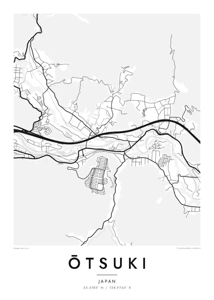
The river winds through the narrow valley, and almost every road and railway follows it. That creates the long, bundled shape at the centre of the map.
Poster in mab ejjab eļap an kōkaan · Japan
35.6185° N / 138.9740° E
A narrow mountain valley town where river, railway and expressway squeeze together below steep forested slopes


Juon jikin kweilok, ļalem eñjake
Jibburi juon style ñan lo e ilo wall. Aolep style ej jokutok wōt āinwōt juon — mede, likūt ilo frame ak ñan bōk āinwōt HD files.
 Pixels eo eṃool · 24 × 36″ file in mede
Alikkar ñan prin
Menin juon crop 100% jān file in mede eo eṃool. Aolep poster — meej, likūt ilo frame ak load — rej kōṃṃane ilo server ko am ilo 300 DPI, ñan 7,200 × 10,800 pixel, bwe lanes ko re dik wōt rej pād im alikkar ilo mede eo 24 × 36″.
Ioon kiin


Mab eo
Ōtsuki lies in eastern Yamanashi, in a deep valley surrounded by steep, wooded mountains. From above the town is long and narrow. The Katsura River, the JR Chūō Main Line and the Chūō Expressway all follow the valley floor, with homes and small streets fitted into whatever flat land remains between them.
Ōtsuki is a junction on the route to Mount Fuji. The Fujikyū line branches south from Ōtsuki Station toward Fujiyoshida and Kawaguchiko, so many travellers change trains here. Just east of the centre is the Saruhashi, the Monkey Bridge, a wooden cantilever bridge over a gorge, often counted among Japan's three unusual bridges.
An Ōtsuki map poster shows the town squeezed into its setting. The river and transport lines form strong parallel curves, and the mountains appear as broad empty areas crossed by only a few winding roads. It is a clear record of how a Japanese valley town is shaped by its terrain, and it suits both residents and Fuji travellers.
The river winds through the narrow valley, and almost every road and railway follows it. That creates the long, bundled shape at the centre of the map.
The Monkey Bridge spans a narrow gorge east of the centre. This wooden cantilever bridge is one of the best-known historic structures in the region.
At Ōtsuki Station the Fujikyū line leaves the Chūō Main Line and heads south toward Mount Fuji, giving the map a branching rail line.
Kōmmane bwe en aṃ
Kōbaiki juon raan, juon etan ak juon naan eo aṃ, ukōt wāween, joñan ak ooj.
Preview eo ejjeḷọk oṇāān ej resolution edik im ewor watermark. Poster ko rej mede im HD files rej kōṃṃane ilo 300 DPI, ñan 7,200 × 10,800 px, ejjeḷọk watermark.
Etke Ōtsuki
Many people pass through Ōtsuki on the way to Fuji, and some stay long enough to know its valley well. The map captures that transit role and the dramatic setting, and the empty mountain areas make it a very graphic print.
Change the title and subtitle, including Japanese text if you prefer, and add a date or adjust the coordinates line. The five styles are Classic black and white, Noir, Paper, Blueprint and Sand. Noir works well with the narrow valley.
Order poster Ōtsuki| Joñan prin | Resolution | File ko |
|---|---|---|
| 30 × 40 cm11.8 × 15.7″ | 3,543 × 4,724 px | PNG · PDF |
| 29.7 × 42 cm (A3)11.7 × 16.5″ | 3,508 × 4,961 px | PNG · PDF |
| 42 × 59.4 cm (A2)16.5 × 23.4″ | 4,961 × 7,016 px | PNG · PDF |
| 45.7 × 61 cm18 × 24″ | 5,400 × 7,200 px | PNG · PDF |
| 50 × 70 cm19.7 × 27.6″ | 5,906 × 8,268 px | PNG · PDF |
| 61 × 91.4 cm24 × 36″ | 7,200 × 10,800 px | PNG · PDF |
Ñan keidi, preview eo ejjeļọk wōnāān ej 900 px an depakpak, ewōr watermark im ej ñan screen wōt. File HD ko rej ñan 8× an alikkar ilo aolep tu im rej prin emmanḷọk ilo joñan poster eo aolepen.
Kāālōt juon style i tōp in page eo, innām kāālōt Poster eṃōj Mede — juon size im, eḷaññe kwōj kōṇaan, juon frame — ak Digital HD Files. Checkout ej juon wōt buñtōn, im page in order eo aṃ enaaj kāāl ñe payment eo ej dedeḷọk.
Emej ilo bok premium 200 gsm matte, ilo juon iaan jiljino size, jān 30 × 40 cm ñan 24 × 36″. Poster ko rej mede rej jino jān $39, jipañ in kadikdik ej pād ilo wōt.
Aet. Kāālōt juon frame wōjke pen ilo black, white, oak ereo ak wōjke marok. Ej itok ippān kilaj ejjab bwilọk im pojak ñan totouk. Poster ko ilo frame rej jino jān $99, jipañ in kadikdik ej pād ilo wōt.
Jāntōn ejjeļo̧k̦ ñan āeļōn̄ ko 60+. Kajjojo poster ej pãleejeḷ ilo juon ian ro jet rejjar bwe ren pãleejeḷ ilo āeļōn̄ ko 30+, im ekkã an tōpar ilo raan ko 3–7 an jerbal. Kwomaroñ lale wāween im tracking ilo My Orders. Jet āeļōn̄ rej aikuj 2–5 wiik, im ijoko jejjeļo̧k̦ ñan jāgià, ļaiboro̧ ej ba ñan eok mokta jān am pay.
Jilkinwōj juon pija ilowaan 14 raan jān an itok, im kōmnaaj mede juon alen ejjeḷọk oṇāān ak kōṃṃan refund ñan eok.
Aet. Ilo editor eo ilo page in, ukōt title eo, subtitle eo im coordinates ñan jabdewōt kwōj kōṇaan, im kāālōt juon style im size. Order ko mede, ilo frame im digital rej kōjerbal wōt design eo aṃ eṃool.
Kōn $9 kwōj bōk 300 DPI PNG im PDF files pojak ñan mede ilo aolep jiljino size, ejjeḷọk watermark, ñan mede ijoko jabdewōt. Ejjañin lukkuun alikkar ippaṃ? Load juon preview eo ejjeḷọk oṇāān kōn watermark ṃokta.
Ekkepaake
