Lincoln Highway
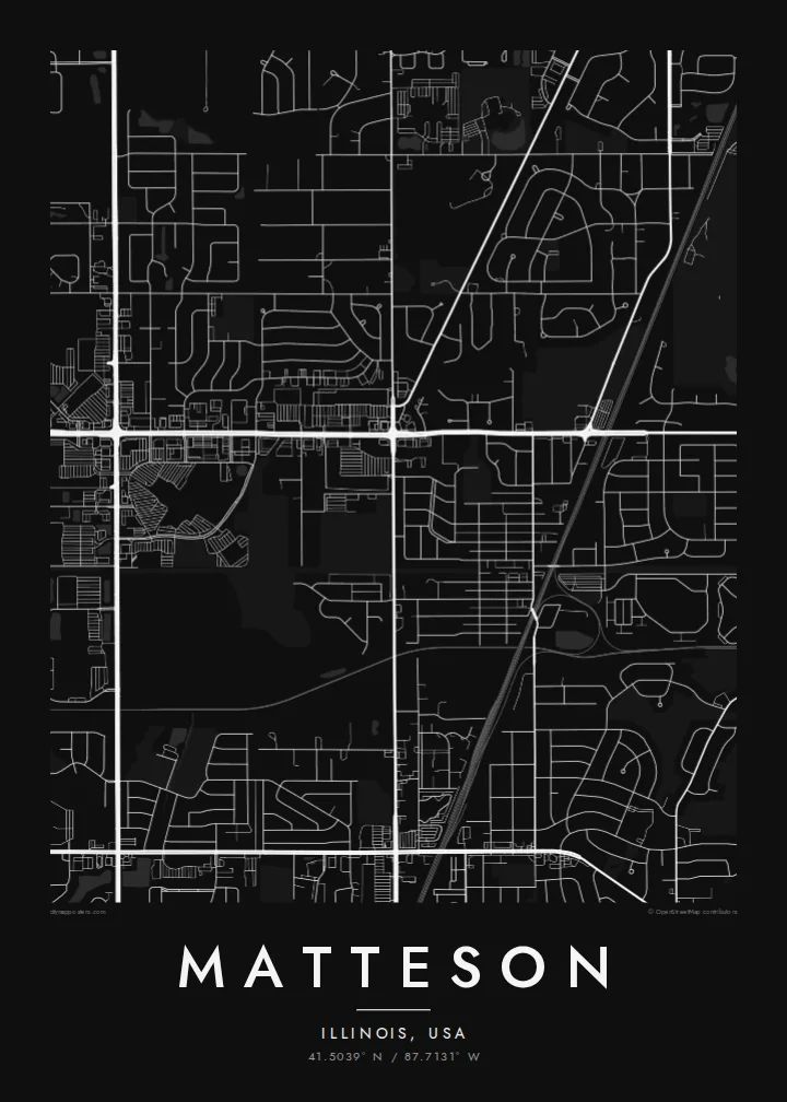
US 30 crosses the village east to west along the route of the Lincoln Highway, the early twentieth-century road linking New York and San Francisco. On the poster it is one of the longest straight lines.
Poster peta minimalis · Amerika Syarikat
41.5039° N / 87.7131° W
A south-suburban Chicago grid where Interstate 57, the Lincoln Highway and the Metra Electric line cut clean lines across former prairie.



Satu bandar, lima suasana
Ketik gaya untuk melihatnya di dinding. Setiap gaya harganya sama — dicetak, dibingkai atau sebagai fail HD.
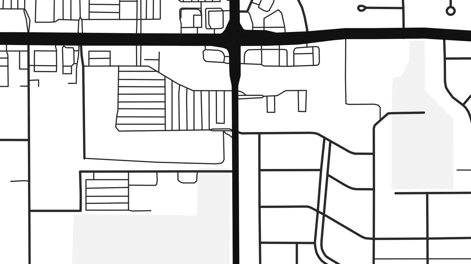 Piksel sebenar · fail cetakan 24 × 36″
Tajam untuk cetakan
Ini ialah potongan 100% daripada fail cetakan sebenar. Setiap poster — dicetak, dibingkai atau dimuat turun — dijana di pelayan kami pada 300 DPI, sehingga 7,200 × 10,800 piksel, jadi lorong sekecil mana pun kekal tajam pada cetakan 24 × 36″.
Di dinding


Peta
Matteson sits on the flat land south of Chicago, where the old prairie was divided into survey-mile squares long before the houses arrived. From above, that pattern is still easy to read. Section-line roads run straight north–south and east–west, and the residential streets inside each square form the loops, cul-de-sacs and short crescents typical of postwar Illinois suburbs.
The village began as a railroad settlement and is named after Joel Matteson, a governor of Illinois in the 1850s. The rail corridor still runs through town and now carries Metra Electric commuter trains toward downtown Chicago. On the map it reads as a long, unbroken line, and most streets meet it at right angles instead of crossing it at random.
Two major roads frame the picture. Interstate 57 runs north–south through the village with its interchange ramps, and US 30, the historic Lincoln Highway, runs east–west along one of the country's earliest coast-to-coast routes. A Matteson map poster shows where a transcontinental road, a commuter railway and quiet residential blocks meet, all in one orderly composition.
US 30 crosses the village east to west along the route of the Lincoln Highway, the early twentieth-century road linking New York and San Francisco. On the poster it is one of the longest straight lines.
The interstate runs north–south through the village. Its interchange ramps are the most curved, sculptural shapes on an otherwise rectilinear map.
Between the section-line roads, subdivisions use curving drives and cul-de-sacs. Each square mile gets its own pattern of rounded lines inside a rigid outer frame.
Jadikan milik anda
Tambah tarikh, nama atau ayat anda sendiri, tukar gaya, saiz atau orientasi.
Pratonton percuma beresolusi rendah dengan tanda air. Cetakan dan fail HD dijana pada 300 DPI, sehingga 7,200 × 10,800 px, tanpa tanda air.
Kenapa Matteson
For people who grew up in the south suburbs or rode the Metra from here, the map is a quiet record of daily routes: the station, the highway ramps, the street where the family house stood. It suits a hallway, a home office or a first apartment in the city.
You can set your own title, subtitle and coordinates line, for example a family name or a move-in date, and choose Classic black & white, Noir, Paper, Blueprint or Sand. The $9 digital download includes six print sizes as 300 DPI PNG and PDF files. Printed and framed versions ship from partners in 30+ countries.
Tempah poster Matteson| Saiz cetakan | Resolusi | Fail |
|---|---|---|
| 30 × 40 cm11.8 × 15.7″ | 3,543 × 4,724 px | PNG · PDF |
| 29.7 × 42 cm (A3)11.7 × 16.5″ | 3,508 × 4,961 px | PNG · PDF |
| 42 × 59.4 cm (A2)16.5 × 23.4″ | 4,961 × 7,016 px | PNG · PDF |
| 45.7 × 61 cm18 × 24″ | 5,400 × 7,200 px | PNG · PDF |
| 50 × 70 cm19.7 × 27.6″ | 5,906 × 8,268 px | PNG · PDF |
| 61 × 91.4 cm24 × 36″ | 7,200 × 10,800 px | PNG · PDF |
Sebagai perbandingan, pratonton percuma selebar 900 px, bertera air dan untuk skrin sahaja. Fail HD mempunyai resolusi sehingga 8× ganda pada setiap arah dan dicetak dengan kemas pada saiz poster penuh.
Pilih gaya di bahagian atas halaman, kemudian pilih Poster Cetakan — saiz dan, jika mahu, bingkai — atau Fail Digital HD. Pembayaran hanya satu langkah, dan halaman pesanan anda akan dikemas kini sebaik sahaja pembayaran selesai.
Ia dicetak pada kertas matte premium 200 gsm dalam salah satu daripada enam saiz, dari 30 × 40 cm hingga 24 × 36″. Poster cetakan bermula pada $39, penghantaran percuma.
Boleh. Pilih bingkai kayu pejal dalam warna hitam, putih, oak semula jadi atau kayu gelap. Ia dilengkapi kaca tahan pecah dan sedia untuk digantung. Poster berbingkai bermula pada $99, penghantaran percuma.
Penghantaran adalah percuma ke 60+ negara. Setiap poster dicetak oleh rakan pencetakan kami yang paling hampir di 30+ negara dan biasanya tiba dalam 3–7 hari bekerja. Anda boleh menjejaki status dan penjejakan di bawah Pesanan Saya. Beberapa negara mengambil masa 2–5 minggu, dan jika kami belum menghantar ke sana, laman web akan memberitahu anda sebelum anda membayar.
Hantarkan kami gambar dalam masa 14 hari selepas penghantaran dan kami akan mencetak semula secara percuma atau memberikan bayaran balik.
Boleh. Dalam editor di halaman ini, ubah tajuk, subtajuk dan baris koordinat mengikut kehendak anda, kemudian pilih gaya dan saiz. Pesanan cetakan, berbingkai dan digital semuanya menggunakan reka bentuk anda dengan tepat.
Dengan harga $9, anda dapat fail PNG 300 DPI dan PDF sedia cetak dalam kesemua enam saiz, tanpa tanda air, untuk dicetak di mana-mana sahaja. Belum pasti? Muat turun pratonton percuma bertanda air dahulu.
