Lake Biwa shoreline
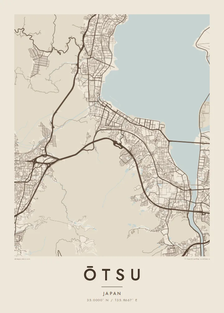
The lake fills a large part of the frame, and the city follows its edge in a long, gently curving strip of streets, promenades and reclaimed waterfront.
Poster peta minimalis · Jepun
35.0000° N / 135.8667° E
A long lakeside city on the southern tip of Lake Biwa, pressed between the water and the slopes of Mount Hiei


Satu bandar, lima suasana
Ketik gaya untuk melihatnya di dinding. Setiap gaya harganya sama — dicetak, dibingkai atau sebagai fail HD.
 Piksel sebenar · fail cetakan 24 × 36″
Tajam untuk cetakan
Ini ialah potongan 100% daripada fail cetakan sebenar. Setiap poster — dicetak, dibingkai atau dimuat turun — dijana di pelayan kami pada 300 DPI, sehingga 7,200 × 10,800 piksel, jadi lorong sekecil mana pun kekal tajam pada cetakan 24 × 36″.
Di dinding


Peta
Ōtsu, the capital of Shiga Prefecture, stretches along the southwestern shore of Lake Biwa, the largest lake in Japan. The city is long and narrow: a band of streets and rail lines squeezed between the lake and the wooded ridges that separate it from Kyoto. On a map the shoreline and the mountains define almost every neighbourhood.
The city's roots run deep. In the seventh century it briefly served as the imperial capital under Emperor Tenji, and above it, on Mount Hiei, stands Enryaku-ji, the head temple of Tendai Buddhism. Closer to the water are Mii-dera and, to the south, Ishiyama-dera, where Murasaki Shikibu is said to have begun The Tale of Genji.
At the lake's southern end the Seta River flows out beneath the old Seta bridge, and the Lake Biwa Canal leaves the city through tunnels towards Kyoto. An Ōtsu map poster traces these lines of water and movement: the shore, the river, the canal and the roads that have linked the lake to the old capital for centuries.
The lake fills a large part of the frame, and the city follows its edge in a long, gently curving strip of streets, promenades and reclaimed waterfront.
At the southern tip the lake narrows into the Seta River, its only natural outlet, crossed by the long Seta no Karahashi bridge that has stood at this point in various forms for centuries.
Behind the city the ground rises sharply into Mount Hiei and the neighbouring hills, where the street grid gives way to forest and winding temple roads.
Jadikan milik anda
Tambah tarikh, nama atau ayat anda sendiri, tukar gaya, saiz atau orientasi.
Pratonton percuma beresolusi rendah dengan tanda air. Cetakan dan fail HD dijana pada 300 DPI, sehingga 7,200 × 10,800 px, tanpa tanda air.
Kenapa Ōtsu
Ōtsu appeals to anyone who loves the meeting of water and mountains, and to those who know it from temple visits, lakeside walks or a daily commute to Kyoto. The long shoreline composition works especially well on a tall portrait format.
Personalise the title, subtitle and coordinates, perhaps with a date or a lakeside address, and select one of five styles: Classic black & white, Noir, Paper, Blueprint or Sand. Each style gives the broad shape of the lake a different weight against the streets.
Tempah poster Ōtsu| Saiz cetakan | Resolusi | Fail |
|---|---|---|
| 30 × 40 cm (11.8 × 15.7″) | 3,543 × 4,724 px | PNG · PDF |
| 29.7 × 42 cm (A3, 11.7 × 16.5″) | 3,508 × 4,961 px | PNG · PDF |
| 42 × 59.4 cm (A2, 16.5 × 23.4″) | 4,961 × 7,016 px | PNG · PDF |
| 45.7 × 61 cm (18 × 24″) | 5,400 × 7,200 px | PNG · PDF |
| 50 × 70 cm (19.7 × 27.6″) | 5,906 × 8,268 px | PNG · PDF |
| 61 × 91.4 cm (24 × 36″) | 7,200 × 10,800 px | PNG · PDF |
Sebagai perbandingan, pratonton percuma selebar 900 px, bertera air dan untuk skrin sahaja. Fail HD mempunyai resolusi sehingga 8× ganda pada setiap arah dan dicetak dengan kemas pada saiz poster penuh.
Pilih gaya di bahagian atas halaman, kemudian pilih Poster Cetakan — saiz dan, jika mahu, bingkai — atau Fail Digital HD. Pembayaran hanya satu langkah, dan halaman pesanan anda akan dikemas kini sebaik sahaja pembayaran selesai.
Ia dicetak pada kertas matte premium 200 gsm dalam salah satu daripada enam saiz, dari 30 × 40 cm hingga 24 × 36″. Poster cetakan bermula pada {printFrom}, penghantaran percuma.
Boleh. Pilih bingkai kayu pejal dalam warna hitam, putih, oak semula jadi atau kayu gelap. Ia dilengkapi kaca tahan pecah dan sedia untuk digantung. Poster berbingkai bermula pada {framedFrom}, penghantaran percuma.
Penghantaran percuma ke seluruh dunia. Setiap poster dicetak oleh rakan cetakan kami yang paling dekat di lebih 30 negara dan biasanya tiba dalam 3–7 hari bekerja. Anda boleh menyemak status dan penjejakan di bawah Pesanan Saya.
Hantarkan kami gambar dalam masa 14 hari selepas penghantaran dan kami akan mencetak semula secara percuma atau memberikan bayaran balik.
Boleh. Dalam editor di halaman ini, ubah tajuk, subtajuk dan baris koordinat mengikut kehendak anda, kemudian pilih gaya dan saiz. Pesanan cetakan, berbingkai dan digital semuanya menggunakan reka bentuk anda dengan tepat.
Dengan harga $9, anda dapat fail PNG 300 DPI dan PDF sedia cetak dalam kesemua enam saiz, tanpa tanda air, untuk dicetak di mana-mana sahaja. Belum pasti? Muat turun pratonton percuma bertanda air dahulu.
