San Juan and San Francisco
The two oldest quarters form a tight knot of narrow, irregular streets. They are clearly distinguishable from the more regular modern districts around them.
Poster peta minimalis · Sepanyol
27.9924° N / 15.4192° W
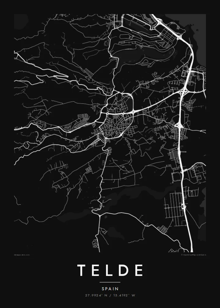
Gran Canaria's second city, spreading from two historic quarters down a slope of ravines to the eastern coast.



Satu bandar, lima suasana
Ketik gaya untuk melihatnya di dinding. Setiap gaya harganya sama — dicetak, dibingkai atau sebagai fail HD.
 Piksel sebenar · fail cetakan 24 × 36″
Tajam untuk cetakan
Ini ialah potongan 100% daripada fail cetakan sebenar. Setiap poster — dicetak, dibingkai atau dimuat turun — dijana di pelayan kami pada 300 DPI, sehingga 7,200 × 10,800 piksel, jadi lorong sekecil mana pun kekal tajam pada cetakan 24 × 36″.
Di dinding


Peta
Telde lies on the eastern side of Gran Canaria, between the island's central highlands and the Atlantic. It is the second-largest municipality on the island. Instead of one compact core it forms a string of districts. They spread across a gently sloping landscape cut by ravines, or barrancos, that run from the hills down to the shore.
Before the Castilian conquest, Telde was one of the island's two indigenous seats of power. Its oldest quarters, San Juan and San Francisco, keep narrow streets and low whitewashed houses, and the Basilica of San Juan Bautista stands at the centre of the former. The coastline includes beaches such as Melenara and La Garita, and Gran Canaria Airport lies just to the south.
A Telde map poster shows a scattered, layered city. There is a historic centre inland, with separate districts spreading across the slope, dry ravines between them, and a rocky coastline along the eastern edge. It is more complex than a typical grid, and that is its appeal.
The two oldest quarters form a tight knot of narrow, irregular streets. They are clearly distinguishable from the more regular modern districts around them.
Dry barrancos run down from the interior to the sea. They leave open corridors that separate the neighbourhoods and give the map strong diagonal lines.
The eastern coast is a series of small bays and headlands. It gives the poster an irregular, detailed edge, with the beach districts clustered along it.
Jadikan milik anda
Tambah tarikh, nama atau ayat anda sendiri, tukar gaya, saiz atau orientasi.
Pratonton percuma beresolusi rendah dengan tanda air. Cetakan dan fail HD dijana pada 300 DPI, sehingga 7,200 × 10,800 px, tanpa tanda air.
Kenapa Telde
Telde is home for many Canarians and a familiar stop for people who know Gran Canaria beyond the resorts. A print of its districts and ravines is a genuine piece of the island.
Personalise the title, subtitle and coordinates line. The Sand style suits the island's dry landscape, and Noir gives a more modern look. The HD files include six print sizes, and a free watermarked preview is available first.
Tempah poster Telde| Saiz cetakan | Resolusi | Fail |
|---|---|---|
| 30 × 40 cm (11.8 × 15.7″) | 3,543 × 4,724 px | PNG · PDF |
| 29.7 × 42 cm (A3, 11.7 × 16.5″) | 3,508 × 4,961 px | PNG · PDF |
| 42 × 59.4 cm (A2, 16.5 × 23.4″) | 4,961 × 7,016 px | PNG · PDF |
| 45.7 × 61 cm (18 × 24″) | 5,400 × 7,200 px | PNG · PDF |
| 50 × 70 cm (19.7 × 27.6″) | 5,906 × 8,268 px | PNG · PDF |
| 61 × 91.4 cm (24 × 36″) | 7,200 × 10,800 px | PNG · PDF |
Sebagai perbandingan, pratonton percuma selebar 900 px, bertera air dan untuk skrin sahaja. Fail HD mempunyai resolusi sehingga 8× ganda pada setiap arah dan dicetak dengan kemas pada saiz poster penuh.
Pilih gaya di bahagian atas halaman, kemudian pilih Poster Cetakan — saiz dan, jika mahu, bingkai — atau Fail Digital HD. Pembayaran hanya satu langkah, dan halaman pesanan anda akan dikemas kini sebaik sahaja pembayaran selesai.
Ia dicetak pada kertas matte premium 200 gsm dalam salah satu daripada enam saiz, dari 30 × 40 cm hingga 24 × 36″. Poster cetakan bermula pada {printFrom}, penghantaran percuma.
Boleh. Pilih bingkai kayu pejal dalam warna hitam, putih, oak semula jadi atau kayu gelap. Ia dilengkapi kaca tahan pecah dan sedia untuk digantung. Poster berbingkai bermula pada {framedFrom}, penghantaran percuma.
Penghantaran percuma ke seluruh dunia. Setiap poster dicetak oleh rakan cetakan kami yang paling dekat di lebih 30 negara dan biasanya tiba dalam 3–7 hari bekerja. Anda boleh menyemak status dan penjejakan di bawah Pesanan Saya.
Hantarkan kami gambar dalam masa 14 hari selepas penghantaran dan kami akan mencetak semula secara percuma atau memberikan bayaran balik.
Boleh. Dalam editor di halaman ini, ubah tajuk, subtajuk dan baris koordinat mengikut kehendak anda, kemudian pilih gaya dan saiz. Pesanan cetakan, berbingkai dan digital semuanya menggunakan reka bentuk anda dengan tepat.
Dengan harga $9, anda dapat fail PNG 300 DPI dan PDF sedia cetak dalam kesemua enam saiz, tanpa tanda air, untuk dicetak di mana-mana sahaja. Belum pasti? Muat turun pratonton percuma bertanda air dahulu.
Berdekatan
