Barrier beaches
A narrow strip of sand runs along the Atlantic shore, holding bays and ponds behind it and giving the southern edge of the map a double outline.
मिनिमलिस्ट नक्सा पोस्टर · संयुक्त राज्य
40.8974° N / 72.3736° W
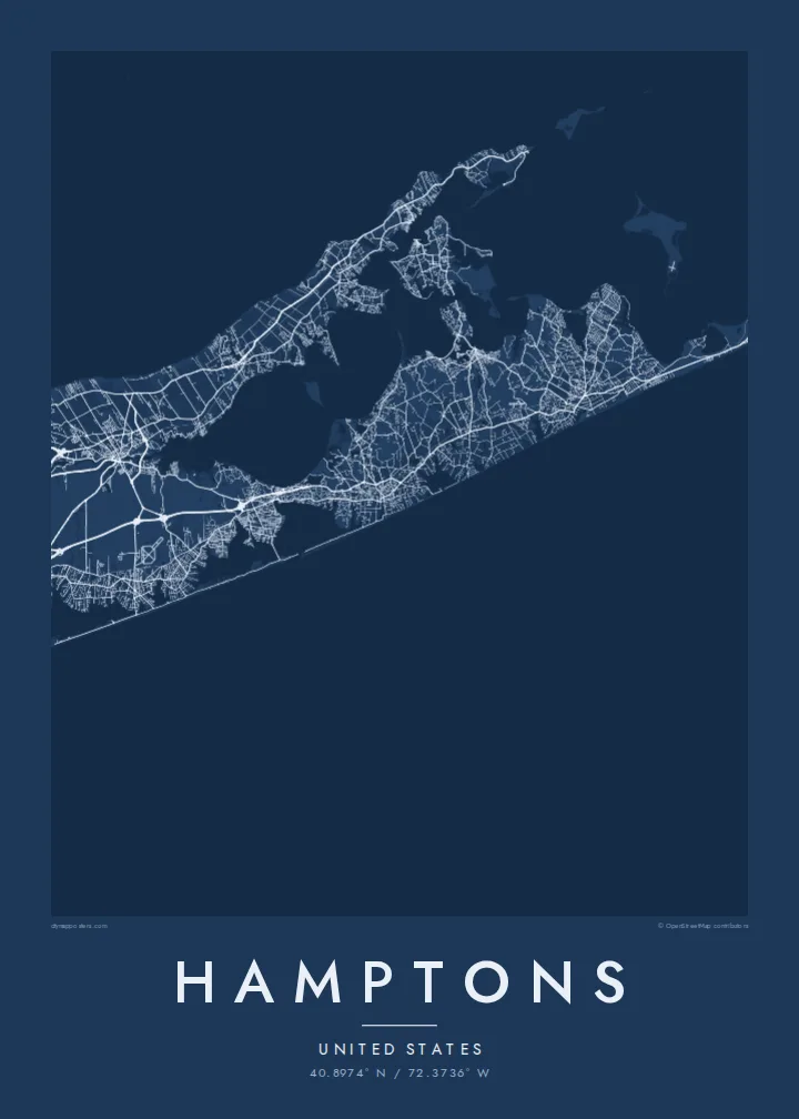
A chain of villages along Long Island's South Fork, between barrier beaches, ponds and bays, ending at Montauk Point



एउटै शहर, पाँच मुड
पर्खालमा कस्तो देखिन्छ हेर्न कुनै स्टाइल छान्नुहोस्। हरेक स्टाइलको मूल्य उस्तै हुन्छ — प्रिन्ट, फ्रेम वा HD फाइलको रूपमा।
 वास्तविक पिक्सेल · 24 × 36″ प्रिन्ट फाइल
प्रिन्टमा प्रस्ट
यो वास्तविक प्रिन्ट फाइलको 100% क्रप हो। हरेक पोस्टर — प्रिन्ट, फ्रेम वा डाउनलोड — हाम्रो सर्भरमा 300 DPI मा, 7,200 × 10,800 पिक्सेलसम्म रेन्डर हुन्छ, त्यसैले सबैभन्दा साना गल्लीहरू पनि 24 × 36″ प्रिन्टमा स्पष्ट देखिन्छन्।
भित्तामा


नक्सा
The Hamptons occupy the South Fork of Long Island, at the eastern end of New York State. The map shows a long, tapering strip of land with the Atlantic along its southern side and a network of bays to the north. Along the ocean edge, barrier beaches enclose a series of coastal ponds and inlets, while inland the villages sit among farmland and woods.
Southampton, East Hampton and several neighbouring villages were settled in the seventeenth century, and Sag Harbor grew into a whaling port. From the late nineteenth century the area became a summer retreat for New Yorkers and artists. At the eastern tip stands the Montauk Point Lighthouse, authorised under George Washington, at the very end of the fork.
A Hamptons map poster follows Montauk Highway, which links the villages from west to east, with smaller lanes leading down to the ocean beaches. Shinnecock Bay and its canal mark the western approach, and ponds such as Mecox and Georgica cut into the shoreline. Toward Montauk the land narrows further, and the settlements thin out.
A narrow strip of sand runs along the Atlantic shore, holding bays and ponds behind it and giving the southern edge of the map a double outline.
The former whaling village faces the sheltered bays on the north side of the fork, with its small street network gathered around the harbour.
The fork ends in a blunt headland, and the lighthouse at its tip marks the easternmost point of New York State.
आफ्नै बनाउनुहोस्
मिति, नाम वा आफ्नै एक लाइन थप्नुहोस्, शैली, साइज वा दिशा बदल्नुहोस्।
नि:शुल्क प्रिभ्यू कम-रिजोलुसन र वाटरमार्कसहित हुन्छ। प्रिन्ट र HD फाइलहरू 300 DPI मा, 7,200 × 10,800 px सम्म, वाटरमार्क बिना रेन्डर गरिन्छन्।
किन Hamptons
It suits families with a summer house, people who come back every season and anyone who spent formative summers on the South Fork. Put a village, a house name or a surname in the title, and use the subtitle for a year or a date.
Choose one of five styles: Classic black & white, Noir, Paper, Blueprint or Sand. The $9 digital download includes six print sizes as 300 DPI PNG and print-ready PDF files, with no watermark. Printed posters on matte paper are also available.
Hamptons पोस्टर अर्डर गर्नुहोस्| प्रिन्ट साइज | रिजोल्युसन | फाइलहरू |
|---|---|---|
| 30 × 40 cm (11.8 × 15.7″) | 3,543 × 4,724 px | PNG · PDF |
| 29.7 × 42 cm (A3, 11.7 × 16.5″) | 3,508 × 4,961 px | PNG · PDF |
| 42 × 59.4 cm (A2, 16.5 × 23.4″) | 4,961 × 7,016 px | PNG · PDF |
| 45.7 × 61 cm (18 × 24″) | 5,400 × 7,200 px | PNG · PDF |
| 50 × 70 cm (19.7 × 27.6″) | 5,906 × 8,268 px | PNG · PDF |
| 61 × 91.4 cm (24 × 36″) | 7,200 × 10,800 px | PNG · PDF |
तुलनाका लागि, निःशुल्क प्रिभ्यु 900 px चौडा, वाटरमार्कसहित र स्क्रिनका लागि मात्र हो। HD फाइलहरूमा हरेक दिशामा 8× सम्म बढी रिजोल्युसन हुन्छ र पूरा पोस्टर साइजमा सफा छापिन्छ।
पेजको माथिबाट कुनै स्टाइल छान्नुहोस्, त्यसपछि प्रिन्टेड पोस्टर — साइज र चाहेमा फ्रेम — वा डिजिटल HD फाइलहरू छान्नुहोस्। चेकआउट एक चरणमा हुन्छ, र पेमेन्ट भएपश्चात तपाईंको अर्डर पेज तुरुन्तै अपडेट हुन्छ।
यो प्रिमियम 200 gsm म्याट पेपरमा, 30 × 40 cm देखि 24 × 36″ सम्मका छ साइजमध्ये एकमा प्रिन्ट गरिन्छ। प्रिन्टेड पोस्टरहरू {printFrom} बाट सुरु हुन्छन्, ढुवानी सहित।
हो। कालो, सेतो, प्राकृतिक ओक वा गाढा काठको ठोस काठको फ्रेम छान्नुहोस्। यो फुट्दैन भन्ने गिलाससहित आउँछ र झुन्ड्याउनका लागि तयार हुन्छ। फ्रेम गरिएका पोस्टरहरू {framedFrom} बाट सुरु हुन्छन्, ढुवानी सहित।
विश्वभर निःशुल्क ढुवानी। प्रत्येक पोस्टर ३०+ देशमा रहेका हाम्रा प्रिन्ट पार्टनरमध्ये सबैभन्दा नजिकको पार्टनरले छाप्छ र सामान्यतया ३–७ कार्यदिनभित्र पुग्छ। तपाईं मेरा अर्डरहरू मा गएर स्थिति र ट्र्याकिङ हेर्न सक्नुहुन्छ। केही देशमा २–५ हप्ता लाग्छ, र जहाँ हामी अझै ढुवानी गर्दैनौं, भुक्तानी गर्नुअघि नै साइटले जानकारी दिन्छ।
डेलिवरी भएको 14 दिनभित्र हामीलाई फोटो पठाउनुहोस्, हामी नि:शुल्क पुनः प्रिन्ट गरिदिनेछौं वा रिफन्ड दिनेछौं।
हो। यो पेजको एडिटरमा, शीर्षक, उपशीर्षक र कोअर्डिनेट लाइनलाई तपाईंले चाहेजस्तै बदल्नुहोस्, अनि स्टाइल र साइज छान्नुहोस्। प्रिन्टेड, फ्रेम गरिएका र डिजिटल अर्डर सबैले तपाईंको डिजाइन नै प्रयोग गर्छन्।
$9 मा तपाईंले सबै छ साइजमा 300 DPI PNG र प्रिन्ट-रेडी PDF फाइलहरू पाउनुहुन्छ, वाटरमार्क बिना, जुनसुकै ठाउँमा प्रिन्ट गर्न मिल्ने। अझै पक्का हुनुभएको छैन? पहिले नि:शुल्क वाटरमार्क भएको प्रिभ्यू डाउनलोड गर्नुहोस्।
