Rounded outline
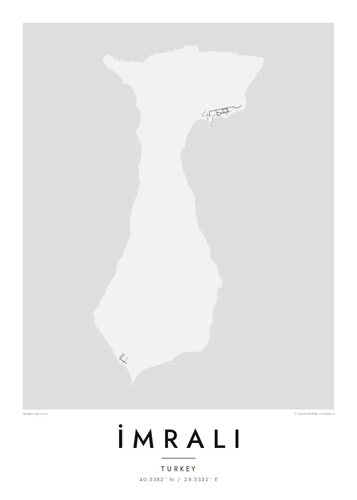
The island's coast is smooth and only lightly indented. The map shows a compact, soft-edged form surrounded by a wide stretch of open water.
मिनिमलिस्ट नक्सा पोस्टर · तुर्किये
40.5382° N / 28.5352° E
A compact, hilly island in the southern Sea of Marmara, with a smooth coastline and few marked features.


एउटै शहर, पाँच मुड
पर्खालमा कस्तो देखिन्छ हेर्न कुनै स्टाइल छान्नुहोस्। हरेक स्टाइलको मूल्य उस्तै हुन्छ — प्रिन्ट, फ्रेम वा HD फाइलको रूपमा।
 वास्तविक पिक्सेल · 24 × 36″ प्रिन्ट फाइल
प्रिन्टमा प्रस्ट
यो वास्तविक प्रिन्ट फाइलको 100% क्रप हो। हरेक पोस्टर — प्रिन्ट, फ्रेम वा डाउनलोड — हाम्रो सर्भरमा 300 DPI मा, 7,200 × 10,800 पिक्सेलसम्म रेन्डर हुन्छ, त्यसैले सबैभन्दा साना गल्लीहरू पनि 24 × 36″ प्रिन्टमा स्पष्ट देखिन्छन्।
भित्तामा


नक्सा
İmralı lies in the southern Sea of Marmara, near the mouth of the Gulf of Gemlik and within sight of the Bursa coastline. On a map it is a small, rounded island with a gently curving outline and a hilly interior. It has almost no marked roads or settlements. Its shape is simple, closer to a pebble than to the jagged islands of the Aegean.
The island has served as a prison since the 1930s, and access has long been limited to the authorities. Since 1999 it has held Abdullah Öcalan, which has made the name widely known in Turkey and abroad. The island therefore stays largely closed to visitors, and maps show few details of its interior.
From the Marmara coast it sits low on the horizon between the mainland and open water. An İmralı map poster treats the island purely as geography: a clean outline in the sea, with the surrounding coast and water giving scale to a place better known by name than by sight.
The island's coast is smooth and only lightly indented. The map shows a compact, soft-edged form surrounded by a wide stretch of open water.
The island lies near the mouth of the Gulf of Gemlik, between the southern coast and the open sea, which frames it clearly on the page.
Access is restricted and there has been little development, so the interior carries few roads or buildings. The hills alone define the map.
आफ्नै बनाउनुहोस्
मिति, नाम वा आफ्नै एक लाइन थप्नुहोस्, शैली, साइज वा दिशा बदल्नुहोस्।
नि:शुल्क प्रिभ्यू कम-रिजोलुसन र वाटरमार्कसहित हुन्छ। प्रिन्ट र HD फाइलहरू 300 DPI मा, 7,200 × 10,800 px सम्म, वाटरमार्क बिना रेन्डर गरिन्छन्।
किन İmralı
Some people want the island for its place in modern Turkish history, others simply for its shape in the Marmara. Either way the print is restrained and neutral, a piece of geography rather than a statement on the wall.
Change the title and subtitle to suit your purpose, keep the coordinates line, and pick from five styles, such as Classic black & white or Paper. The free watermarked preview lets you check the framing before you choose files or a print.
İmralı पोस्टर अर्डर गर्नुहोस्| प्रिन्ट साइज | रिजोल्युसन | फाइलहरू |
|---|---|---|
| 30 × 40 cm (11.8 × 15.7″) | 3,543 × 4,724 px | PNG · PDF |
| 29.7 × 42 cm (A3, 11.7 × 16.5″) | 3,508 × 4,961 px | PNG · PDF |
| 42 × 59.4 cm (A2, 16.5 × 23.4″) | 4,961 × 7,016 px | PNG · PDF |
| 45.7 × 61 cm (18 × 24″) | 5,400 × 7,200 px | PNG · PDF |
| 50 × 70 cm (19.7 × 27.6″) | 5,906 × 8,268 px | PNG · PDF |
| 61 × 91.4 cm (24 × 36″) | 7,200 × 10,800 px | PNG · PDF |
तुलनाका लागि, निःशुल्क प्रिभ्यु 900 px चौडा, वाटरमार्कसहित र स्क्रिनका लागि मात्र हो। HD फाइलहरूमा हरेक दिशामा 8× सम्म बढी रिजोल्युसन हुन्छ र पूरा पोस्टर साइजमा सफा छापिन्छ।
पेजको माथिबाट कुनै स्टाइल छान्नुहोस्, त्यसपछि प्रिन्टेड पोस्टर — साइज र चाहेमा फ्रेम — वा डिजिटल HD फाइलहरू छान्नुहोस्। चेकआउट एक चरणमा हुन्छ, र पेमेन्ट भएपश्चात तपाईंको अर्डर पेज तुरुन्तै अपडेट हुन्छ।
यो प्रिमियम 200 gsm म्याट पेपरमा, 30 × 40 cm देखि 24 × 36″ सम्मका छ साइजमध्ये एकमा प्रिन्ट गरिन्छ। प्रिन्टेड पोस्टरहरू $39 बाट सुरु हुन्छन्, ढुवानी सहित।
हो। कालो, सेतो, प्राकृतिक ओक वा गाढा काठको ठोस काठको फ्रेम छान्नुहोस्। यो फुट्दैन भन्ने गिलाससहित आउँछ र झुन्ड्याउनका लागि तयार हुन्छ। फ्रेम गरिएका पोस्टरहरू $99 बाट सुरु हुन्छन्, ढुवानी सहित।
विश्वभर निःशुल्क ढुवानी। प्रत्येक पोस्टर ३०+ देशमा रहेका हाम्रा प्रिन्ट पार्टनरमध्ये सबैभन्दा नजिकको पार्टनरले छाप्छ र सामान्यतया ३–७ कार्यदिनभित्र पुग्छ। तपाईं मेरा अर्डरहरू मा गएर स्थिति र ट्र्याकिङ हेर्न सक्नुहुन्छ। केही देशमा २–५ हप्ता लाग्छ, र जहाँ हामी अझै ढुवानी गर्दैनौं, भुक्तानी गर्नुअघि नै साइटले जानकारी दिन्छ।
डेलिवरी भएको 14 दिनभित्र हामीलाई फोटो पठाउनुहोस्, हामी नि:शुल्क पुनः प्रिन्ट गरिदिनेछौं वा रिफन्ड दिनेछौं।
हो। यो पेजको एडिटरमा, शीर्षक, उपशीर्षक र कोअर्डिनेट लाइनलाई तपाईंले चाहेजस्तै बदल्नुहोस्, अनि स्टाइल र साइज छान्नुहोस्। प्रिन्टेड, फ्रेम गरिएका र डिजिटल अर्डर सबैले तपाईंको डिजाइन नै प्रयोग गर्छन्।
$9 मा तपाईंले सबै छ साइजमा 300 DPI PNG र प्रिन्ट-रेडी PDF फाइलहरू पाउनुहुन्छ, वाटरमार्क बिना, जुनसुकै ठाउँमा प्रिन्ट गर्न मिल्ने। अझै पक्का हुनुभएको छैन? पहिले नि:शुल्क वाटरमार्क भएको प्रिभ्यू डाउनलोड गर्नुहोस्।
