Paddy field grid
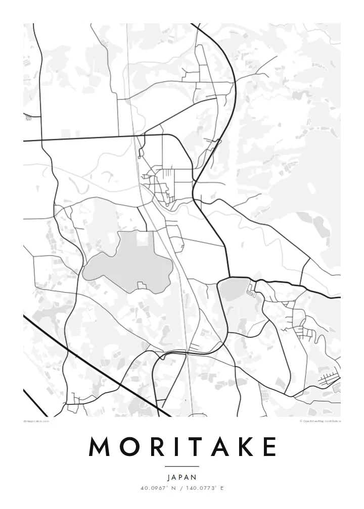
Rice paddies fill the lowlands in a precise grid of rectangles. It is the most striking pattern on the map and typical of the Akita plains.
मिनिमलिस्ट नक्सा पोस्टर · जापान
40.0967° N / 140.0773° E
A rural settlement in northwest Akita, where village streets meet rice paddies between hills and the Sea of Japan coast


एउटै शहर, पाँच मुड
पर्खालमा कस्तो देखिन्छ हेर्न कुनै स्टाइल छान्नुहोस्। हरेक स्टाइलको मूल्य उस्तै हुन्छ — प्रिन्ट, फ्रेम वा HD फाइलको रूपमा।
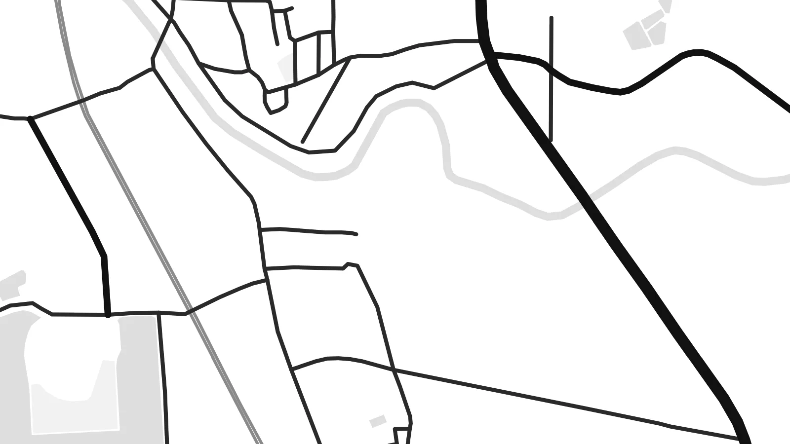 वास्तविक पिक्सेल · 24 × 36″ प्रिन्ट फाइल
प्रिन्टमा प्रस्ट
यो वास्तविक प्रिन्ट फाइलको 100% क्रप हो। हरेक पोस्टर — प्रिन्ट, फ्रेम वा डाउनलोड — हाम्रो सर्भरमा 300 DPI मा, 7,200 × 10,800 पिक्सेलसम्म रेन्डर हुन्छ, त्यसैले सबैभन्दा साना गल्लीहरू पनि 24 × 36″ प्रिन्टमा स्पष्ट देखिन्छन्।
भित्तामा


नक्सा
Moritake lies in Yamamoto district in the northwest of Akita Prefecture, in the town of Mitane, on the Sea of Japan side of northern Honshu. The landscape is quiet farming country. Flat rice paddies fill the lowlands, wooded hills rise inland, and the coast is not far to the west. Mitane is known throughout Japan for junsai, an aquatic plant grown in ponds and served as a delicacy.
On a map the settlement forms a narrow strip of houses and shops along the main road and railway. The land beyond is divided into a very regular grid of paddy fields. Their clean rectangles cover much of the lowland and stop where the forested hills begin. Irrigation ponds and small streams add scattered points of water.
A Moritake map poster shows the geometry of rural Japan: a line of settlement, the neat grid of paddies and the soft edges of the hills. In monochrome the paddy grid becomes a delicate pattern. The long, thin village runs through it as a single stroke, giving the print an unusually calm, graphic quality.
Rice paddies fill the lowlands in a precise grid of rectangles. It is the most striking pattern on the map and typical of the Akita plains.
Houses and shops line the main road and railway in a narrow strip. The settlement reads as one long line crossing the open fields.
Irrigation ponds dot the farmland, and forested hills rise at the edges. Together they frame the flat paddy grid with softer, irregular shapes.
आफ्नै बनाउनुहोस्
मिति, नाम वा आफ्नै एक लाइन थप्नुहोस्, शैली, साइज वा दिशा बदल्नुहोस्।
नि:शुल्क प्रिभ्यू कम-रिजोलुसन र वाटरमार्कसहित हुन्छ। प्रिन्ट र HD फाइलहरू 300 DPI मा, 7,200 × 10,800 px सम्म, वाटरमार्क बिना रेन्डर गरिन्छन्।
किन Moritake
For people from Akita, and for anyone who has spent time in rural northern Japan, this map holds the calm order of the paddy fields and the village that runs through them. It works well in a simple, minimal room.
Personalise the title, subtitle and coordinates line, including Japanese script if you like. Paper and Sand suit the farmland, and Classic black & white brings out the paddy grid. Noir and Blueprint are also available.
Moritake पोस्टर अर्डर गर्नुहोस्| प्रिन्ट साइज | रिजोल्युसन | फाइलहरू |
|---|---|---|
| 30 × 40 cm (11.8 × 15.7″) | 3,543 × 4,724 px | PNG · PDF |
| 29.7 × 42 cm (A3, 11.7 × 16.5″) | 3,508 × 4,961 px | PNG · PDF |
| 42 × 59.4 cm (A2, 16.5 × 23.4″) | 4,961 × 7,016 px | PNG · PDF |
| 45.7 × 61 cm (18 × 24″) | 5,400 × 7,200 px | PNG · PDF |
| 50 × 70 cm (19.7 × 27.6″) | 5,906 × 8,268 px | PNG · PDF |
| 61 × 91.4 cm (24 × 36″) | 7,200 × 10,800 px | PNG · PDF |
तुलनाका लागि, निःशुल्क प्रिभ्यु 900 px चौडा, वाटरमार्कसहित र स्क्रिनका लागि मात्र हो। HD फाइलहरूमा हरेक दिशामा 8× सम्म बढी रिजोल्युसन हुन्छ र पूरा पोस्टर साइजमा सफा छापिन्छ।
पेजको माथिबाट कुनै स्टाइल छान्नुहोस्, त्यसपछि प्रिन्टेड पोस्टर — साइज र चाहेमा फ्रेम — वा डिजिटल HD फाइलहरू छान्नुहोस्। चेकआउट एक चरणमा हुन्छ, र पेमेन्ट भएपश्चात तपाईंको अर्डर पेज तुरुन्तै अपडेट हुन्छ।
यो प्रिमियम 200 gsm म्याट पेपरमा, 30 × 40 cm देखि 24 × 36″ सम्मका छ साइजमध्ये एकमा प्रिन्ट गरिन्छ। प्रिन्टेड पोस्टरहरू {printFrom} बाट सुरु हुन्छन्, ढुवानी सहित।
हो। कालो, सेतो, प्राकृतिक ओक वा गाढा काठको ठोस काठको फ्रेम छान्नुहोस्। यो फुट्दैन भन्ने गिलाससहित आउँछ र झुन्ड्याउनका लागि तयार हुन्छ। फ्रेम गरिएका पोस्टरहरू {framedFrom} बाट सुरु हुन्छन्, ढुवानी सहित।
ढुवानी विश्वभरि नि:शुल्क छ। हरेक पोस्टर 30+ देशहरूमा रहेका हाम्रा प्रिन्ट पार्टनरहरूमध्ये सबैभन्दा नजिकैको ठाउँबाट प्रिन्ट गरिन्छ र सामान्यतया 3–7 कार्य दिनभित्र आइपुग्छ। तपाईं My Orders अन्तर्गत स्थिति र ट्र्याकिंग हेर्न सक्नुहुन्छ।
डेलिवरी भएको 14 दिनभित्र हामीलाई फोटो पठाउनुहोस्, हामी नि:शुल्क पुनः प्रिन्ट गरिदिनेछौं वा रिफन्ड दिनेछौं।
हो। यो पेजको एडिटरमा, शीर्षक, उपशीर्षक र कोअर्डिनेट लाइनलाई तपाईंले चाहेजस्तै बदल्नुहोस्, अनि स्टाइल र साइज छान्नुहोस्। प्रिन्टेड, फ्रेम गरिएका र डिजिटल अर्डर सबैले तपाईंको डिजाइन नै प्रयोग गर्छन्।
$9 मा तपाईंले सबै छ साइजमा 300 DPI PNG र प्रिन्ट-रेडी PDF फाइलहरू पाउनुहुन्छ, वाटरमार्क बिना, जुनसुकै ठाउँमा प्रिन्ट गर्न मिल्ने। अझै पक्का हुनुभएको छैन? पहिले नि:शुल्क वाटरमार्क भएको प्रिभ्यू डाउनलोड गर्नुहोस्।
