Vltava and its bridges
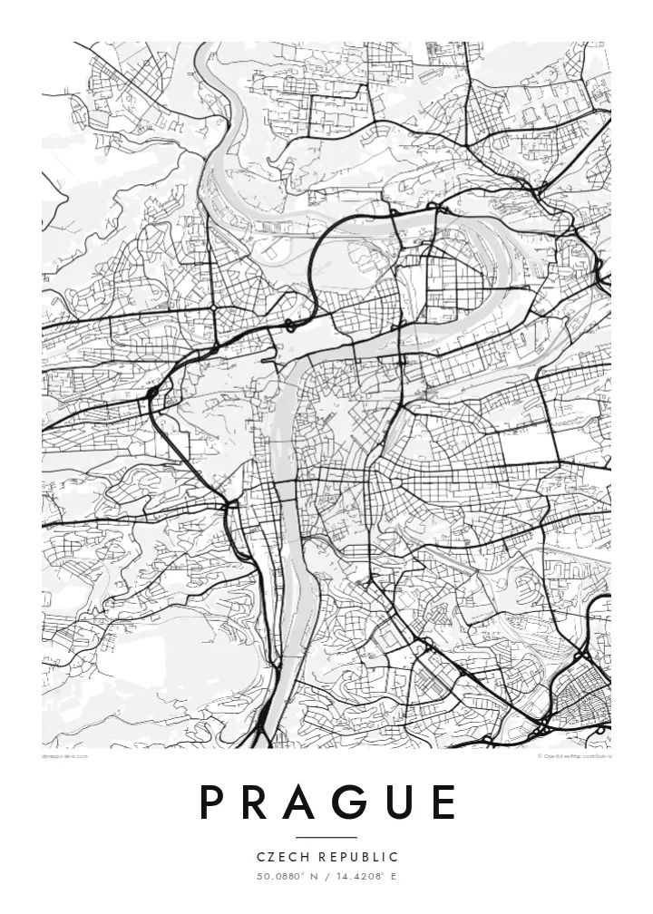
The river curves through the city in a broad S, crossed by Charles Bridge and a series of later bridges. Several islands divide the channel.
मिनिमलिस्ट नक्सा पोस्टर · चेकिया
50.0880° N / 14.4208° E
A city built along a deep bend of the Vltava, with the castle on one bank and the Old Town on the other.


एउटै शहर, पाँच मुड
पर्खालमा कस्तो देखिन्छ हेर्न कुनै स्टाइल छान्नुहोस्। हरेक स्टाइलको मूल्य उस्तै हुन्छ — प्रिन्ट, फ्रेम वा HD फाइलको रूपमा।
 वास्तविक पिक्सेल · 24 × 36″ प्रिन्ट फाइल
प्रिन्टमा प्रस्ट
यो वास्तविक प्रिन्ट फाइलको 100% क्रप हो। हरेक पोस्टर — प्रिन्ट, फ्रेम वा डाउनलोड — हाम्रो सर्भरमा 300 DPI मा, 7,200 × 10,800 पिक्सेलसम्म रेन्डर हुन्छ, त्यसैले सबैभन्दा साना गल्लीहरू पनि 24 × 36″ प्रिन्टमा स्पष्ट देखिन्छन्।
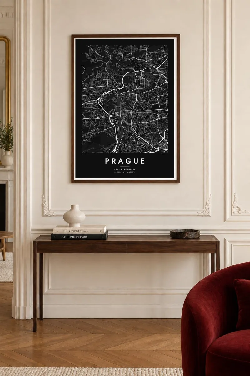
भित्तामा


नक्सा
The Vltava flows north through Prague in a wide S-shaped curve and divides the city into two clearly different halves. On the left bank, the castle complex stretches along a ridge above Malá Strana, with the green slopes of Petřín hill to the south. On the right bank are the Old Town and the New Town, whose streets gather toward the river from the flatter ground to the east.
Charles Bridge, begun in 1357, links the two banks and remains one of the most recognisable elements of any Prague map poster. Upstream and downstream, a series of later bridges crosses the river at regular intervals, and islands such as Kampa and Střelecký ostrov divide the water. The Old Town's streets meet at the square with the astronomical clock, first installed in 1410.
The New Town was founded by Charles IV in 1348 and was laid out on an ambitious scale for its time. Wenceslas Square and Charles Square are still among the largest open spaces in the city. To the south, the fortress of Vyšehrad sits above the river on a rocky outcrop. Together these layers make Prague one of Europe's most detailed and rewarding maps.
The river curves through the city in a broad S, crossed by Charles Bridge and a series of later bridges. Several islands divide the channel.
On the left bank, the long castle complex follows the ridge above the Lesser Town. The winding lanes of Malá Strana descend from it toward the river.
Charles IV's fourteenth-century plan introduced large squares and wide streets. Wenceslas Square is still the long, clear rectangle at the centre of the modern city.
आफ्नै बनाउनुहोस्
मिति, नाम वा आफ्नै एक लाइन थप्नुहोस्, शैली, साइज वा दिशा बदल्नुहोस्।
नि:शुल्क प्रिभ्यू कम-रिजोलुसन र वाटरमार्कसहित हुन्छ। प्रिन्ट र HD फाइलहरू 300 DPI मा, 7,200 × 10,800 px सम्म, वाटरमार्क बिना रेन्डर गरिन्छन्।
किन Prague
Prague is where many people studied, fell in love or spent a significant trip, and its river, bridges and castle create one of the most balanced city maps in Europe. It works at both small and large sizes.
Add a title such as Praha, a subtitle and your own coordinates or date, and choose Classic black & white, Noir, Paper, Blueprint or Sand. Download HD files or order a print with an optional wooden frame.
Prague पोस्टर अर्डर गर्नुहोस्| प्रिन्ट साइज | रिजोल्युसन | फाइलहरू |
|---|---|---|
| 30 × 40 cm (11.8 × 15.7″) | 3,543 × 4,724 px | PNG · PDF |
| 29.7 × 42 cm (A3, 11.7 × 16.5″) | 3,508 × 4,961 px | PNG · PDF |
| 42 × 59.4 cm (A2, 16.5 × 23.4″) | 4,961 × 7,016 px | PNG · PDF |
| 45.7 × 61 cm (18 × 24″) | 5,400 × 7,200 px | PNG · PDF |
| 50 × 70 cm (19.7 × 27.6″) | 5,906 × 8,268 px | PNG · PDF |
| 61 × 91.4 cm (24 × 36″) | 7,200 × 10,800 px | PNG · PDF |
तुलनाका लागि, निःशुल्क प्रिभ्यु 900 px चौडा, वाटरमार्कसहित र स्क्रिनका लागि मात्र हो। HD फाइलहरूमा हरेक दिशामा 8× सम्म बढी रिजोल्युसन हुन्छ र पूरा पोस्टर साइजमा सफा छापिन्छ।
पेजको माथिबाट कुनै स्टाइल छान्नुहोस्, त्यसपछि प्रिन्टेड पोस्टर — साइज र चाहेमा फ्रेम — वा डिजिटल HD फाइलहरू छान्नुहोस्। चेकआउट एक चरणमा हुन्छ, र पेमेन्ट भएपश्चात तपाईंको अर्डर पेज तुरुन्तै अपडेट हुन्छ।
यो प्रिमियम 200 gsm म्याट पेपरमा, 30 × 40 cm देखि 24 × 36″ सम्मका छ साइजमध्ये एकमा प्रिन्ट गरिन्छ। प्रिन्टेड पोस्टरहरू $39 बाट सुरु हुन्छन्, ढुवानी सहित।
हो। कालो, सेतो, प्राकृतिक ओक वा गाढा काठको ठोस काठको फ्रेम छान्नुहोस्। यो फुट्दैन भन्ने गिलाससहित आउँछ र झुन्ड्याउनका लागि तयार हुन्छ। फ्रेम गरिएका पोस्टरहरू $99 बाट सुरु हुन्छन्, ढुवानी सहित।
विश्वभर निःशुल्क ढुवानी। प्रत्येक पोस्टर ३०+ देशमा रहेका हाम्रा प्रिन्ट पार्टनरमध्ये सबैभन्दा नजिकको पार्टनरले छाप्छ र सामान्यतया ३–७ कार्यदिनभित्र पुग्छ। तपाईं मेरा अर्डरहरू मा गएर स्थिति र ट्र्याकिङ हेर्न सक्नुहुन्छ। केही देशमा २–५ हप्ता लाग्छ, र जहाँ हामी अझै ढुवानी गर्दैनौं, भुक्तानी गर्नुअघि नै साइटले जानकारी दिन्छ।
डेलिवरी भएको 14 दिनभित्र हामीलाई फोटो पठाउनुहोस्, हामी नि:शुल्क पुनः प्रिन्ट गरिदिनेछौं वा रिफन्ड दिनेछौं।
हो। यो पेजको एडिटरमा, शीर्षक, उपशीर्षक र कोअर्डिनेट लाइनलाई तपाईंले चाहेजस्तै बदल्नुहोस्, अनि स्टाइल र साइज छान्नुहोस्। प्रिन्टेड, फ्रेम गरिएका र डिजिटल अर्डर सबैले तपाईंको डिजाइन नै प्रयोग गर्छन्।
$9 मा तपाईंले सबै छ साइजमा 300 DPI PNG र प्रिन्ट-रेडी PDF फाइलहरू पाउनुहुन्छ, वाटरमार्क बिना, जुनसुकै ठाउँमा प्रिन्ट गर्न मिल्ने। अझै पक्का हुनुभएको छैन? पहिले नि:शुल्क वाटरमार्क भएको प्रिभ्यू डाउनलोड गर्नुहोस्।
