Tórshavn and Tinganes
The capital's streets fan out from the harbour, with the rocky Tinganes peninsula at its centre. It is the densest cluster of lines anywhere in the Faroes.
मिनिमलिस्ट नक्सा पोस्टर · फारो टापुहरू
62.1236° N / 6.9969° W
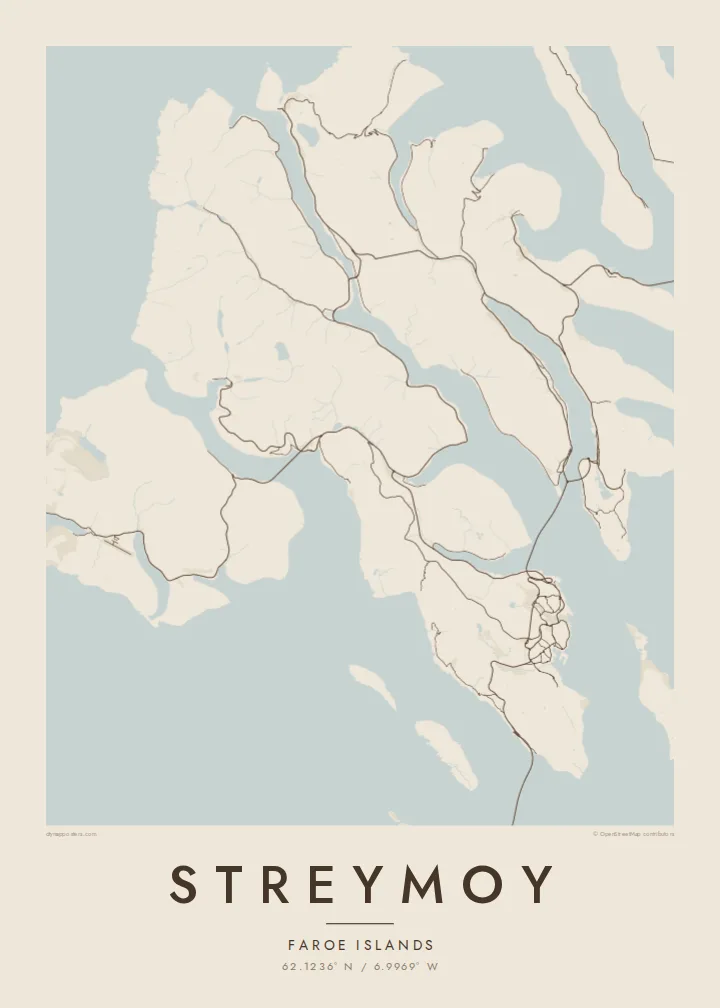
The largest Faroe island, a long mountain spine notched by fjords, with Tórshavn tucked into its southeastern shore.


एउटै शहर, पाँच मुड
पर्खालमा कस्तो देखिन्छ हेर्न कुनै स्टाइल छान्नुहोस्। हरेक स्टाइलको मूल्य उस्तै हुन्छ — प्रिन्ट, फ्रेम वा HD फाइलको रूपमा।
 वास्तविक पिक्सेल · 24 × 36″ प्रिन्ट फाइल
प्रिन्टमा प्रस्ट
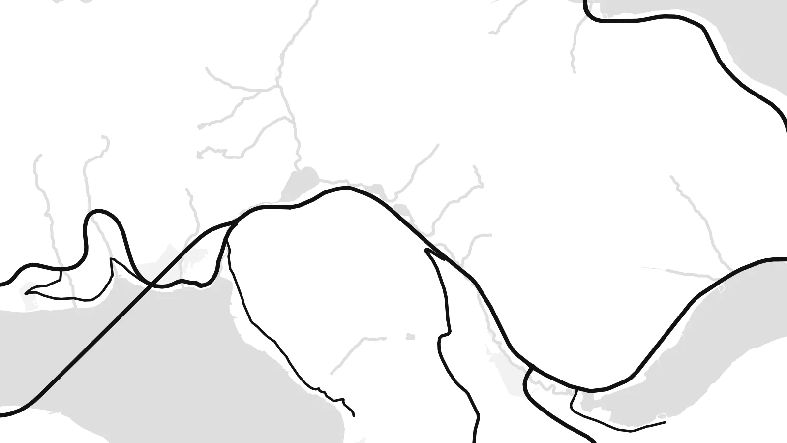
यो वास्तविक प्रिन्ट फाइलको 100% क्रप हो। हरेक पोस्टर — प्रिन्ट, फ्रेम वा डाउनलोड — हाम्रो सर्भरमा 300 DPI मा, 7,200 × 10,800 पिक्सेलसम्म रेन्डर हुन्छ, त्यसैले सबैभन्दा साना गल्लीहरू पनि 24 × 36″ प्रिन्टमा स्पष्ट देखिन्छन्।
भित्तामा


नक्सा
Streymoy is the largest and most populous of the Faroe Islands, a long island running northwest to southeast between Vágar and Eysturoy. From above it looks like a mountain spine with steep flanks, the coast notched by fjords and the interior crossed by only a handful of roads. Villages sit on narrow shelves of flat ground where valleys meet the sea.
Tórshavn, the capital, occupies the southeastern coast, its streets climbing from the harbour and the small Tinganes peninsula, where the Faroese government sits among turf-roofed buildings. To the south, Kirkjubøur holds the medieval ruins of the Magnus Cathedral. On the north coast, Saksun sits above a tidal lagoon that fills and drains with the sea.
Streymoy is tied to its neighbours by a short bridge across the sound to Eysturoy and by tunnels running beneath the sea, so most journeys in the archipelago pass through it. A Streymoy map poster shows how these links pull the island into the centre of the Faroes, with Tórshavn as its densest point and long empty ridges stretching north.
The capital's streets fan out from the harbour, with the rocky Tinganes peninsula at its centre. It is the densest cluster of lines anywhere in the Faroes.
A narrow channel separates Streymoy from Eysturoy, spanned by a short bridge. On the map it reads almost like a river, the thinnest gap between two islands.
In the north, a small tidal lagoon opens to the sea through a narrow channel below the village of Saksun, a delicate shape on an otherwise steep coastline.
आफ्नै बनाउनुहोस्
मिति, नाम वा आफ्नै एक लाइन थप्नुहोस्, शैली, साइज वा दिशा बदल्नुहोस्।
नि:शुल्क प्रिभ्यू कम-रिजोलुसन र वाटरमार्कसहित हुन्छ। प्रिन्ट र HD फाइलहरू 300 DPI मा, 7,200 × 10,800 px सम्म, वाटरमार्क बिना रेन्डर गरिन्छन्।
किन Streymoy
For Faroese families and anyone who has lived in Tórshavn, Streymoy is home ground. For visitors it is where most journeys start and end. The island's long outline and cut coast make a strong, graphic poster.
Use the title for a village or street name, the subtitle for a date, and the coordinates line for a precise spot. Choose one of five styles, Classic black & white, Noir, Paper, Blueprint or Sand, as a $9 HD file or a printed poster.
Streymoy पोस्टर अर्डर गर्नुहोस्| प्रिन्ट साइज | रिजोल्युसन | फाइलहरू |
|---|---|---|
| 30 × 40 cm11.8 × 15.7″ | 3,543 × 4,724 px | PNG · PDF |
| 29.7 × 42 cm (A3)11.7 × 16.5″ | 3,508 × 4,961 px | PNG · PDF |
| 42 × 59.4 cm (A2)16.5 × 23.4″ | 4,961 × 7,016 px | PNG · PDF |
| 45.7 × 61 cm18 × 24″ | 5,400 × 7,200 px | PNG · PDF |
| 50 × 70 cm19.7 × 27.6″ | 5,906 × 8,268 px | PNG · PDF |
| 61 × 91.4 cm24 × 36″ | 7,200 × 10,800 px | PNG · PDF |
तुलनाका लागि, निःशुल्क प्रिभ्यु 900 px चौडा, वाटरमार्कसहित र स्क्रिनका लागि मात्र हो। HD फाइलहरूमा हरेक दिशामा 8× सम्म बढी रिजोल्युसन हुन्छ र पूरा पोस्टर साइजमा सफा छापिन्छ।
पेजको माथिबाट कुनै स्टाइल छान्नुहोस्, त्यसपछि प्रिन्टेड पोस्टर — साइज र चाहेमा फ्रेम — वा डिजिटल HD फाइलहरू छान्नुहोस्। चेकआउट एक चरणमा हुन्छ, र पेमेन्ट भएपश्चात तपाईंको अर्डर पेज तुरुन्तै अपडेट हुन्छ।
यो प्रिमियम 200 gsm म्याट पेपरमा, 30 × 40 cm देखि 24 × 36″ सम्मका छ साइजमध्ये एकमा प्रिन्ट गरिन्छ। प्रिन्टेड पोस्टरहरू $39 बाट सुरु हुन्छन्, ढुवानी सहित।
हो। कालो, सेतो, प्राकृतिक ओक वा गाढा काठको ठोस काठको फ्रेम छान्नुहोस्। यो फुट्दैन भन्ने गिलाससहित आउँछ र झुन्ड्याउनका लागि तयार हुन्छ। फ्रेम गरिएका पोस्टरहरू $99 बाट सुरु हुन्छन्, ढुवानी सहित।
६०+ देशमा ढुवानी निःशुल्क छ। प्रत्येक पोस्टर ३०+ देशमा रहेका हाम्रा प्रिन्ट साझेदारमध्ये सबैभन्दा नजिककाद्वारा छापिन्छ र सामान्यतया ३–७ कार्यदिनभित्र पुग्छ। तपाईं “मेरा अर्डरहरू” मा गएर स्थिति र ट्र्याकिङ हेर्न सक्नुहुन्छ। केही देशमा २–५ हप्ता लाग्छ, र हामीले अझै ढुवानी नगर्ने ठाउँमा भुक्तानी गर्नुअघि नै साइटले जानकारी दिन्छ।
डेलिवरी भएको 14 दिनभित्र हामीलाई फोटो पठाउनुहोस्, हामी नि:शुल्क पुनः प्रिन्ट गरिदिनेछौं वा रिफन्ड दिनेछौं।
हो। यो पेजको एडिटरमा, शीर्षक, उपशीर्षक र कोअर्डिनेट लाइनलाई तपाईंले चाहेजस्तै बदल्नुहोस्, अनि स्टाइल र साइज छान्नुहोस्। प्रिन्टेड, फ्रेम गरिएका र डिजिटल अर्डर सबैले तपाईंको डिजाइन नै प्रयोग गर्छन्।
$9 मा तपाईंले सबै छ साइजमा 300 DPI PNG र प्रिन्ट-रेडी PDF फाइलहरू पाउनुहुन्छ, वाटरमार्क बिना, जुनसुकै ठाउँमा प्रिन्ट गर्न मिल्ने। अझै पक्का हुनुभएको छैन? पहिले नि:शुल्क वाटरमार्क भएको प्रिभ्यू डाउनलोड गर्नुहोस्।
