Toronto Islands
A group of low, connected islands lies just offshore, enclosing the inner harbour. On the map they form a soft, curved edge between the city and the open lake.
मिनिमलिस्ट नक्सा पोस्टर · क्यानाडा
43.7064° N / 79.3986° W
A lakeside grid cut by deep green ravines, with a chain of islands sheltering the harbour



एउटै शहर, पाँच मुड
पर्खालमा कस्तो देखिन्छ हेर्न कुनै स्टाइल छान्नुहोस्। हरेक स्टाइलको मूल्य उस्तै हुन्छ — प्रिन्ट, फ्रेम वा HD फाइलको रूपमा।
 वास्तविक पिक्सेल · 24 × 36″ प्रिन्ट फाइल
प्रिन्टमा प्रस्ट
यो वास्तविक प्रिन्ट फाइलको 100% क्रप हो। हरेक पोस्टर — प्रिन्ट, फ्रेम वा डाउनलोड — हाम्रो सर्भरमा 300 DPI मा, 7,200 × 10,800 पिक्सेलसम्म रेन्डर हुन्छ, त्यसैले सबैभन्दा साना गल्लीहरू पनि 24 × 36″ प्रिन्टमा स्पष्ट देखिन्छन्।
भित्तामा


नक्सा
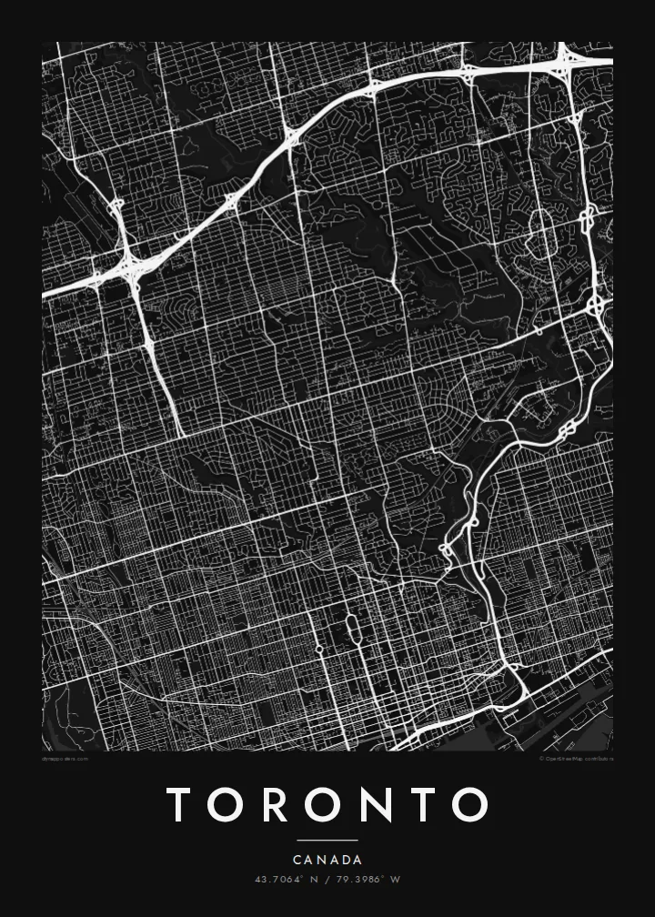
Toronto spreads along the northern shore of Lake Ontario. From above, the city is dominated by a long, regular grid. Major streets run north from the lake and cross avenues running east–west. Yonge Street, one of the city's main axes, runs north from the waterfront through the centre.
The grid is interrupted by a network of ravines. The Don Valley and the Humber River cut deep, winding green corridors through the city, carrying rivers, parks and trails. On the map they appear as long irregular strips that break up the straight lines of streets.
Offshore, the Toronto Islands form a chain of low land that shelters the inner harbour. The Gardiner Expressway and rail corridor run along the waterfront, with the CN Tower rising near the shore. A Toronto map poster shows how the lake, the grid and the ravines fit together into one clear shape.
A group of low, connected islands lies just offshore, enclosing the inner harbour. On the map they form a soft, curved edge between the city and the open lake.
The Don and Humber valleys, plus smaller ravines, cut deep green corridors through the city. They create long, irregular gaps in the street grid.
Yonge Street runs north from the lakefront through downtown and beyond. It forms a central line in Toronto's grid, with neighbourhoods arranged on both sides.
आफ्नै बनाउनुहोस्
मिति, नाम वा आफ्नै एक लाइन थप्नुहोस्, शैली, साइज वा दिशा बदल्नुहोस्।
नि:शुल्क प्रिभ्यू कम-रिजोलुसन र वाटरमार्कसहित हुन्छ। प्रिन्ट र HD फाइलहरू 300 DPI मा, 7,200 × 10,800 px सम्म, वाटरमार्क बिना रेन्डर गरिन्छन्।
किन Toronto
Toronto is a city many people move to for study or work and then call home. A map of the lake, the islands and the ravines captures the Toronto they know in a clean, simple form.
You can personalise the title, subtitle and coordinates, for example with your neighbourhood or a special date, and choose Classic black & white, Noir, Paper, Blueprint or Sand. Get it as a digital file or printed poster.
Toronto पोस्टर अर्डर गर्नुहोस्| प्रिन्ट साइज | रिजोल्युसन | फाइलहरू |
|---|---|---|
| 30 × 40 cm (11.8 × 15.7″) | 3,543 × 4,724 px | PNG · PDF |
| 29.7 × 42 cm (A3, 11.7 × 16.5″) | 3,508 × 4,961 px | PNG · PDF |
| 42 × 59.4 cm (A2, 16.5 × 23.4″) | 4,961 × 7,016 px | PNG · PDF |
| 45.7 × 61 cm (18 × 24″) | 5,400 × 7,200 px | PNG · PDF |
| 50 × 70 cm (19.7 × 27.6″) | 5,906 × 8,268 px | PNG · PDF |
| 61 × 91.4 cm (24 × 36″) | 7,200 × 10,800 px | PNG · PDF |
तुलनाका लागि, निःशुल्क प्रिभ्यु 900 px चौडा, वाटरमार्कसहित र स्क्रिनका लागि मात्र हो। HD फाइलहरूमा हरेक दिशामा 8× सम्म बढी रिजोल्युसन हुन्छ र पूरा पोस्टर साइजमा सफा छापिन्छ।
पेजको माथिबाट कुनै स्टाइल छान्नुहोस्, त्यसपछि प्रिन्टेड पोस्टर — साइज र चाहेमा फ्रेम — वा डिजिटल HD फाइलहरू छान्नुहोस्। चेकआउट एक चरणमा हुन्छ, र पेमेन्ट भएपश्चात तपाईंको अर्डर पेज तुरुन्तै अपडेट हुन्छ।
यो प्रिमियम 200 gsm म्याट पेपरमा, 30 × 40 cm देखि 24 × 36″ सम्मका छ साइजमध्ये एकमा प्रिन्ट गरिन्छ। प्रिन्टेड पोस्टरहरू $39 बाट सुरु हुन्छन्, ढुवानी सहित।
हो। कालो, सेतो, प्राकृतिक ओक वा गाढा काठको ठोस काठको फ्रेम छान्नुहोस्। यो फुट्दैन भन्ने गिलाससहित आउँछ र झुन्ड्याउनका लागि तयार हुन्छ। फ्रेम गरिएका पोस्टरहरू $99 बाट सुरु हुन्छन्, ढुवानी सहित।
विश्वभर निःशुल्क ढुवानी। प्रत्येक पोस्टर ३०+ देशमा रहेका हाम्रा प्रिन्ट पार्टनरमध्ये सबैभन्दा नजिकको पार्टनरले छाप्छ र सामान्यतया ३–७ कार्यदिनभित्र पुग्छ। तपाईं मेरा अर्डरहरू मा गएर स्थिति र ट्र्याकिङ हेर्न सक्नुहुन्छ। केही देशमा २–५ हप्ता लाग्छ, र जहाँ हामी अझै ढुवानी गर्दैनौं, भुक्तानी गर्नुअघि नै साइटले जानकारी दिन्छ।
डेलिवरी भएको 14 दिनभित्र हामीलाई फोटो पठाउनुहोस्, हामी नि:शुल्क पुनः प्रिन्ट गरिदिनेछौं वा रिफन्ड दिनेछौं।
हो। यो पेजको एडिटरमा, शीर्षक, उपशीर्षक र कोअर्डिनेट लाइनलाई तपाईंले चाहेजस्तै बदल्नुहोस्, अनि स्टाइल र साइज छान्नुहोस्। प्रिन्टेड, फ्रेम गरिएका र डिजिटल अर्डर सबैले तपाईंको डिजाइन नै प्रयोग गर्छन्।
$9 मा तपाईंले सबै छ साइजमा 300 DPI PNG र प्रिन्ट-रेडी PDF फाइलहरू पाउनुहुन्छ, वाटरमार्क बिना, जुनसुकै ठाउँमा प्रिन्ट गर्न मिल्ने। अझै पक्का हुनुभएको छैन? पहिले नि:शुल्क वाटरमार्क भएको प्रिभ्यू डाउनलोड गर्नुहोस्।
