Lake Timsah
The lake forms a broad open shape at the edge of the city, with the Suez Canal passing through it. Beaches and gardens line the shore facing the water.
Beot el poster er a chizu · Egypt
30.6043° N / 32.2722° E
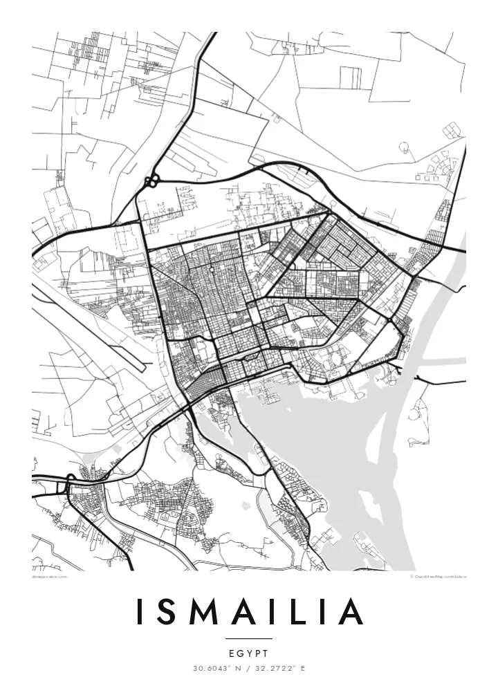
A canal town laid out on the shore of Lake Timsah, halfway along the Suez Canal, with a gridded garden quarter.


Ta el beluu, eim el style
Chotii a style e mo omes er ngii er a bades. A rokui el style a diak el mora el ongraol — el lidudech, el ngar er a bilong, me a lechub el HD el file.
 Mera el pixel · 24 × 36″ el print file
Kmal ungil el print
Tiaikid a 100% el cheldechedechal a mera el print file. A rokui el poster — lidudech, ngar er a bilong, me a lechub e download — a mengedmokl er a server er kid er a 300 DPI, el mo er a 7,200 × 10,800 pixel, me a kekerei el rael a blechoel el mo klemedengei er a 24 × 36″ el print.
Er a bab er a mederrekong


A chizu
Ismailia was founded in 1863 as a base for the construction of the Suez Canal and named after Khedive Ismail. It stands on the north-western shore of Lake Timsah, roughly midway between Port Said and Suez, and the map is dominated by water: the lake, the straight line of the canal running through it, and the freshwater Ismailia Canal bringing Nile water across the desert.
The original town was planned in a clear grid, with a European quarter of broad streets, villas and gardens that still gives Ismailia a greener, more orderly look than many Egyptian cities. The Suez Canal Authority has its headquarters here, and the waterfront toward the lake is lined with public gardens and small beaches.
Beyond the grid, newer districts spread along the roads to Cairo, Port Said and Suez, and the desert presses close on the edges of the map. An Ismailia map poster brings these layers together: a nineteenth-century planned town, a lake that the canal passes through, and a thin green line of irrigation cutting across the sand.
The lake forms a broad open shape at the edge of the city, with the Suez Canal passing through it. Beaches and gardens line the shore facing the water.
The original planned district has a regular grid of wide streets and villas set among trees, one of the clearest examples of nineteenth-century town planning in Egypt.
A freshwater canal from the Nile reaches the city from the west, a thin line of water and green fields crossing otherwise empty desert on the map.
Meruul el bo er kau
Mruul a sils, ngakl me a tekoi er kau, me ke olsisebii a style, klungel me a orientation.
A ngeasek el preview a kekerei a resolution e ngar er ngii a watermark. A Prints me a HD files a mengedmokl er a 300 DPI, el mo er a 7,200 × 10,800 px, el diak a watermark.
Ngera me a Ismailia
Ismailia is a city many Egyptians associate with calm streets, the lake and the ships passing along the canal. The map works as a keepsake for residents, for people who studied or served there, and for anyone fascinated by the history of the canal.
Personalise the title, subtitle and coordinates line, then choose from five styles: Classic black & white, Noir, Paper, Blueprint or Sand. Blueprint suits the engineering story of the canal particularly well. Printed posters come on matte paper with an optional wooden frame.
Oid a Ismailia el poster| Klungel er a print | Resolution | File |
|---|---|---|
| 30 × 40 cm11.8 × 15.7″ | 3,543 × 4,724 px | PNG · PDF |
| 29.7 × 42 cm (A3)11.7 × 16.5″ | 3,508 × 4,961 px | PNG · PDF |
| 42 × 59.4 cm (A2)16.5 × 23.4″ | 4,961 × 7,016 px | PNG · PDF |
| 45.7 × 61 cm18 × 24″ | 5,400 × 7,200 px | PNG · PDF |
| 50 × 70 cm19.7 × 27.6″ | 5,906 × 8,268 px | PNG · PDF |
| 61 × 91.4 cm24 × 36″ | 7,200 × 10,800 px | PNG · PDF |
A preview el diak el oldars a 900 px a klungel, ngar er ngii a watermark, e ng el kirel a screen. A HD file a ngar er ngii a 8× el klou el resolution, e ungil el print er a rokui el klungel er a poster.
Mengai a style er a eou er a page, e mongdibel a Printed Poster — el size, e a lechub e bilong — me a lechub e Digital HD Files. A checkout a di di tang el rrael, e a order page er kau a mo mechesang sel mo merek a udoud.
Ngii a lidudech er a klou el ungil 200 gsm matte el babier er a tang er a euid el size, mei er a 30 × 40 cm el mo er a 24 × 36″. A lidudech el poster a mo mekedeb er a $39, e a shipping a diak longraol.
Choi. Melilt a mera el kerrekar el frame er a chelellakl, chesisebangiau, natural oak, me a chelebacheb el kerrekar. Ngii a ngar er ngii a glazing el diak lebo lengebechel, e mo klemedengei el mo lomelilt. A framed poster a mo mekedeb er a $99, e a shipping a diak longraol.
A ngarngii a mengedub el mo er a 60+ el beluu. A chelsel poster a mebo mengelebed er a ngii el print partner er tial ngii el kmal ngar er ngii er a 30+ el beluu, ma e ng di meruul er a 3–7 el ngarngii el rak. Ke mo mesaul a status me a tracking er ngii er a My Orders. A ta el beluu a mo mekesai 2–5 el ngarngii el bak, ma el di ngar a beluu el diak mo medengelii, a site a mo kmeklii er kau el mei ng diak le mo tuobed.
Molecha a picture er kid er a uleb el 14 el sils er a lebo er a lomtok, e kid a mo di ngmuu el mengedmokl er ngii, me a lechub e mo msang a udoud er kau.
Choi. Er a editor er tia el page, molecha a title, subtitle, me a coordinates el rael el mo uangii el soam, e melilt a style me a size. A lidudech, framed, me a digital el order a rokui el mo use er a mera el design er kau.
Er a $9 e kau a mo ngmai a 300 DPI PNG me a print-ready PDF el files er a rokui el euid el size, el diak a watermark, el sebechem el mo lidudech er bek el basio. Diak dimo medengei? Download a ngeasek el preview el ngar er ngii a watermark er a uchei.
