Subic Bay
The deep, sheltered bay forms the western edge of the map, its coastline curving around the city and the former base, with piers and harbour structures along the shore.
Beot el poster er a chizu · Philippines
14.8292° N / 120.2828° E
A city pressed between the Zambales mountains and Subic Bay, its compact grid facing the former naval base across a narrow waterway.


Ta el beluu, eim el style
Chotii a style e mo omes er ngii er a bades. A rokui el style a diak el mora el ongraol — el lidudech, el ngar er a bilong, me a lechub el HD el file.
 Mera el pixel · 24 × 36″ el print file
Kmal ungil el print
Tiaikid a 100% el cheldechedechal a mera el print file. A rokui el poster — lidudech, ngar er a bilong, me a lechub e download — a mengedmokl er a server er kid er a 300 DPI, el mo er a 7,200 × 10,800 pixel, me a kekerei el rael a blechoel el mo klemedengei er a 24 × 36″ el print.
Er a bab er a mederrekong


A chizu
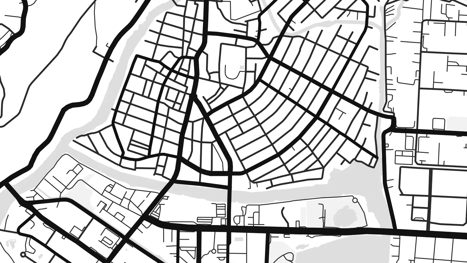
Olongapo occupies a narrow strip of flat land at the head of Subic Bay, with forested hills of the Zambales range rising close behind. The downtown streets form a tight, regular grid squeezed between the slopes and the shore, and newer neighbourhoods climb into the valleys wherever the terrain allows. On the map, green hills press in from almost every side.
For much of the twentieth century the city's life was tied to the United States Naval Base Subic Bay, one of the largest American military installations abroad. When the base closed in 1992, its land was converted into the Subic Bay Freeport Zone, with a port, an airport and industrial areas. A small waterway and the main gate still mark the line between base and city.
The Olongapo map poster shows the two halves side by side: the dense civilian grid on one side, the spacious layout of the former base on the other, with its long waterfront and roads winding into the hills. It is an unusual portrait of how military history shapes a city's form, even decades after the base itself has gone.
The deep, sheltered bay forms the western edge of the map, its coastline curving around the city and the former base, with piers and harbour structures along the shore.
Between the hills and the water, central Olongapo is laid out in a compact grid of short blocks, one of the densest parts of the map.
The former naval base spreads across a large area beside the city, with broad roads, open spaces and waterfront facilities giving it a very different texture.
Meruul el bo er kau
Mruul a sils, ngakl me a tekoi er kau, me ke olsisebii a style, klungel me a orientation.
A ngeasek el preview a kekerei a resolution e ngar er ngii a watermark. A Prints me a HD files a mengedmokl er a 300 DPI, el mo er a 7,200 × 10,800 px, el diak a watermark.
Ngera me a Olongapo
Olongapo is remembered by many, including former service members, Filipino families and people who have worked in the freeport. The map brings together hills, bay and city in a composition that makes sense to all of them.
Add a title, a subtitle with a year or unit name, and adjust the coordinates line. Choose among five styles; Blueprint suits the naval history well. A free watermarked preview is available before buying the $9 HD files.
Oid a Olongapo el poster| Klungel er a print | Resolution | File |
|---|---|---|
| 30 × 40 cm11.8 × 15.7″ | 3,543 × 4,724 px | PNG · PDF |
| 29.7 × 42 cm (A3)11.7 × 16.5″ | 3,508 × 4,961 px | PNG · PDF |
| 42 × 59.4 cm (A2)16.5 × 23.4″ | 4,961 × 7,016 px | PNG · PDF |
| 45.7 × 61 cm18 × 24″ | 5,400 × 7,200 px | PNG · PDF |
| 50 × 70 cm19.7 × 27.6″ | 5,906 × 8,268 px | PNG · PDF |
| 61 × 91.4 cm24 × 36″ | 7,200 × 10,800 px | PNG · PDF |
A preview el diak el oldars a 900 px a klungel, ngar er ngii a watermark, e ng el kirel a screen. A HD file a ngar er ngii a 8× el klou el resolution, e ungil el print er a rokui el klungel er a poster.
Mengai a style er a eou er a page, e mongdibel a Printed Poster — el size, e a lechub e bilong — me a lechub e Digital HD Files. A checkout a di di tang el rrael, e a order page er kau a mo mechesang sel mo merek a udoud.
Ngii a lidudech er a klou el ungil 200 gsm matte el babier er a tang er a euid el size, mei er a 30 × 40 cm el mo er a 24 × 36″. A lidudech el poster a mo mekedeb er a $39, e a shipping a diak longraol.
Choi. Melilt a mera el kerrekar el frame er a chelellakl, chesisebangiau, natural oak, me a chelebacheb el kerrekar. Ngii a ngar er ngii a glazing el diak lebo lengebechel, e mo klemedengei el mo lomelilt. A framed poster a mo mekedeb er a $99, e a shipping a diak longraol.
A ngarngii a mengedub el mo er a 60+ el beluu. A chelsel poster a mebo mengelebed er a ngii el print partner er tial ngii el kmal ngar er ngii er a 30+ el beluu, ma e ng di meruul er a 3–7 el ngarngii el rak. Ke mo mesaul a status me a tracking er ngii er a My Orders. A ta el beluu a mo mekesai 2–5 el ngarngii el bak, ma el di ngar a beluu el diak mo medengelii, a site a mo kmeklii er kau el mei ng diak le mo tuobed.
Molecha a picture er kid er a uleb el 14 el sils er a lebo er a lomtok, e kid a mo di ngmuu el mengedmokl er ngii, me a lechub e mo msang a udoud er kau.
Choi. Er a editor er tia el page, molecha a title, subtitle, me a coordinates el rael el mo uangii el soam, e melilt a style me a size. A lidudech, framed, me a digital el order a rokui el mo use er a mera el design er kau.
Er a $9 e kau a mo ngmai a 300 DPI PNG me a print-ready PDF el files er a rokui el euid el size, el diak a watermark, el sebechem el mo lidudech er bek el basio. Diak dimo medengei? Download a ngeasek el preview el ngar er ngii a watermark er a uchei.
Kmeed
