Ajinkyatara fort hill
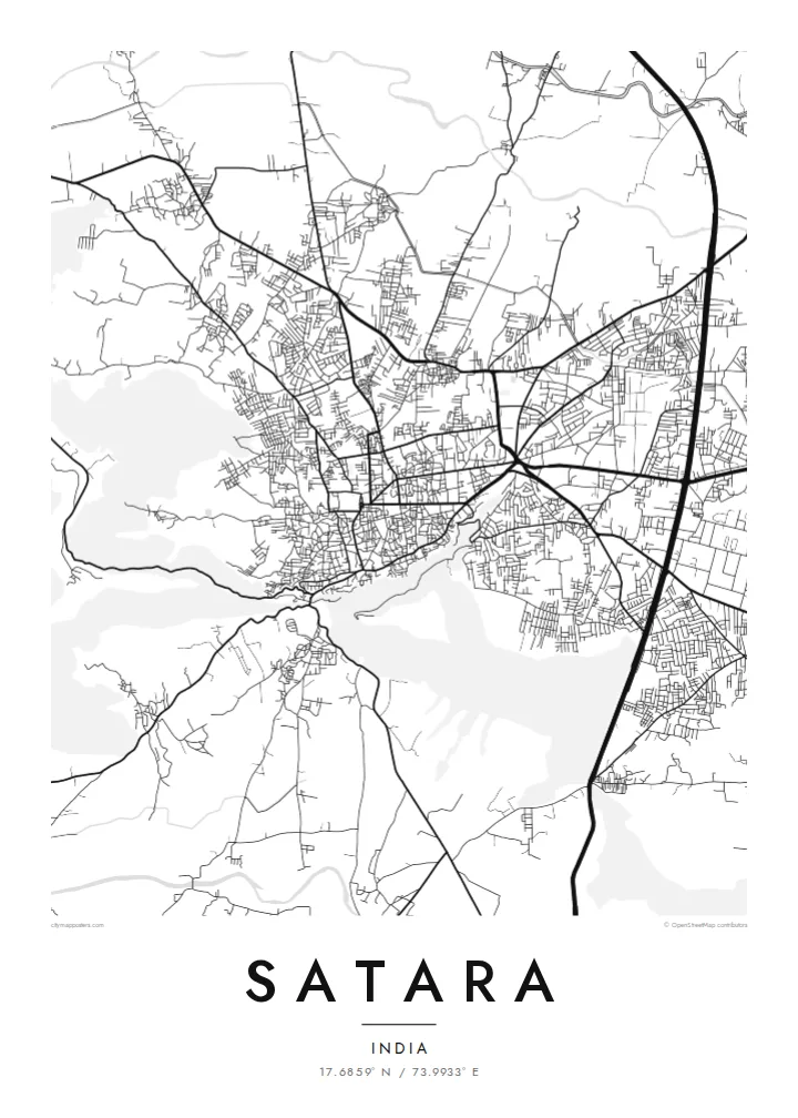
The fort's plateau rises right beside the town. On the map the streets thin out and bend around its slopes, leaving a clear open shape that anchors the whole composition.
Beot el poster er a chizu · India
17.6859° N / 73.9933° E
A hill-ringed Deccan town between the Krishna and Venna rivers, with a fort ridge rising directly above its streets


Ta el beluu, eim el style
Chotii a style e mo omes er ngii er a bades. A rokui el style a diak el mora el ongraol — el lidudech, el ngar er a bilong, me a lechub el HD el file.
 Mera el pixel · 24 × 36″ el print file
Kmal ungil el print
Tiaikid a 100% el cheldechedechal a mera el print file. A rokui el poster — lidudech, ngar er a bilong, me a lechub e download — a mengedmokl er a server er kid er a 300 DPI, el mo er a 7,200 × 10,800 pixel, me a kekerei el rael a blechoel el mo klemedengei er a 24 × 36″ el print.
Er a bab er a mederrekong


A chizu
Satara sits in a bowl of the Western Ghats foothills, close to where the Venna joins the Krishna. From above, the town spreads across fairly level ground and stops where the slopes begin, so the edges of its street network follow the contours of the hills around it. Ajinkyatara, the fort that overlooks the city, shows on the map as a flat-topped ridge pressing against the edge of town.
Satara matters in Maratha history. In the eighteenth century it was the seat of the Chhatrapati line descended from Shivaji. The older quarters still have the dense, irregular lanes of a courtly town rather than a planned grid. Newer neighbourhoods and the main highway corridor spread outward in straighter lines, so the map has two distinct textures side by side.
A Satara map poster also has room for the landscape beyond the town. To the west, the Kaas plateau, known for the wildflowers that cover it after the monsoon, sits high on the escarpment, and roads climb toward it in tight switchbacks. Drawn in fine black lines, the river, the fort hill and the winding ghat roads make a composition that is clearly tied to its terrain.
The fort's plateau rises right beside the town. On the map the streets thin out and bend around its slopes, leaving a clear open shape that anchors the whole composition.
Two rivers meet near the city. Their curving channels add soft, organic lines to the map, a counterpoint to the compact and busy street pattern of the town itself.
Roads heading west toward the Sahyadri escarpment fold into tight hairpins as they climb, a pattern that reads almost like handwriting when printed in thin black line.
Meruul el bo er kau
Mruul a sils, ngakl me a tekoi er kau, me ke olsisebii a style, klungel me a orientation.
A ngeasek el preview a kekerei a resolution e ngar er ngii a watermark. A Prints me a HD files a mengedmokl er a 300 DPI, el mo er a 7,200 × 10,800 px, el diak a watermark.
Ngera me a Satara
For people from Satara, and for those who have passed through on the way to the Kaas plateau or Mahabaleshwar, this map shows a familiar geography of fort, river and hills. It works as a quiet reminder of home, of student years, or of a monsoon trek.
You can set your own title, subtitle and coordinates line, adding a family name or a date, and choose from five styles: Classic black & white, Noir, Paper, Blueprint or Sand. You can download HD files for $9 or order a matte print with an optional wooden frame.
Oid a Satara el poster| Klungel er a print | Resolution | File |
|---|---|---|
| 30 × 40 cm11.8 × 15.7″ | 3,543 × 4,724 px | PNG · PDF |
| 29.7 × 42 cm (A3)11.7 × 16.5″ | 3,508 × 4,961 px | PNG · PDF |
| 42 × 59.4 cm (A2)16.5 × 23.4″ | 4,961 × 7,016 px | PNG · PDF |
| 45.7 × 61 cm18 × 24″ | 5,400 × 7,200 px | PNG · PDF |
| 50 × 70 cm19.7 × 27.6″ | 5,906 × 8,268 px | PNG · PDF |
| 61 × 91.4 cm24 × 36″ | 7,200 × 10,800 px | PNG · PDF |
A preview el diak el oldars a 900 px a klungel, ngar er ngii a watermark, e ng el kirel a screen. A HD file a ngar er ngii a 8× el klou el resolution, e ungil el print er a rokui el klungel er a poster.
Mengai a style er a eou er a page, e mongdibel a Printed Poster — el size, e a lechub e bilong — me a lechub e Digital HD Files. A checkout a di di tang el rrael, e a order page er kau a mo mechesang sel mo merek a udoud.
Ngii a lidudech er a klou el ungil 200 gsm matte el babier er a tang er a euid el size, mei er a 30 × 40 cm el mo er a 24 × 36″. A lidudech el poster a mo mekedeb er a $39, e a shipping a diak longraol.
Choi. Melilt a mera el kerrekar el frame er a chelellakl, chesisebangiau, natural oak, me a chelebacheb el kerrekar. Ngii a ngar er ngii a glazing el diak lebo lengebechel, e mo klemedengei el mo lomelilt. A framed poster a mo mekedeb er a $99, e a shipping a diak longraol.
A ngarngii a mengedub el mo er a 60+ el beluu. A chelsel poster a mebo mengelebed er a ngii el print partner er tial ngii el kmal ngar er ngii er a 30+ el beluu, ma e ng di meruul er a 3–7 el ngarngii el rak. Ke mo mesaul a status me a tracking er ngii er a My Orders. A ta el beluu a mo mekesai 2–5 el ngarngii el bak, ma el di ngar a beluu el diak mo medengelii, a site a mo kmeklii er kau el mei ng diak le mo tuobed.
Molecha a picture er kid er a uleb el 14 el sils er a lebo er a lomtok, e kid a mo di ngmuu el mengedmokl er ngii, me a lechub e mo msang a udoud er kau.
Choi. Er a editor er tia el page, molecha a title, subtitle, me a coordinates el rael el mo uangii el soam, e melilt a style me a size. A lidudech, framed, me a digital el order a rokui el mo use er a mera el design er kau.
Er a $9 e kau a mo ngmai a 300 DPI PNG me a print-ready PDF el files er a rokui el euid el size, el diak a watermark, el sebechem el mo lidudech er bek el basio. Diak dimo medengei? Download a ngeasek el preview el ngar er ngii a watermark er a uchei.
