Indented coastline
Countless small bays, headlands and islets surround the island, producing an intricate edge that looks especially striking against open water on the map.
සරල සිතියම් පෝස්ටරය · ජපානය
33.7829° N / 129.7209° E
An island city in the strait between Kyushu and Tsushima, low hills and small harbours tucked into a ragged coastline.


එක් නගරයක්, මනෝභාව පහක්
ශෛලියක් තට්ටු කර එය බිත්තියේ බලන්න. සෑම ශෛලියක්ම එකම මිලට — මුද්රිත, රාමු කළ හෝ HD ගොනු ලෙස.
 සැබෑ පික්සල් · 24 × 36″ මුද්රණ ගොනුව
මුද්රණයට තියුණු
මෙය සැබෑ මුද්රණ ගොනුවේ 100% කැපුමකි. සෑම පෝස්ටරයක්ම — මුද්රිත, රාමු කළ හෝ බාගත කළ — අපගේ සර්වර්වල 300 DPI වලින්, 7,200 × 10,800 පික්සල් දක්වා විදැහුම් කරනු ලැබේ, එමගින් 24 × 36″ මුද්රණයක සිඟුම් වීදිවත් පැහැදිලිව පෙනේ.
බිත්තියේ


සිතියම
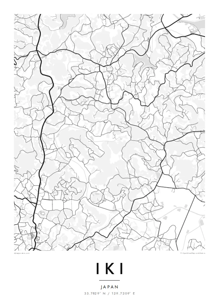
Iki is an island city in Nagasaki Prefecture, set in the strait between northern Kyushu and Tsushima. The whole island fits on a single map: a compact, roughly rounded landmass with a heavily indented coastline, small bays and offshore islets. Inland, low hills and a surprisingly broad central plain are covered in fields and scattered villages rather than steep mountains.
Towns cluster around the harbours. Gōnoura in the southwest is the main ferry port, while Ashibe and others sit on sheltered inlets elsewhere on the coast. Roads loop between them across the island, and the network of rural lanes connecting farms gives the interior a fine, branching texture.
Iki has a long history as a stepping stone between Japan and the Asian mainland. The Harunotsuji site on the island is thought to be the centre of Ikikoku, one of the states mentioned in ancient Chinese records. The island is also known for barley shochu. An Iki map poster frames an entire island in one clear, legible shape.
Countless small bays, headlands and islets surround the island, producing an intricate edge that looks especially striking against open water on the map.
The main port sits in a sheltered bay on the southwest coast, where the densest streets meet ferry terminals and fishing piers.
The interior is unusually flat for an island in the region, with fields, farm roads and small settlements spread evenly across it.
ඔබේම කරගන්න
දිනයක්, නමක් හෝ ඔබේම වාක්යයක් එක් කරන්න, ශෛලිය, ප්රමාණය හෝ දිශානතිය වෙනස් කරන්න.
නොමිලේ පෙරදසුන අඩු විභේදනයෙන් සහ watermark සමඟින් වේ. මුද්රණ සහ HD ගොනු watermark නොමැතිව, 300 DPI, 7,200 × 10,800 px දක්වා විදැහුම් කරනු ලැබේ.
ඇයි Iki
Island maps have a completeness that city maps rarely do, and Iki is a fine example. It suits islanders who moved to the mainland, frequent visitors, and anyone drawn to Japan's quieter coastal places.
Add a name, a date or a line in Japanese to the title, subtitle and coordinates line. Choose among five styles, with Blueprint and Noir working especially well for coastlines, and download HD files for $9 or order a printed poster.
Iki පෝස්ටරය ඇණවුම් කරන්න| මුද්රණ ප්රමාණය | විභේදනය | ගොනු |
|---|---|---|
| 30 × 40 cm (11.8 × 15.7″) | 3,543 × 4,724 px | PNG · PDF |
| 29.7 × 42 cm (A3, 11.7 × 16.5″) | 3,508 × 4,961 px | PNG · PDF |
| 42 × 59.4 cm (A2, 16.5 × 23.4″) | 4,961 × 7,016 px | PNG · PDF |
| 45.7 × 61 cm (18 × 24″) | 5,400 × 7,200 px | PNG · PDF |
| 50 × 70 cm (19.7 × 27.6″) | 5,906 × 8,268 px | PNG · PDF |
| 61 × 91.4 cm (24 × 36″) | 7,200 × 10,800 px | PNG · PDF |
සැසඳීම සඳහා, නොමිලේ ලැබෙන පෙරදසුන 900 px පළල, ජල සලකුණු සහිත සහ තිර සඳහා අදහස් කළකි. HD ගොනුවල එක් එක් දිශාවට 8 ගුණයක් දක්වා විභේදනයක් ඇති අතර සම්පූර්ණ පෝස්ටර් ප්රමාණයෙන් පිරිසිදුව මුද්රණය වේ.
පිටුවේ ඉහළින් ශෛලියක් තෝරන්න, පසුව මුද්රිත පෝස්ටරය — ප්රමාණයක් සහ, ඔබ කැමති නම්, රාමුවක් — හෝ Digital HD Files තෝරන්න. ගෙවීම එක් පියවරකින් සිදු වන අතර, ගෙවීම සම්පූර්ණ වූ විගසම ඔබේ ඇණවුම් පිටුව යාවත්කාලීන වේ.
එය 30 × 40 cm සිට 24 × 36″ දක්වා ප්රමාණ හයකින් ප්රිමියම් 200 gsm මැට් කඩදාසි මත මුද්රණය කෙරේ. මුද්රිත පෝස්ටර $39 සිට ආරම්භ වේ, බෙදාහැරීම ඇතුළුව.
ඔව්. කළු, සුදු, ස්වාභාවික ඕක් හෝ තද පැහැති දැව රාමුවක් තෝරන්න. එය කැඩෙන්නට නොහැකි වීදුරුවක් සමඟින් සූදානම්ව එනු ලබන අතර එසැණින් එල්ලීමට හැකිය. රාමු කළ පෝස්ටර $99 සිට ආරම්භ වේ, බෙදාහැරීම ඇතුළුව.
ලොව පුරා නොමිලේ බෙදාහැරීම. සෑම පෝස්ටරයක්ම රටවල් 30+ ක අපගේ මුද්රණ හවුල්කරුවන්ගෙන් ඔබට ළඟම සිටින අයෙකු විසින් මුද්රණය කරන අතර සාමාන්යයෙන් වැඩ කරන දින 3–7 ක් ඇතුළත ලැබේ. තත්ත්වය සහ ලුහුබැඳීම "මගේ ඇණවුම්" යටතේ බලාගත හැක. සමහර රටවලට සති 2–5 ක් ගත වන අතර, අපි තවමත් බෙදාහරින්නේ නැති රටවල් සම්බන්ධයෙන් ගෙවීමට පෙර අඩවිය ඔබට දැනුම් දෙයි.
බෙදාහැරීමෙන් දින 14ක් ඇතුළත අපට ඡායාරූපයක් යවන්න, අපි එය නොමිලේ නැවත මුද්රණය කරන්නෙමු හෝ ඔබට මුදල් ආපසු ලබා දෙන්නෙමු.
ඔව්. මෙම පිටුවේ එඩිටරයේ, මාතෘකාව, උපමාතෘකාව සහ ඛණාංක රේඛාව ඔබට කැමති ඕනෑම දෙයකට වෙනස් කර, ශෛලියක් සහ ප්රමාණයක් තෝරන්න. මුද්රිත, රාමු කළ සහ ඩිජිටල් ඇණවුම් සියල්ලම හරියටම ඔබේ නිර්මාණය භාවිත කරයි.
$9කට ඔබට ප්රමාණ හයම සඳහා 300 DPI PNG සහ මුද්රණයට සූදානම් PDF ගොනු, watermark නොමැතිව, ඕනෑම තැනක මුද්රණය කිරීමට ලැබේ. තවම විශ්වාස නැද්ද? මුලින්ම නොමිලේ watermark සහිත පෙරදසුනක් බාගන්න.
