The border river
The Itararé river runs along the state line and gives the map a natural western edge between São Paulo and Paraná.
සරල සිතියම් පෝස්ටරය · බ්රසීලය
24.1125° S / 49.3317° W
A frontier town on the São Paulo–Paraná border, laid out in a grid beside the river that gave it its name



එක් නගරයක්, මනෝභාව පහක්
ශෛලියක් තට්ටු කර එය බිත්තියේ බලන්න. සෑම ශෛලියක්ම එකම මිලට — මුද්රිත, රාමු කළ හෝ HD ගොනු ලෙස.
 සැබෑ පික්සල් · 24 × 36″ මුද්රණ ගොනුව
මුද්රණයට තියුණු
මෙය සැබෑ මුද්රණ ගොනුවේ 100% කැපුමකි. සෑම පෝස්ටරයක්ම — මුද්රිත, රාමු කළ හෝ බාගත කළ — අපගේ සර්වර්වල 300 DPI වලින්, 7,200 × 10,800 පික්සල් දක්වා විදැහුම් කරනු ලැබේ, එමගින් 24 × 36″ මුද්රණයක සිඟුම් වීදිවත් පැහැදිලිව පෙනේ.
බිත්තියේ


සිතියම
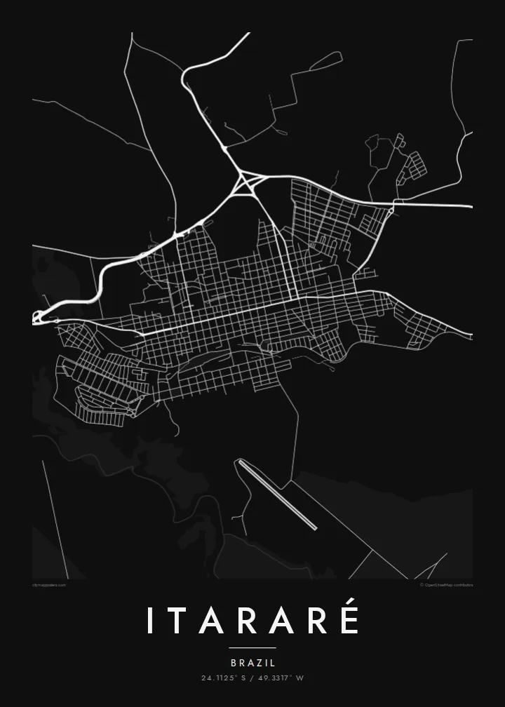
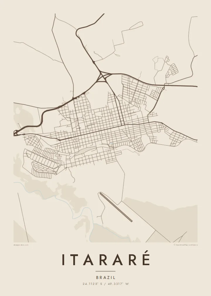
Itararé sits in the far south of São Paulo state, right at the border with Paraná. The Itararé river marks the boundary between the two states. On the map, the town forms a fairly regular grid of blocks on rolling upland, with roads leaving in several directions towards farmland and neighbouring towns. The river valley to the west is cut into the landscape.
The name comes from Tupi and is usually translated as stone carved by water, which fits the eroded river gorges in the region. Itararé is also famous in Brazilian history for the battle that never happened. In 1930, government and revolutionary forces were expected to clash near the town, but the fighting was called off before it started.
An Itararé map poster shows a border town in its simplest form: a compact grid, a few long approach roads and the line of a river that divides two states. The humorist Apparício Torelly took his pen name, Barão de Itararé, from the non-battle, and that story gives this quiet map a wry footnote.
The Itararé river runs along the state line and gives the map a natural western edge between São Paulo and Paraná.
The central blocks are laid out regularly on gently rolling ground, and a small number of main roads carry traffic in and out of town.
Highways leave the town towards both São Paulo and Paraná, drawing long lines that show its position as a crossing point.
ඔබේම කරගන්න
දිනයක්, නමක් හෝ ඔබේම වාක්යයක් එක් කරන්න, ශෛලිය, ප්රමාණය හෝ දිශානතිය වෙනස් කරන්න.
නොමිලේ පෙරදසුන අඩු විභේදනයෙන් සහ watermark සමඟින් වේ. මුද්රණ සහ HD ගොනු watermark නොමැතිව, 300 DPI, 7,200 × 10,800 px දක්වා විදැහුම් කරනු ලැබේ.
ඇයි Itararé
People hang Itararé for family ties, for a childhood in the interior or for its odd place in the history of 1930. The simple grid next to the border river makes a clean, balanced picture on the wall.
The title, subtitle and coordinates line are all editable, so the poster can carry a name, a date or a private joke about the battle that never was. Pick from five styles: Classic black & white, Noir, Paper, Blueprint or Sand.
Itararé පෝස්ටරය ඇණවුම් කරන්න| මුද්රණ ප්රමාණය | විභේදනය | ගොනු |
|---|---|---|
| 30 × 40 cm (11.8 × 15.7″) | 3,543 × 4,724 px | PNG · PDF |
| 29.7 × 42 cm (A3, 11.7 × 16.5″) | 3,508 × 4,961 px | PNG · PDF |
| 42 × 59.4 cm (A2, 16.5 × 23.4″) | 4,961 × 7,016 px | PNG · PDF |
| 45.7 × 61 cm (18 × 24″) | 5,400 × 7,200 px | PNG · PDF |
| 50 × 70 cm (19.7 × 27.6″) | 5,906 × 8,268 px | PNG · PDF |
| 61 × 91.4 cm (24 × 36″) | 7,200 × 10,800 px | PNG · PDF |
සැසඳීම සඳහා, නොමිලේ ලැබෙන පෙරදසුන 900 px පළල, ජල සලකුණු සහිත සහ තිර සඳහා අදහස් කළකි. HD ගොනුවල එක් එක් දිශාවට 8 ගුණයක් දක්වා විභේදනයක් ඇති අතර සම්පූර්ණ පෝස්ටර් ප්රමාණයෙන් පිරිසිදුව මුද්රණය වේ.
පිටුවේ ඉහළින් ශෛලියක් තෝරන්න, පසුව මුද්රිත පෝස්ටරය — ප්රමාණයක් සහ, ඔබ කැමති නම්, රාමුවක් — හෝ Digital HD Files තෝරන්න. ගෙවීම එක් පියවරකින් සිදු වන අතර, ගෙවීම සම්පූර්ණ වූ විගසම ඔබේ ඇණවුම් පිටුව යාවත්කාලීන වේ.
එය 30 × 40 cm සිට 24 × 36″ දක්වා ප්රමාණ හයකින් ප්රිමියම් 200 gsm මැට් කඩදාසි මත මුද්රණය කෙරේ. මුද්රිත පෝස්ටර {printFrom} සිට ආරම්භ වේ, බෙදාහැරීම ඇතුළුව.
ඔව්. කළු, සුදු, ස්වාභාවික ඕක් හෝ තද පැහැති දැව රාමුවක් තෝරන්න. එය කැඩෙන්නට නොහැකි වීදුරුවක් සමඟින් සූදානම්ව එනු ලබන අතර එසැණින් එල්ලීමට හැකිය. රාමු කළ පෝස්ටර {framedFrom} සිට ආරම්භ වේ, බෙදාහැරීම ඇතුළුව.
ලොව පුරා නොමිලේ බෙදාහැරීම. සෑම පෝස්ටරයක්ම රටවල් 30+ ක අපගේ මුද්රණ හවුල්කරුවන්ගෙන් ඔබට ළඟම සිටින අයෙකු විසින් මුද්රණය කරන අතර සාමාන්යයෙන් වැඩ කරන දින 3–7 ක් ඇතුළත ලැබේ. තත්ත්වය සහ ලුහුබැඳීම "මගේ ඇණවුම්" යටතේ බලාගත හැක. සමහර රටවලට සති 2–5 ක් ගත වන අතර, අපි තවමත් බෙදාහරින්නේ නැති රටවල් සම්බන්ධයෙන් ගෙවීමට පෙර අඩවිය ඔබට දැනුම් දෙයි.
බෙදාහැරීමෙන් දින 14ක් ඇතුළත අපට ඡායාරූපයක් යවන්න, අපි එය නොමිලේ නැවත මුද්රණය කරන්නෙමු හෝ ඔබට මුදල් ආපසු ලබා දෙන්නෙමු.
ඔව්. මෙම පිටුවේ එඩිටරයේ, මාතෘකාව, උපමාතෘකාව සහ ඛණාංක රේඛාව ඔබට කැමති ඕනෑම දෙයකට වෙනස් කර, ශෛලියක් සහ ප්රමාණයක් තෝරන්න. මුද්රිත, රාමු කළ සහ ඩිජිටල් ඇණවුම් සියල්ලම හරියටම ඔබේ නිර්මාණය භාවිත කරයි.
$9කට ඔබට ප්රමාණ හයම සඳහා 300 DPI PNG සහ මුද්රණයට සූදානම් PDF ගොනු, watermark නොමැතිව, ඕනෑම තැනක මුද්රණය කිරීමට ලැබේ. තවම විශ්වාස නැද්ද? මුලින්ම නොමිලේ watermark සහිත පෙරදසුනක් බාගන්න.
