Highway 307
The main road runs a short way inland, almost parallel to the coast. It is a single strong line with short spurs leading down to the beaches and resorts.
සරල සිතියම් පෝස්ටරය · මෙක්සිකෝව
20.5805° N / 87.1175° W
A long Caribbean shoreline of beaches and reef, running south from Cancún with one highway parallel to the sea


එක් නගරයක්, මනෝභාව පහක්
ශෛලියක් තට්ටු කර එය බිත්තියේ බලන්න. සෑම ශෛලියක්ම එකම මිලට — මුද්රිත, රාමු කළ හෝ HD ගොනු ලෙස.
 සැබෑ පික්සල් · 24 × 36″ මුද්රණ ගොනුව
මුද්රණයට තියුණු
මෙය සැබෑ මුද්රණ ගොනුවේ 100% කැපුමකි. සෑම පෝස්ටරයක්ම — මුද්රිත, රාමු කළ හෝ බාගත කළ — අපගේ සර්වර්වල 300 DPI වලින්, 7,200 × 10,800 පික්සල් දක්වා විදැහුම් කරනු ලැබේ, එමගින් 24 × 36″ මුද්රණයක සිඟුම් වීදිවත් පැහැදිලිව පෙනේ.
බිත්තියේ


සිතියම
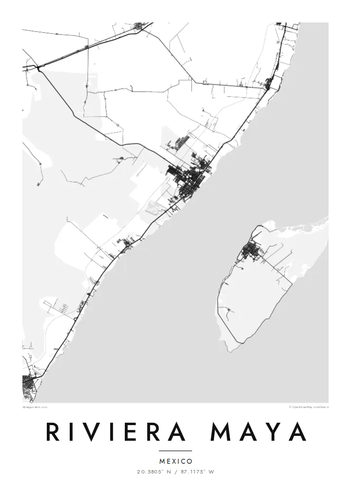
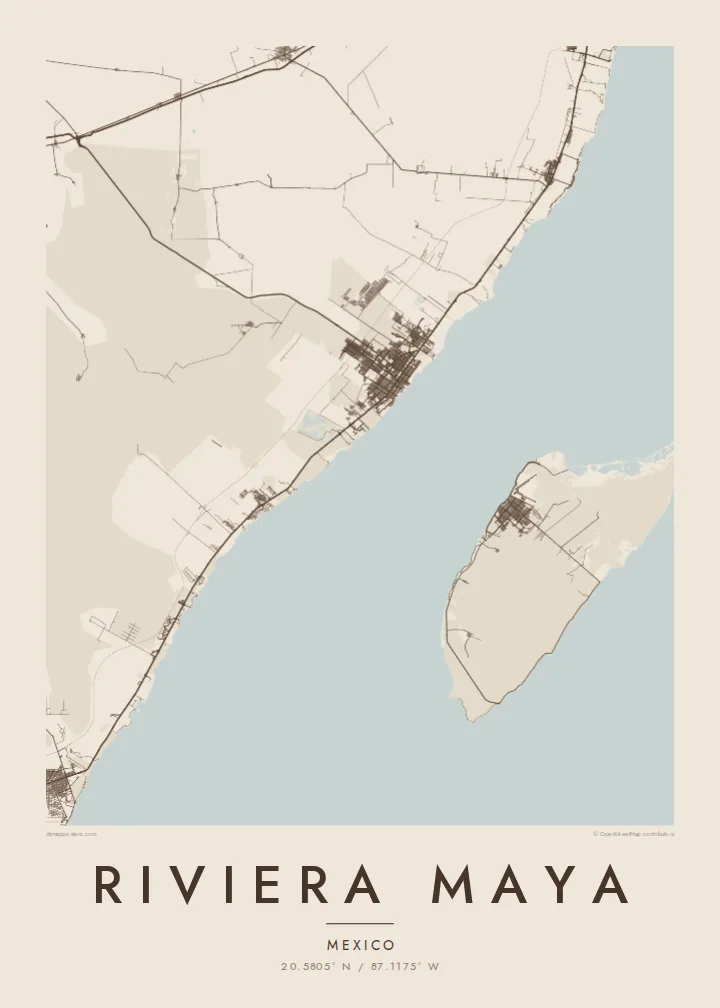
The Riviera Maya follows the Caribbean coast of the Mexican state of Quintana Roo, usually counted from just south of Cancún down to Tulum and beyond. The land here is flat limestone with almost no rivers on the surface, so the map looks strikingly simple: a long, gently curving coastline, with Federal Highway 307 running a little inland and almost parallel to it.
The water moves underground instead, through large cave systems that open up as cenotes, sinkholes scattered through the forest. Offshore, the Mesoamerican Barrier Reef follows the coast, and the island of Cozumel lies across a channel from Playa del Carmen. At Tulum, the ruins of a walled Maya city stand on a cliff directly above the sea.
A Riviera Maya map poster captures this linear structure. Playa del Carmen's street grid spreads out from the ferry pier, access roads to the resorts branch toward the beaches like the teeth of a comb, and lagoons and small bays break the shoreline here and there. Where the frame reaches it, Cozumel appears as a large shape offshore.
The main road runs a short way inland, almost parallel to the coast. It is a single strong line with short spurs leading down to the beaches and resorts.
The walled Maya site sits on a low cliff above the Caribbean, a small enclosure on the shore to the east of the modern town.
Across a strait from Playa del Carmen lies Cozumel, Mexico's largest Caribbean island, with its town of San Miguel facing the mainland.
ඔබේම කරගන්න
දිනයක්, නමක් හෝ ඔබේම වාක්යයක් එක් කරන්න, ශෛලිය, ප්රමාණය හෝ දිශානතිය වෙනස් කරන්න.
නොමිලේ පෙරදසුන අඩු විභේදනයෙන් සහ watermark සමඟින් වේ. මුද්රණ සහ HD ගොනු watermark නොමැතිව, 300 DPI, 7,200 × 10,800 px දක්වා විදැහුම් කරනු ලැබේ.
ඇයි Riviera Maya
Many couples marry on these beaches, and many travellers return to the same stretch of sand year after year. Put names in the title and the date in the subtitle, and move the coordinates to the resort, cenote or beach you remember.
Sand and Paper give the coast a soft, sunlit tone, while Blueprint and Noir bring out the clean geometry of road and shore. Classic black & white is also available. The $9 download includes six print sizes, with no watermark.
Riviera Maya පෝස්ටරය ඇණවුම් කරන්න| මුද්රණ ප්රමාණය | විභේදනය | ගොනු |
|---|---|---|
| 30 × 40 cm11.8 × 15.7″ | 3,543 × 4,724 px | PNG · PDF |
| 29.7 × 42 cm (A3)11.7 × 16.5″ | 3,508 × 4,961 px | PNG · PDF |
| 42 × 59.4 cm (A2)16.5 × 23.4″ | 4,961 × 7,016 px | PNG · PDF |
| 45.7 × 61 cm18 × 24″ | 5,400 × 7,200 px | PNG · PDF |
| 50 × 70 cm19.7 × 27.6″ | 5,906 × 8,268 px | PNG · PDF |
| 61 × 91.4 cm24 × 36″ | 7,200 × 10,800 px | PNG · PDF |
සැසඳීම සඳහා, නොමිලේ ලැබෙන පෙරදසුන 900 px පළල, ජල සලකුණු සහිත සහ තිර සඳහා අදහස් කළකි. HD ගොනුවල එක් එක් දිශාවට 8 ගුණයක් දක්වා විභේදනයක් ඇති අතර සම්පූර්ණ පෝස්ටර් ප්රමාණයෙන් පිරිසිදුව මුද්රණය වේ.
පිටුවේ ඉහළින් ශෛලියක් තෝරන්න, පසුව මුද්රිත පෝස්ටරය — ප්රමාණයක් සහ, ඔබ කැමති නම්, රාමුවක් — හෝ Digital HD Files තෝරන්න. ගෙවීම එක් පියවරකින් සිදු වන අතර, ගෙවීම සම්පූර්ණ වූ විගසම ඔබේ ඇණවුම් පිටුව යාවත්කාලීන වේ.
එය 30 × 40 cm සිට 24 × 36″ දක්වා ප්රමාණ හයකින් ප්රිමියම් 200 gsm මැට් කඩදාසි මත මුද්රණය කෙරේ. මුද්රිත පෝස්ටර $39 සිට ආරම්භ වේ, බෙදාහැරීම ඇතුළුව.
ඔව්. කළු, සුදු, ස්වාභාවික ඕක් හෝ තද පැහැති දැව රාමුවක් තෝරන්න. එය කැඩෙන්නට නොහැකි වීදුරුවක් සමඟින් සූදානම්ව එනු ලබන අතර එසැණින් එල්ලීමට හැකිය. රාමු කළ පෝස්ටර $99 සිට ආරම්භ වේ, බෙදාහැරීම ඇතුළුව.
රටවල් 60+ කට බෙදාහැරීම නොමිලේ. සෑම පෝස්ටරයක්ම රටවල් 30+ ක ඇති අපගේ මුද්රණ හවුල්කරුවන්ගෙන් ඔබට ළඟම සිටින අයකු විසින් මුද්රණය කර, සාමාන්යයෙන් වැඩ කරන දින 3–7 ක් ඇතුළත ලැබේ. තත්ත්වය සහ ලුහුබැඳීම My Orders යටතේ බලාගත හැක. සමහර රටවලට සති 2–5 ක් ගත වේ; අපි තවම බෙදාහරින්නේ නැති රටකට නම්, ගෙවීමට පෙර අඩවිය ඒ බව ඔබට දන්වයි.
බෙදාහැරීමෙන් දින 14ක් ඇතුළත අපට ඡායාරූපයක් යවන්න, අපි එය නොමිලේ නැවත මුද්රණය කරන්නෙමු හෝ ඔබට මුදල් ආපසු ලබා දෙන්නෙමු.
ඔව්. මෙම පිටුවේ එඩිටරයේ, මාතෘකාව, උපමාතෘකාව සහ ඛණාංක රේඛාව ඔබට කැමති ඕනෑම දෙයකට වෙනස් කර, ශෛලියක් සහ ප්රමාණයක් තෝරන්න. මුද්රිත, රාමු කළ සහ ඩිජිටල් ඇණවුම් සියල්ලම හරියටම ඔබේ නිර්මාණය භාවිත කරයි.
$9කට ඔබට ප්රමාණ හයම සඳහා 300 DPI PNG සහ මුද්රණයට සූදානම් PDF ගොනු, watermark නොමැතිව, ඕනෑම තැනක මුද්රණය කිරීමට ලැබේ. තවම විශ්වාස නැද්ද? මුලින්ම නොමිලේ watermark සහිත පෙරදසුනක් බාගන්න.
