Charlotte Amalie
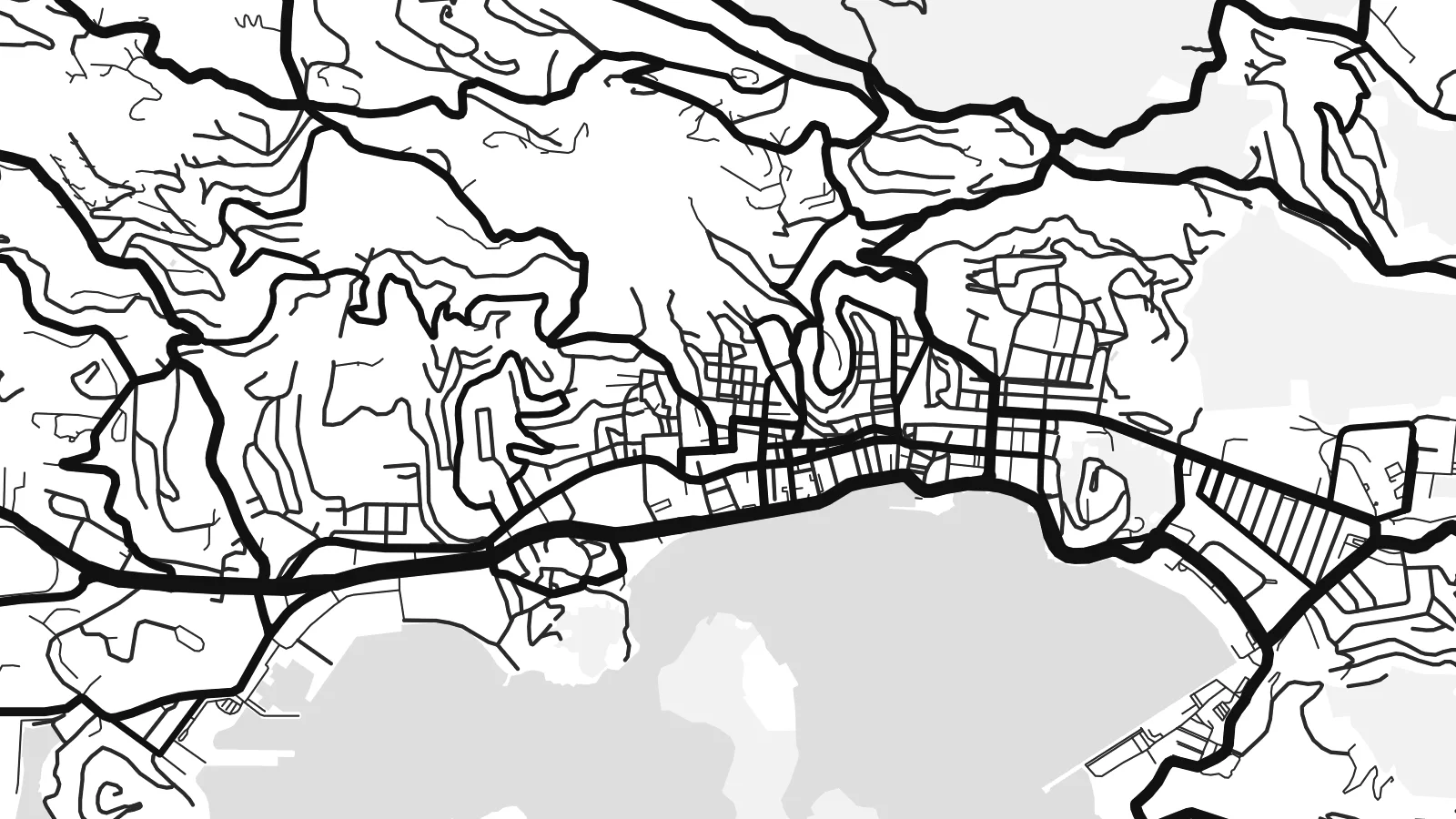
The capital wraps around a broad harbour, and its historic centre climbs in steep, stepped lanes above the waterfront. It is the densest part of the map.
සරල සිතියම් පෝස්ටරය · එක්සත් ජනපදය
18.3429° N / 64.9370° W
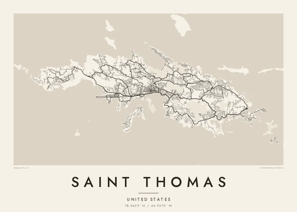
A steep, ridged Caribbean island with a harbour capital on its south coast and a deep, rounded bay on the north.




එක් නගරයක්, මනෝභාව පහක්
ශෛලියක් තට්ටු කර එය බිත්තියේ බලන්න. සෑම ශෛලියක්ම එකම මිලට — මුද්රිත, රාමු කළ හෝ HD ගොනු ලෙස.
 සැබෑ පික්සල් · 24 × 36″ මුද්රණ ගොනුව
මුද්රණයට තියුණු
මෙය සැබෑ මුද්රණ ගොනුවේ 100% කැපුමකි. සෑම පෝස්ටරයක්ම — මුද්රිත, රාමු කළ හෝ බාගත කළ — අපගේ සර්වර්වල 300 DPI වලින්, 7,200 × 10,800 පික්සල් දක්වා විදැහුම් කරනු ලැබේ, එමගින් 24 × 36″ මුද්රණයක සිඟුම් වීදිවත් පැහැදිලිව පෙනේ.
බිත්තියේ


සිතියම
Saint Thomas is one of the three main United States Virgin Islands, a narrow island with a high ridge along its length. From above, the coast is intricate, with headlands, coves and small offshore islands on every side. The land rises steeply almost everywhere, so roads follow the contours in long switchbacks. Most building is spread along the southern shore.
Charlotte Amalie, the territorial capital, lines a wide harbour on the south coast. Cruise piers and a waterfront road front a historic core of narrow lanes and stepped streets that climb the hill. On the north side, Magens Bay forms a deep, rounded bite into the coast, sheltered by long headlands. A Saint Thomas map poster brings out both shapes clearly.
The island was a Danish colony for more than two centuries, until the United States bought the Danish West Indies in 1917. Danish street names and buildings still mark Charlotte Amalie. Cars still drive on the left, a long-standing local convention, even though most vehicles on the island are built for driving on the right.
The capital wraps around a broad harbour, and its historic centre climbs in steep, stepped lanes above the waterfront. It is the densest part of the map.
A deep, sheltered bay on the north shore, almost enclosed by two long headlands. Its rounded shape is one of the most recognisable features on the island.
A mountainous spine runs east to west through the island. The roads that climb it twist into tight curves before dropping down to either coast.
ඔබේම කරගන්න
දිනයක්, නමක් හෝ ඔබේම වාක්යයක් එක් කරන්න, ශෛලිය, ප්රමාණය හෝ දිශානතිය වෙනස් කරන්න.
නොමිලේ පෙරදසුන අඩු විභේදනයෙන් සහ watermark සමඟින් වේ. මුද්රණ සහ HD ගොනු watermark නොමැතිව, 300 DPI, 7,200 × 10,800 px දක්වා විදැහුම් කරනු ලැබේ.
ඇයි Saint Thomas
Saint Thomas is a landmark for cruise passengers, sailors and people who have made a life in the Virgin Islands. The map is a lasting keepsake of a harbour arrival, a wedding on the beach or years spent living on the hillside.
You can personalise the title and subtitle, add the coordinates of a favourite bay, and pick one of five styles. Download the HD files for $9 in any of six sizes, or order a matte print with an optional wooden frame.
Saint Thomas පෝස්ටරය ඇණවුම් කරන්න| මුද්රණ ප්රමාණය | විභේදනය | ගොනු |
|---|---|---|
| 30 × 40 cm11.8 × 15.7″ | 3,543 × 4,724 px | PNG · PDF |
| 29.7 × 42 cm (A3)11.7 × 16.5″ | 3,508 × 4,961 px | PNG · PDF |
| 42 × 59.4 cm (A2)16.5 × 23.4″ | 4,961 × 7,016 px | PNG · PDF |
| 45.7 × 61 cm18 × 24″ | 5,400 × 7,200 px | PNG · PDF |
| 50 × 70 cm19.7 × 27.6″ | 5,906 × 8,268 px | PNG · PDF |
| 61 × 91.4 cm24 × 36″ | 7,200 × 10,800 px | PNG · PDF |
සැසඳීම සඳහා, නොමිලේ ලැබෙන පෙරදසුන 900 px පළල, ජල සලකුණු සහිත සහ තිර සඳහා අදහස් කළකි. HD ගොනුවල එක් එක් දිශාවට 8 ගුණයක් දක්වා විභේදනයක් ඇති අතර සම්පූර්ණ පෝස්ටර් ප්රමාණයෙන් පිරිසිදුව මුද්රණය වේ.
පිටුවේ ඉහළින් ශෛලියක් තෝරන්න, පසුව මුද්රිත පෝස්ටරය — ප්රමාණයක් සහ, ඔබ කැමති නම්, රාමුවක් — හෝ Digital HD Files තෝරන්න. ගෙවීම එක් පියවරකින් සිදු වන අතර, ගෙවීම සම්පූර්ණ වූ විගසම ඔබේ ඇණවුම් පිටුව යාවත්කාලීන වේ.
එය 30 × 40 cm සිට 24 × 36″ දක්වා ප්රමාණ හයකින් ප්රිමියම් 200 gsm මැට් කඩදාසි මත මුද්රණය කෙරේ. මුද්රිත පෝස්ටර $39 සිට ආරම්භ වේ, බෙදාහැරීම ඇතුළුව.
ඔව්. කළු, සුදු, ස්වාභාවික ඕක් හෝ තද පැහැති දැව රාමුවක් තෝරන්න. එය කැඩෙන්නට නොහැකි වීදුරුවක් සමඟින් සූදානම්ව එනු ලබන අතර එසැණින් එල්ලීමට හැකිය. රාමු කළ පෝස්ටර $99 සිට ආරම්භ වේ, බෙදාහැරීම ඇතුළුව.
රටවල් 60+ කට බෙදාහැරීම නොමිලේ. සෑම පෝස්ටරයක්ම රටවල් 30+ ක ඇති අපගේ මුද්රණ හවුල්කරුවන්ගෙන් ඔබට ළඟම සිටින අයකු විසින් මුද්රණය කර, සාමාන්යයෙන් වැඩ කරන දින 3–7 ක් ඇතුළත ලැබේ. තත්ත්වය සහ ලුහුබැඳීම My Orders යටතේ බලාගත හැක. සමහර රටවලට සති 2–5 ක් ගත වේ; අපි තවම බෙදාහරින්නේ නැති රටකට නම්, ගෙවීමට පෙර අඩවිය ඒ බව ඔබට දන්වයි.
බෙදාහැරීමෙන් දින 14ක් ඇතුළත අපට ඡායාරූපයක් යවන්න, අපි එය නොමිලේ නැවත මුද්රණය කරන්නෙමු හෝ ඔබට මුදල් ආපසු ලබා දෙන්නෙමු.
ඔව්. මෙම පිටුවේ එඩිටරයේ, මාතෘකාව, උපමාතෘකාව සහ ඛණාංක රේඛාව ඔබට කැමති ඕනෑම දෙයකට වෙනස් කර, ශෛලියක් සහ ප්රමාණයක් තෝරන්න. මුද්රිත, රාමු කළ සහ ඩිජිටල් ඇණවුම් සියල්ලම හරියටම ඔබේ නිර්මාණය භාවිත කරයි.
$9කට ඔබට ප්රමාණ හයම සඳහා 300 DPI PNG සහ මුද්රණයට සූදානම් PDF ගොනු, watermark නොමැතිව, ඕනෑම තැනක මුද්රණය කිරීමට ලැබේ. තවම විශ්වාස නැද්ද? මුලින්ම නොමිලේ watermark සහිත පෙරදසුනක් බාගන්න.
