The ferry crossing
The short ferry route between Lévis and Quebec City crosses one of the narrowest parts of the St. Lawrence, linking the two cities facing each other.
Minimalističen plakat z zemljevidom · Kanada
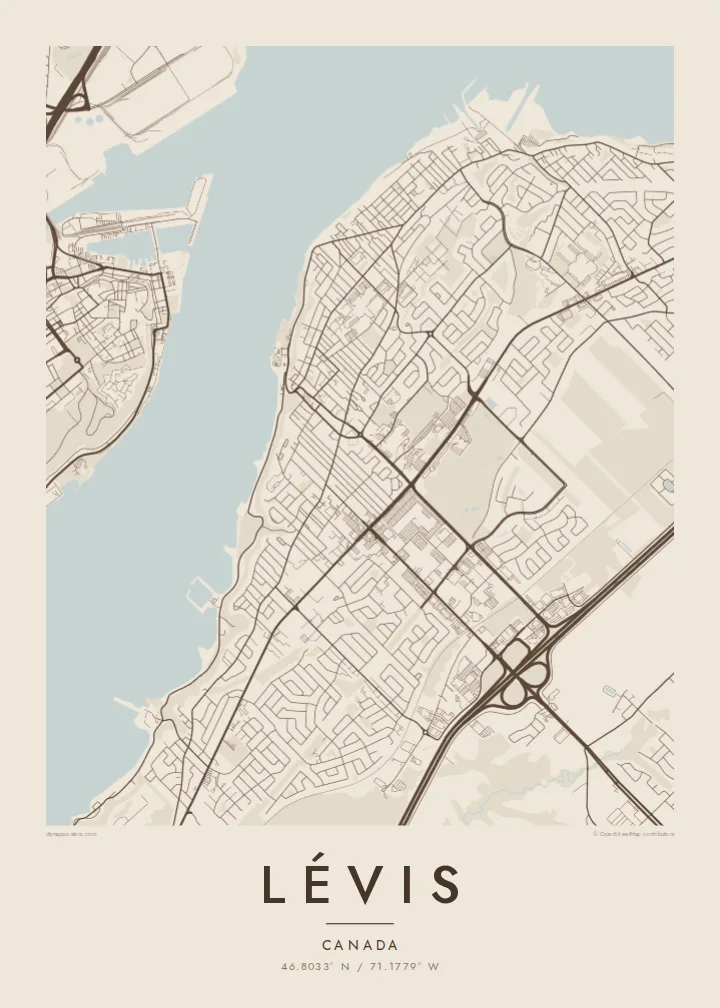
46.8033° N / 71.1779° W
A long shoreline city along the south bank of the St. Lawrence, facing the cliffs and old walls of Quebec City


Eno mesto, pet razpoloženj
Dotaknite se stila, da ga vidite na steni. Vsi stili stanejo enako — natisnjen, uokvirjen ali kot HD datoteke.
 Dejanski slikovni piki · datoteka za tisk 24 × 36″
Ostro za tisk
To je 100-odstotni izrez dejanske datoteke za tisk. Vsak poster — natisnjen, uokvirjen ali prenesen — izrišemo na naših strežnikih pri 300 DPI, do 7,200 × 10,800 slikovnih pik, tako da tudi najmanjše ulice ostanejo ostre na tisku 24 × 36″.
Na steni


Zemljevid
Lévis stretches along the south shore of the St. Lawrence River, directly across from Quebec City. On a map, the city is long and narrow in its older parts, following the river for many kilometres. A steep escarpment separates the lower waterfront from the upper town, and later neighbourhoods have spread inland across the plateau.
A ferry has linked Lévis to Quebec City for generations, and the crossing is a short trip across a narrow reach of the river. At the western end, the Quebec Bridge and the Pierre Laporte Bridge span the St. Lawrence close together. Lévis is also where Alphonse Desjardins founded the first caisse populaire in 1900, the origin of the Desjardins cooperative movement.
A Lévis map poster draws the south bank as a strong line of streets facing the wide river. The Chaudière River reaches the St. Lawrence to the west, and the two bridges add clean strokes across the water. If the frame is slightly wider, the old city of Quebec appears on the opposite shore.
The short ferry route between Lévis and Quebec City crosses one of the narrowest parts of the St. Lawrence, linking the two cities facing each other.
The Quebec Bridge and the Pierre Laporte Bridge cross the river side by side at the western end of the city, forming two parallel lines over the water.
A cliff separates the narrow riverside strip from the upper town, and roads climb it on steep curving routes that stand out against the grid above.
Naj bo vaš
Dodajte datum, ime ali svoje besedilo, zamenjajte slog, velikost ali usmerjenost.
Brezplačen predogled je nizke ločljivosti in z vodnim žigom. Natisi in HD datoteke so izrisani pri 300 DPI, do 7,200 × 10,800 px, brez vodnega žiga.
Zakaj Lévis
Lévis is often seen as the view of Quebec City, but for people who live there it is a city with its own identity. A map that puts its shoreline first gives the south bank the attention it deserves.
You can change the title, the subtitle and the coordinates line, in English or French. Five styles are available: Classic black and white, Noir, Paper, Blueprint and Sand. Noir makes the river an especially deep, dramatic band.
Naročite poster Lévis| Velikost tiska | Ločljivost | Datoteke |
|---|---|---|
| 30 × 40 cm (11.8 × 15.7″) | 3,543 × 4,724 px | PNG · PDF |
| 29.7 × 42 cm (A3, 11.7 × 16.5″) | 3,508 × 4,961 px | PNG · PDF |
| 42 × 59.4 cm (A2, 16.5 × 23.4″) | 4,961 × 7,016 px | PNG · PDF |
| 45.7 × 61 cm (18 × 24″) | 5,400 × 7,200 px | PNG · PDF |
| 50 × 70 cm (19.7 × 27.6″) | 5,906 × 8,268 px | PNG · PDF |
| 61 × 91.4 cm (24 × 36″) | 7,200 × 10,800 px | PNG · PDF |
Za primerjavo: brezplačni predogled je širok 900 px, ima vodni žig in je namenjen zaslonom. Datoteke HD imajo do 8-krat večjo ločljivost v vsako smer in se čisto natisnejo v polni velikosti plakata.
Izberite stil na vrhu strani, nato izberite Natisnjen poster — velikost in, če želite, okvir — ali Digitalne HD datoteke. Nakup je zaključen v enem koraku, stran naročila pa se posodobi takoj, ko je plačilo izvedeno.
Natisnjen je na premium mat papir 200 gsm v eni od šestih velikosti, od 30 × 40 cm do 24 × 36″. Natisnjeni posterji se začnejo pri {printFrom}, vključno s dostavo.
Da. Izberite okvir iz masivnega lesa v črni, beli, naravni hrastovi ali temni lesni barvi. Ima nezlomljivo steklo in je pripravljen za obešanje. Uokvirjeni posterji se začnejo pri {framedFrom}, vključno s dostavo.
Dostava je brezplačna po vsem svetu. Vsak poster natisne najbližji od naših tiskarskih partnerjev v več kot 30 državah in običajno prispe v 3–7 delovnih dneh. Stanje in sledenje lahko spremljate pod Moja naročila.
Pošljite nam fotografijo v 14 dneh po dostavi in ga bomo brezplačno ponovno natisnili ali vam povrnili denar.
Da. V urejevalniku na tej strani spremenite naslov, podnaslov in vrstico s koordinatami po želji ter izberite stil in velikost. Natisnjena, uokvirjena in digitalna naročila vsa uporabijo prav vaš dizajn.
Za $9 dobite PNG datoteke s 300 DPI in PDF datoteke, pripravljene za tisk, v vseh šestih velikostih, brez vodnega žiga, da jih lahko natisnete kjerkoli. Še niste prepričani? Najprej prenesite brezplačen predogled z vodnim žigom.
V bližini
