Misumi West Port
A carefully engineered Meiji-era harbour of cut stone, with canals and quays, lies near the tip of the peninsula. It is one of the few ports of its era to survive largely intact.
Boodh khariidad fudud · Jabaan
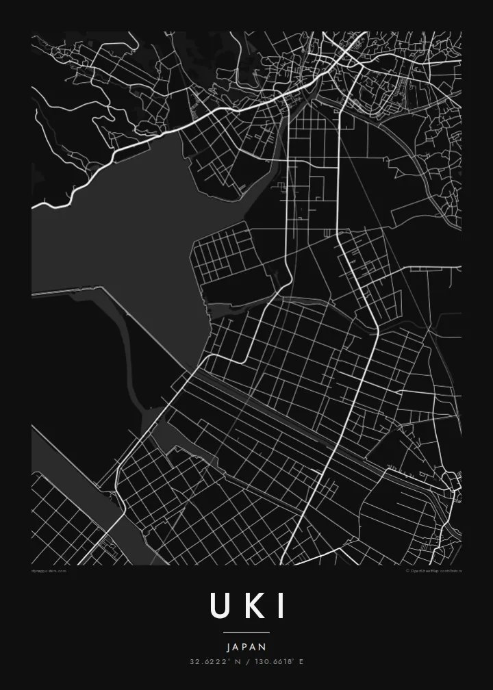
32.6222° N / 130.6618° E
A coastal city at the root of the Uto Peninsula, facing two inland seas with a Meiji-era stone port at its western tip.



Hal magaalo, shan dareen
Taabo qaab si aad u aragto sida uu ku muuqdo darbiga. Dhammaan qaababka waa isku qiimo — daabacan, birxiin ah ama faylal HD ah.
 Pixel-yada dhabta ah · Faylka daabacaadda 24 × 36″
Daabacaad fiiqan
Kani waa go'an 100% ah oo ka mid ah faylka daabacaadda dhabta ah. Boostar kasta — daabacan, birxiin ah ama la soo dejiyay — waxaa lagu sameeyaa serfarradayada 300 DPI, ilaa 7,200 × 10,800 pixel, si xitaa waddooyinka ugu yaryar ugu sii muuqdaan si cad daabacaadda 24 × 36″.
Gidaarka


Khariidadda
Uki sits in Kumamoto Prefecture at the base of the Uto Peninsula, which reaches west toward the Amakusa islands. On a map the city stretches along the peninsula. The Ariake Sea lies to the north and the Yatsushiro Sea to the south, and small towns and fishing harbours are strung along both shores. Hills run down the centre of the peninsula, with farmland and orchards on their lower slopes.
At the western end lies Misumi West Port, a stone harbour built in the late nineteenth century to Dutch designs. It is now a UNESCO World Heritage site as part of the Sites of Japan's Meiji Industrial Revolution. The Yatsushiro Sea off Uki's coast is also associated with the shiranui, a rare optical phenomenon of flickering lights on the water described in local tradition.
A Uki map poster traces a long, narrow city defined by its shorelines. Coastal roads follow the edge of the land, while a railway runs out along the peninsula toward the port. Smaller settlements appear as clusters where valleys meet the sea. The water surrounding almost every side gives the map a strong, clean silhouette.
A carefully engineered Meiji-era harbour of cut stone, with canals and quays, lies near the tip of the peninsula. It is one of the few ports of its era to survive largely intact.
The Ariake Sea and the Yatsushiro Sea border the city on opposite sides. On the map the peninsula becomes a long strip of land between two open bodies of water.
Hills run along the centre of the peninsula, with roads and small valleys branching toward the coasts. This inland ridge divides the city's northern and southern shores.
Adigu u samee
Ku dar taariikh, magac ama weedh adiga kuu gaar ah, beddel qaabka, cabbirka ama jihada.
Tijaabada bilaashka ah waxay leedahay tayo hoose oo leh sumad-biyood. Daabacaadaha iyo faylalka HD waxaa lagu sameeyaa 300 DPI, ilaa 7,200 × 10,800 px, iyagoo aan lahayn sumad-biyood.
Maxaa Uki
Uki is a place of coastal drives, fishing harbours and evenings looking across the water toward Amakusa. A map of the peninsula keeps that geography in view for residents, for visitors and for anyone with family roots in Kumamoto.
Choose Classic black & white, Noir, Paper, Blueprint or Sand, and add your own title, subtitle and coordinates. The free preview lets you check the framing first. HD files cost $9, and printed posters can ship from partners in more than 30 countries.
Dalbo boostarka Uki| Cabbirka daabacaadda | Tayada sawirka | Faylasha |
|---|---|---|
| 30 × 40 cm (11.8 × 15.7″) | 3,543 × 4,724 px | PNG · PDF |
| 29.7 × 42 cm (A3, 11.7 × 16.5″) | 3,508 × 4,961 px | PNG · PDF |
| 42 × 59.4 cm (A2, 16.5 × 23.4″) | 4,961 × 7,016 px | PNG · PDF |
| 45.7 × 61 cm (18 × 24″) | 5,400 × 7,200 px | PNG · PDF |
| 50 × 70 cm (19.7 × 27.6″) | 5,906 × 8,268 px | PNG · PDF |
| 61 × 91.4 cm (24 × 36″) | 7,200 × 10,800 px | PNG · PDF |
Isbarbardhig ahaan, muuqaalka hordhaca ah ee bilaashka ah waa 900 px ballac, wuxuu leeyahay calaamad biyo, waxaana loogu talagalay shaashadaha. Faylasha HD waxay leeyihiin ilaa 8× tayada jiho kasta, waxayna si nadiif ah ugu daabacmaan cabbirka buuxa ee boodhka.
Dooro qaab bogga kore, ka dibna dooro Boostar la Daabacay — cabbir iyo, haddii aad rabto, birxiin — ama Faylal HD ah oo Dijital ah. Bixinta waxay qaadataa hal tallaabo, boggaaga dalabkaana wuu cusboonaysiiyaa isla marka lacagta la bixiyo.
Waxaa lagu daabacaa warqad tayo sare ah oo 200 gsm ah oo matte ah, lix cabbir oo ka mid ah, laga bilaabo 30 × 40 cm ilaa 24 × 36″. Boostarrada la daabacay waxay ka bilaabmaan {printFrom}, rarista way ku jirtaa.
Haa. Dooro birxiin alwaax adag ah oo leh midab madow, cad, oak dabiici ah ama alwaax madow. Waxaa la socda muraayad aan jabin oo diyaar u ah in la sudho. Boostarrada birxiinta leh waxay ka bilaabmaan {framedFrom}, rarista way ku jirtaa.
Rarista adduunka oo dhan waa bilaash. Boostar kasta waxaa daabacaya shirkaddayada daabacaadda ee ugu dhow, oo ku sugan in ka badan 30 dal, waxaana caadi ahaan gaadhaya 3–7 maalmood oo shaqo. Waxaad ku raad-raaci kartaa xaaladda iyo la socodka Dalabaadkayga hoostiisa.
Noo soo dir sawir 14 maalmood gudahood laga bilaabo maalinta rarista, waxaanan mar labaad si bilaash ah u daabici doonaa ama lacagtaada dib kuu celin doonaa.
Haa. Tifaftiraha bogga ku yaal, beddel cinwaanka, cinwaanka hoose iyo khadka isku-duwidyada wax alla wixii aad doonayso, kadibna dooro qaab iyo cabbir. Dalabyada la daabacay, birxiinta leh, iyo kuwa dijitalka ahba waxay isticmaalayaan naqshaddaada saxda ah.
$9 ayaad ku heli doontaa faylal PNG 300 DPI ah iyo PDF diyaar u ah daabacaadda, lixda cabbir oo dhan, iyaga oo aan lahayn sumad-biyood, si aad meel kasta u daabacdo. Weli ma hubtid? Marka hore soo deji tijaabo bilaash ah oo leh sumad-biyood.
Agagaarka
