Inner harbour
Wharves, piers and the harbour basin form the heart of the town. On the map, this is the densest area of streets and shoreline detail.
Minimalistički poster mape · Сједињене Државе
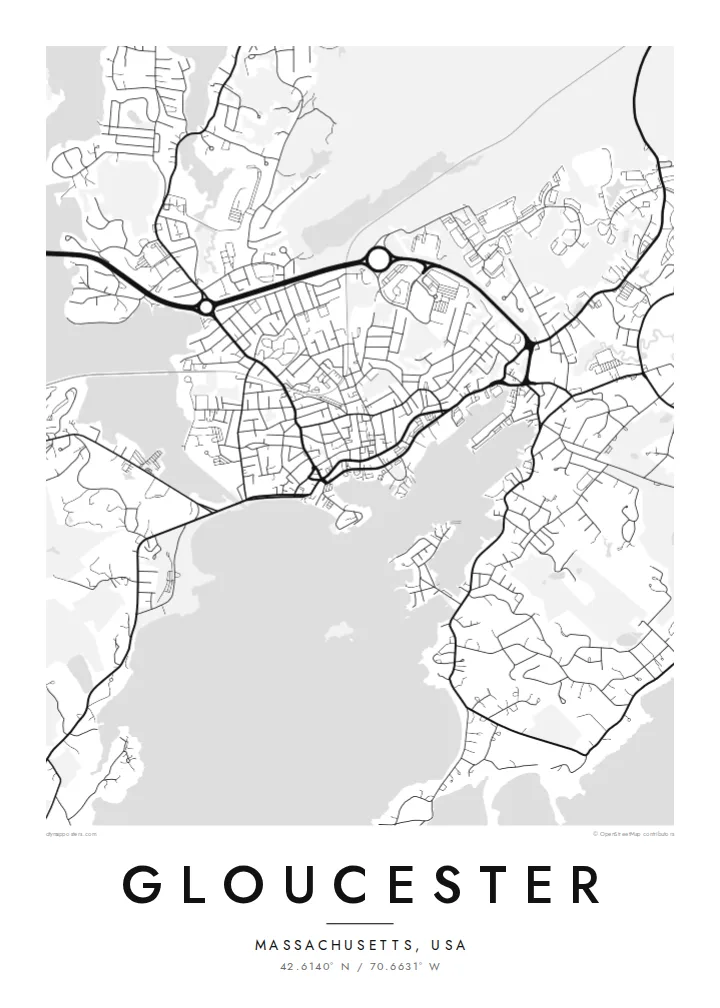
42.6140° N / 70.6631° W
A working harbour town on rocky Cape Ann, wrapped around a deep inner harbour, coves and a tidal river


Jedan grad, pet raspoloženja
Dodirnite stil da ga vidite na zidu. Svaki stil ima istu cenu — u štampi, uramljen ili kao HD fajlovi.
 Stvarni pikseli · fajl za štampu 24 × 36″
Oštro za štampu
Ovo je isečak u realnoj veličini iz fajla za štampu. Svaki poster — štampan, uramljen ili preuzet — renderuje se na našim serverima u rezoluciji 300 DPI, do 7,200 × 10,800 piksela, tako da čak i najsitnije ulice ostaju oštre na štampi 24 × 36″.
Na zidu


Mapa
Gloucester covers most of Cape Ann, the rocky headland north of Boston. Its coastline is complicated: a deep inner harbour with wharves and piers, Rocky Neck reaching into it, and Eastern Point stretching out to the lighthouse. The tidal Annisquam River and its canal cut across the town and separate the cape from the mainland.
Settled in 1623, Gloucester is widely described as America's oldest seaport. It is still a working fishing port and is known for the Fishermen's Memorial facing the harbour. Rocky Neck is one of the oldest continuously operating artists' colonies in the country.
A Gloucester map poster shows an almost continuous edge of coves, beaches and rocky points. The dense harbour streets give way to the wooded interior of the cape, and the Annisquam draws a line through it all. Few towns produce such an intricate coastal outline.
Wharves, piers and the harbour basin form the heart of the town. On the map, this is the densest area of streets and shoreline detail.
The tidal river and canal cut north through Cape Ann, with marshes and inlets along the way. They divide the map with a long, winding line of water.
Two peninsulas enclose the harbour from the south and east. Their shapes give the coastline its recognisable profile.
Prilagodite ga sebi
Dodajte datum, ime ili svoj tekst, promenite stil, veličinu ili orijentaciju.
Besplatan pregled je niske rezolucije sa vodenim žigom. Štampani posteri i HD fajlovi se renderuju u 300 DPI, do 7,200 × 10,800 px, bez vodenog žiga.
Zašto Gloucester
Gloucester means something to fishing families, summer visitors, painters and anyone who has spent time on Cape Ann's beaches. A map of the harbour and coves is a natural choice for a coastal home or a gift for someone who left.
Personalise the title, subtitle and coordinates line, perhaps with a boat's name or a date, and choose from Classic black and white, Noir, Paper, Blueprint and Sand. It comes as $9 HD downloads or as a printed poster shipped within the United States.
Naručite poster Gloucester| Veličina štampe | Rezolucija | Fajlovi |
|---|---|---|
| 30 × 40 cm11.8 × 15.7″ | 3,543 × 4,724 px | PNG · PDF |
| 29.7 × 42 cm (A3)11.7 × 16.5″ | 3,508 × 4,961 px | PNG · PDF |
| 42 × 59.4 cm (A2)16.5 × 23.4″ | 4,961 × 7,016 px | PNG · PDF |
| 45.7 × 61 cm18 × 24″ | 5,400 × 7,200 px | PNG · PDF |
| 50 × 70 cm19.7 × 27.6″ | 5,906 × 8,268 px | PNG · PDF |
| 61 × 91.4 cm24 × 36″ | 7,200 × 10,800 px | PNG · PDF |
Poređenja radi, besplatan pregled je širok 900 px, ima vodeni žig i namenjen je ekranima. HD fajlovi imaju do 8× veću rezoluciju u svakom pravcu i štampaju se čisto u punoj veličini postera.
Izaberite stil na vrhu stranice, zatim odaberite Štampani poster — veličinu i, ako želite, ram — ili Digitalne HD fajlove. Plaćanje traje jedan korak, a stranica vaše narudžbine se ažurira čim uplata prođe.
Štampa se na premium mat papiru gramature 200 g/m² u jednoj od šest veličina, od 30 × 40 cm do 24 × 36″. Štampani posteri počinju od $39, dostava uključena.
Da. Izaberite ram od masivnog drveta u crnoj, beloj, prirodnoj hrastovoj ili tamnoj boji. Dolazi sa neraspadajućim staklom otpornim na udarce i spreman je za kačenje. Uramljeni posteri počinju od $99, dostava uključena.
Dostava je besplatna u 60+ zemalja. Svaki poster štampa najbliži od naših partnera za štampu u 30+ zemalja, a obično stiže za 3–7 radnih dana. Status i praćenje pošiljke možete pratiti u odeljku Moje porudžbine. U nekoliko zemalja dostava traje 2–5 nedelja, a ako još ne dostavljamo u vašu zemlju, sajt će vas na to upozoriti pre plaćanja.
Pošaljite nam fotografiju u roku od 14 dana od isporuke i besplatno ćemo ga ponovo odštampati ili vam vratiti novac.
Da. U uređivaču na ovoj stranici izmenite naslov, podnaslov i red sa koordinatama po želji, i izaberite stil i veličinu. Štampane, uramljene i digitalne narudžbine koriste tačno vaš dizajn.
Za $9 dobijate PNG fajlove u rezoluciji 300 DPI i PDF fajlove spremne za štampu u svih šest veličina, bez vodenog žiga, za štampu bilo gde. Niste sigurni? Prvo preuzmite besplatan pregled sa vodenim žigom.
U blizini
