Makli ridge
The necropolis stretches along a low ridge next to the town. On the map it appears as a long, sparsely lined area, very different in texture from the dense streets nearby.
Minimalistički poster mape · Пакистан
24.7475° N / 67.9235° E
An old Sindhi town at the edge of the Indus delta, with the Makli necropolis spread along the ridge beside it




Jedan grad, pet raspoloženja
Dodirnite stil da ga vidite na zidu. Svaki stil ima istu cenu — u štampi, uramljen ili kao HD fajlovi.
 Stvarni pikseli · fajl za štampu 24 × 36″
Oštro za štampu
Ovo je isečak u realnoj veličini iz fajla za štampu. Svaki poster — štampan, uramljen ili preuzet — renderuje se na našim serverima u rezoluciji 300 DPI, do 7,200 × 10,800 piksela, tako da čak i najsitnije ulice ostaju oštre na štampi 24 × 36″.
Na zidu


Mapa
Thatta lies in lower Sindh, east of the Indus as the river nears its delta. For several centuries it was a major city and a capital of the region. As the river shifted course, its commercial importance faded. Today it is a district town, but the traces of its earlier status remain unusually visible.
The best known is the Makli necropolis, a UNESCO World Heritage Site on a low ridge just outside the town. It is one of the largest funerary sites in the world, with tombs spread over several kilometres. Within Thatta itself stands the Shah Jahan Mosque, known for its tilework and many domes.
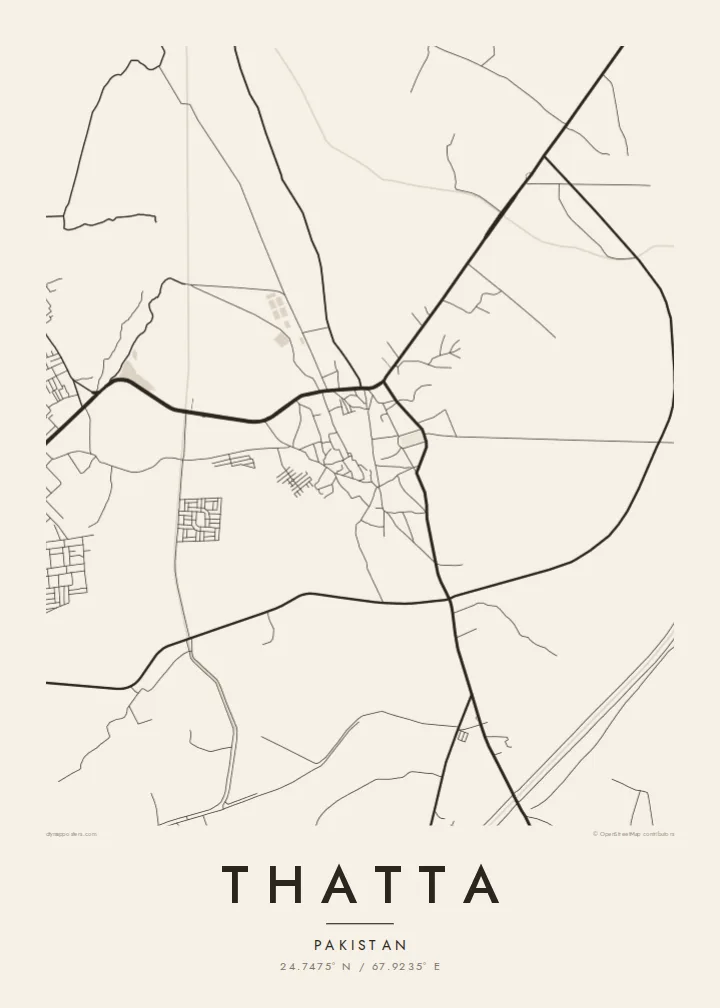
A Thatta map poster sets the town's irregular streets against the long, open strip of Makli and the flat delta country around it. The layout is not a grid. Lanes bend and meet at odd angles, which suggests centuries of gradual growth. The empty spaces on the map carry as much meaning as the built ones.
The necropolis stretches along a low ridge next to the town. On the map it appears as a long, sparsely lined area, very different in texture from the dense streets nearby.
Thatta's lanes follow no regular plan. They curve and branch in a way typical of old South Asian towns that grew slowly over many generations.
Flat land, canals and old river channels surround the town. They hint at the Indus and its shifting course, which shaped Thatta's rise and decline.
Prilagodite ga sebi
Dodajte datum, ime ili svoj tekst, promenite stil, veličinu ili orijentaciju.
Besplatan pregled je niske rezolucije sa vodenim žigom. Štampani posteri i HD fajlovi se renderuju u 300 DPI, do 7,200 × 10,800 px, bez vodenog žiga.
Zašto Thatta
Thatta appeals to people with family roots in Sindh and to anyone drawn to places where history is still visible in the ground plan. The map shows a town that was once a capital, drawn at the scale of its streets.
You can edit the title, subtitle and coordinates line, for example to add a name in Sindhi or Urdu. Then choose one of five styles; Sand and Paper suit the warm tones of the delta landscape.
Naručite poster Thatta| Veličina štampe | Rezolucija | Fajlovi |
|---|---|---|
| 30 × 40 cm (11.8 × 15.7″) | 3,543 × 4,724 px | PNG · PDF |
| 29.7 × 42 cm (A3, 11.7 × 16.5″) | 3,508 × 4,961 px | PNG · PDF |
| 42 × 59.4 cm (A2, 16.5 × 23.4″) | 4,961 × 7,016 px | PNG · PDF |
| 45.7 × 61 cm (18 × 24″) | 5,400 × 7,200 px | PNG · PDF |
| 50 × 70 cm (19.7 × 27.6″) | 5,906 × 8,268 px | PNG · PDF |
| 61 × 91.4 cm (24 × 36″) | 7,200 × 10,800 px | PNG · PDF |
Poređenja radi, besplatan pregled je širok 900 px, ima vodeni žig i namenjen je ekranima. HD fajlovi imaju do 8× veću rezoluciju u svakom pravcu i štampaju se čisto u punoj veličini postera.
Izaberite stil na vrhu stranice, zatim odaberite Štampani poster — veličinu i, ako želite, ram — ili Digitalne HD fajlove. Plaćanje traje jedan korak, a stranica vaše narudžbine se ažurira čim uplata prođe.
Štampa se na premium mat papiru gramature 200 g/m² u jednoj od šest veličina, od 30 × 40 cm do 24 × 36″. Štampani posteri počinju od {printFrom}, dostava uključena.
Da. Izaberite ram od masivnog drveta u crnoj, beloj, prirodnoj hrastovoj ili tamnoj boji. Dolazi sa neraspadajućim staklom otpornim na udarce i spreman je za kačenje. Uramljeni posteri počinju od {framedFrom}, dostava uključena.
Dostava je besplatna širom sveta. Svaki poster štampa najbliži od naših štamparskih partnera u više od 30 zemalja i obično stiže za 3–7 radnih dana. Status i praćenje pošiljke možete videti u odeljku Moje narudžbine.
Pošaljite nam fotografiju u roku od 14 dana od isporuke i besplatno ćemo ga ponovo odštampati ili vam vratiti novac.
Da. U uređivaču na ovoj stranici izmenite naslov, podnaslov i red sa koordinatama po želji, i izaberite stil i veličinu. Štampane, uramljene i digitalne narudžbine koriste tačno vaš dizajn.
Za $9 dobijate PNG fajlove u rezoluciji 300 DPI i PDF fajlove spremne za štampu u svih šest veličina, bez vodenog žiga, za štampu bilo gde. Niste sigurni? Prvo preuzmite besplatan pregled sa vodenim žigom.
U blizini
