Former lakebed
The city sits on the dried bed of Lake Chalco. The flat ground allowed long, straight street grids to be laid out.
Minimalistisk kartposter · Mexiko
19.2617° N / 98.8978° W
A city on the dry bed of a former lake in the Valley of Mexico, with volcanoes rising to the east


En stad, fem stämningar
Tryck på en stil för att se den på väggen. Alla stilar kostar detsamma — tryckt, inramad eller som HD-filer.
 Faktiska pixlar · utskriftsfil 24 × 36″
Knivskarpt tryck
Det här är en 100 % beskuren del av den riktiga utskriftsfilen. Varje poster — tryckt, inramad eller nedladdad — renderas på våra servrar i 300 DPI, upp till 7,200 × 10,800 pixlar, så att även de minsta gatorna förblir skarpa på ett tryck i 24 × 36″.
På väggen

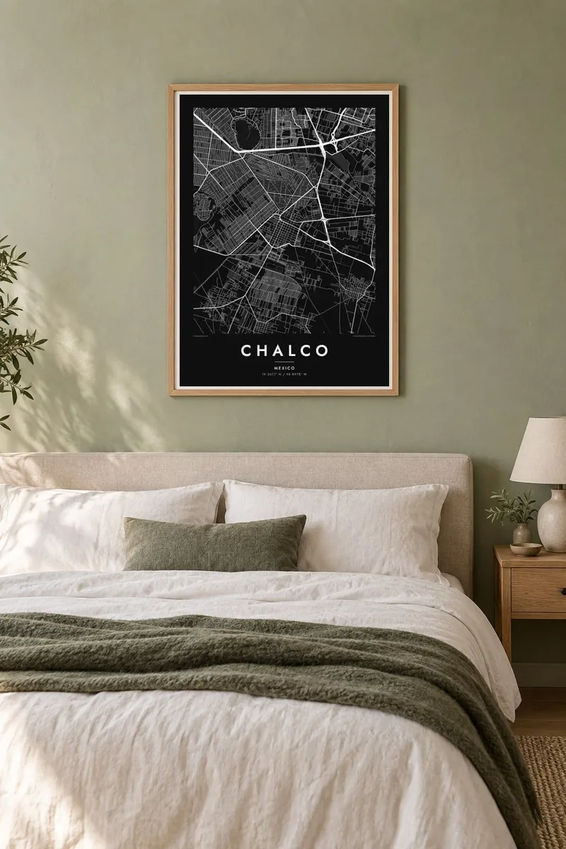

Kartan
Chalco lies in the southeast of the Valley of Mexico, in the State of México, on land that was once the bed of Lake Chalco. The lake was one of the five connected lakes in the valley before the Spanish conquest, and it was gradually drained over several centuries. The flat terrain it left behind is the base for the city's streets today.
On a map, Chalco's older centre forms a small cluster within a much wider urban area that has grown rapidly in recent decades, merging with neighbouring municipalities. The land is almost completely flat, so the new streets follow long, straight grids. East of the city, the ground rises toward the volcanoes Iztaccíhuatl and Popocatépetl.
A Chalco map poster shows the flat grid of the former lakebed, the older town at its heart, and the main highways connecting it to Mexico City. The regular pattern tells the story of a lake turned into land and then into city. It is a thoughtful choice for anyone whose family history is tied to this part of the valley.
The city sits on the dried bed of Lake Chalco. The flat ground allowed long, straight street grids to be laid out.
The older town forms a small, compact core within the much larger urban area that has grown up around it.
Highways lead east, where the land rises toward Iztaccíhuatl and Popocatépetl. The terrain on that side of the map becomes less regular.
Gör den till din
Lägg till ett datum, ett namn eller en egen rad, byt stil, storlek eller orientering.
Den gratis förhandsvisningen har låg upplösning och vattenstämpel. Utskrifter och HD-filer renderas i 300 DPI, upp till 7,200 × 10,800 px, utan vattenstämpel.
Varför Chalco
Chalco is home to a large community with deep ties to the Valley of Mexico. Its map shows how the city grew from a small town on the lakeshore into a large urban area on the former lakebed.
You can add a title, a subtitle with a family name or date, and the coordinates. Choose one of five styles: Classic black & white, Noir, Paper, Blueprint or Sand. Blueprint suits the straight lines of the former lakebed grid.
Beställ Chalco-postern| Tryckstorlek | Upplösning | Filer |
|---|---|---|
| 30 × 40 cm (11.8 × 15.7″) | 3,543 × 4,724 px | PNG · PDF |
| 29.7 × 42 cm (A3, 11.7 × 16.5″) | 3,508 × 4,961 px | PNG · PDF |
| 42 × 59.4 cm (A2, 16.5 × 23.4″) | 4,961 × 7,016 px | PNG · PDF |
| 45.7 × 61 cm (18 × 24″) | 5,400 × 7,200 px | PNG · PDF |
| 50 × 70 cm (19.7 × 27.6″) | 5,906 × 8,268 px | PNG · PDF |
| 61 × 91.4 cm (24 × 36″) | 7,200 × 10,800 px | PNG · PDF |
Som jämförelse är den gratis förhandsvisningen 900 px bred, har vattenstämpel och är tänkt för skärm. HD-filerna har upp till 8× högre upplösning i varje riktning och blir skarpa i full posterstorlek.
Välj en stil högst upp på sidan, och välj sedan Tryckt poster — en storlek och, om du vill, en ram — eller Digitala HD-filer. Kassan tar ett steg, och din orderssida uppdateras så snart betalningen har gått igenom.
Den trycks på matt papper av premiumkvalitet, 200 g/m², i en av sex storlekar, från 30 × 40 cm till 24 × 36″. Tryckta postrar kostar från {printFrom}, frakt ingår.
Ja. Välj en ram i massivt trä i svart, vitt, naturlig ek eller mörkt trä. Den levereras med splitterskyddat glas och är klar att hänga upp. Inramade postrar kostar från {framedFrom}, frakt ingår.
Frakten är gratis över hela världen. Varje poster trycks av den av våra tryckpartner som ligger närmast, i över 30 länder, och kommer oftast fram inom 3–7 arbetsdagar. Du kan följa status och spårning under Mina beställningar. Några länder tar 2–5 veckor, och om vi inte levererar till ditt land ännu får du veta det på sajten innan du betalar.
Skicka oss ett foto inom 14 dagar efter leverans, så trycker vi om den gratis eller återbetalar dig.
Ja. I redigeraren på den här sidan kan du ändra titeln, undertexten och koordinatraden till vad du vill, och välja stil och storlek. Tryckta, inramade och digitala beställningar använder alltid exakt din design.
För $9 får du PNG-filer i 300 DPI och tryckklara PDF-filer i alla sex storlekar, utan vattenstämpel, att skriva ut var du vill. Inte helt säker än? Ladda ner en gratis förhandsvisning med vattenstämpel först.
