Portneuf River valley
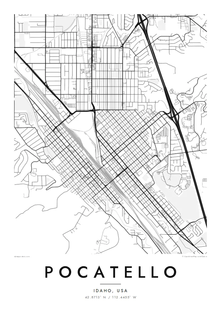
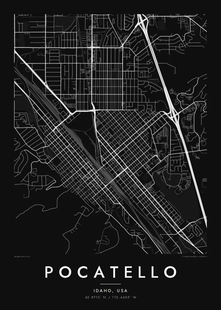
The city follows the narrow valley of the Portneuf River, and the hills on both sides give the map its long, diagonal shape and clear edges.
Minimalistisk kartposter · USA
42.8713° N / 112.4455° W
A railroad town stretched along the Portneuf River valley, hemmed in by the ridges of the Portneuf Gap


En stad, fem stämningar
Tryck på en stil för att se den på väggen. Alla stilar kostar detsamma — tryckt, inramad eller som HD-filer.
 Faktiska pixlar · utskriftsfil 24 × 36″
Knivskarpt tryck
Det här är en 100 % beskuren del av den riktiga utskriftsfilen. Varje poster — tryckt, inramad eller nedladdad — renderas på våra servrar i 300 DPI, upp till 7,200 × 10,800 pixlar, så att även de minsta gatorna förblir skarpa på ett tryck i 24 × 36″.
På väggen


Kartan
Pocatello lies in southeastern Idaho, where the Portneuf River runs out of the mountains onto the Snake River Plain. From above, the city is long and narrow. It follows the valley from southeast to northwest, and its streets are squeezed between hills on both sides. Interstate 15 runs through the corridor, and the railroad lines that shaped the city run beside it.
The city was named after Pocatello, a nineteenth-century leader of the Northwestern Shoshone. It grew as a major junction on the Union Pacific, and the tracks still divide the historic downtown. Idaho State University occupies a large campus on the east side. The Fort Hall Reservation of the Shoshone-Bannock Tribes lies just to the north.
A Pocatello map poster shows a city defined by its valley. The grid of downtown sits at an angle to the compass and follows the railroad instead of true north. Neighbourhoods climb the benches on either side, and the river and highway run through the whole composition in parallel lines.
The city follows the narrow valley of the Portneuf River, and the hills on both sides give the map its long, diagonal shape and clear edges.
Pocatello's historic centre follows the railroad, not the compass. This produces a tilted grid split by the tracks that made the city a major junction.
Idaho State University's campus fills a large area on the east side of the city, with its own open layout of buildings, lawns and paths.
Gör den till din
Lägg till ett datum, ett namn eller en egen rad, byt stil, storlek eller orientering.
Den gratis förhandsvisningen har låg upplösning och vattenstämpel. Utskrifter och HD-filer renderas i 300 DPI, upp till 7,200 × 10,800 px, utan vattenstämpel.
Varför Pocatello
Pocatello means something specific to railroad families, ISU graduates and people who grew up in the Portneuf valley. This map captures the city's shape clearly, and it hangs well in a dorm, an office or a home far from Idaho.
The title, subtitle and coordinates line are yours to edit, perhaps for a graduation year or a family name. Choose from five styles: Classic black & white, Noir, Paper, Blueprint and Sand.
Beställ Pocatello-postern| Tryckstorlek | Upplösning | Filer |
|---|---|---|
| 30 × 40 cm11.8 × 15.7″ | 3,543 × 4,724 px | PNG · PDF |
| 29.7 × 42 cm (A3)11.7 × 16.5″ | 3,508 × 4,961 px | PNG · PDF |
| 42 × 59.4 cm (A2)16.5 × 23.4″ | 4,961 × 7,016 px | PNG · PDF |
| 45.7 × 61 cm18 × 24″ | 5,400 × 7,200 px | PNG · PDF |
| 50 × 70 cm19.7 × 27.6″ | 5,906 × 8,268 px | PNG · PDF |
| 61 × 91.4 cm24 × 36″ | 7,200 × 10,800 px | PNG · PDF |
Som jämförelse är den gratis förhandsvisningen 900 px bred, har vattenstämpel och är tänkt för skärm. HD-filerna har upp till 8× högre upplösning i varje riktning och blir skarpa i full posterstorlek.
Välj en stil högst upp på sidan, och välj sedan Tryckt poster — en storlek och, om du vill, en ram — eller Digitala HD-filer. Kassan tar ett steg, och din orderssida uppdateras så snart betalningen har gått igenom.
Den trycks på matt papper av premiumkvalitet, 200 g/m², i en av sex storlekar, från 30 × 40 cm till 24 × 36″. Tryckta postrar kostar från $39, frakt ingår.
Ja. Välj en ram i massivt trä i svart, vitt, naturlig ek eller mörkt trä. Den levereras med splitterskyddat glas och är klar att hänga upp. Inramade postrar kostar från $99, frakt ingår.
Frakten är gratis till över 60 länder. Varje poster trycks av den av våra tryckpartner i över 30 länder som ligger närmast dig och kommer vanligtvis fram inom 3–7 arbetsdagar. Du kan följa status och spårning under Mina beställningar. Några länder tar 2–5 veckor, och om vi inte levererar till ditt land ännu får du veta det på sidan innan du betalar.
Skicka oss ett foto inom 14 dagar efter leverans, så trycker vi om den gratis eller återbetalar dig.
Ja. I redigeraren på den här sidan kan du ändra titeln, undertexten och koordinatraden till vad du vill, och välja stil och storlek. Tryckta, inramade och digitala beställningar använder alltid exakt din design.
För $9 får du PNG-filer i 300 DPI och tryckklara PDF-filer i alla sex storlekar, utan vattenstämpel, att skriva ut var du vill. Inte helt säker än? Ladda ner en gratis förhandsvisning med vattenstämpel först.
