The curled tip
Provincetown sits inside the final hook of sand, its streets following the harbour in a long, thin strip with dunes behind them.
โปสเตอร์แผนที่มินิมอล · สหรัฐอเมริกา
41.7987° N / 70.3085° W
A peninsula bent like a flexed arm, curling north to a sandy hook at Provincetown and cut from the mainland by a canal


หนึ่งเมือง ห้าอารมณ์
แตะเลือกสไตล์เพื่อดูภาพบนผนัง ทุกสไตล์ราคาเท่ากัน ไม่ว่าจะเป็นแบบพิมพ์ ใส่กรอบ หรือไฟล์ HD
 พิกเซลจริง · ไฟล์พิมพ์ขนาด 24 × 36″
คมชัดระดับงานพิมพ์
นี่คือภาพครอปจากไฟล์พิมพ์จริงแบบ 100% โปสเตอร์ทุกใบ ไม่ว่าจะพิมพ์ ใส่กรอบ หรือดาวน์โหลด จะถูกเรนเดอร์บนเซิร์ฟเวอร์ของเราที่ 300 DPI สูงสุดถึง 7,200 × 10,800 พิกเซล เพื่อให้แม้แต่ซอยเล็กที่สุดยังคมชัดบนงานพิมพ์ขนาด 24 × 36″
บนผนัง
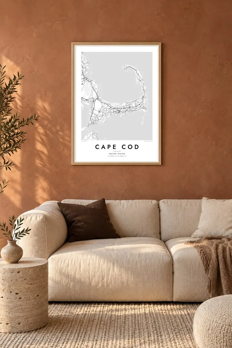
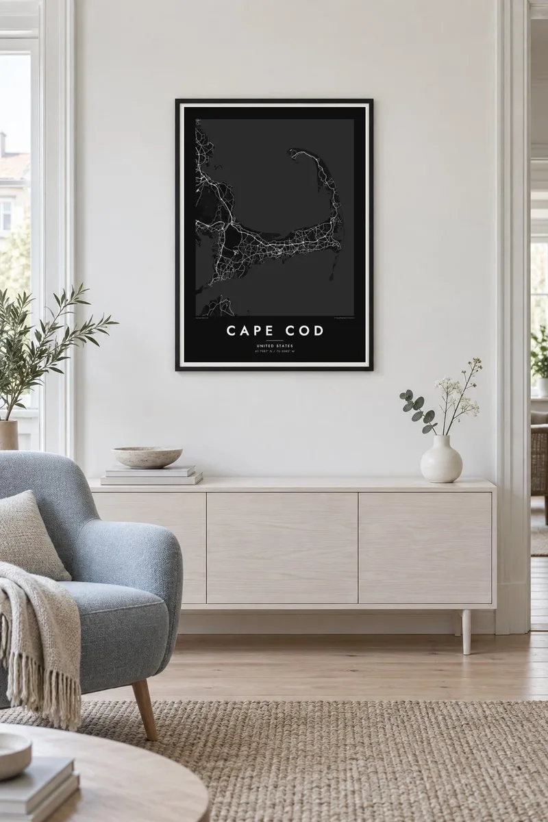
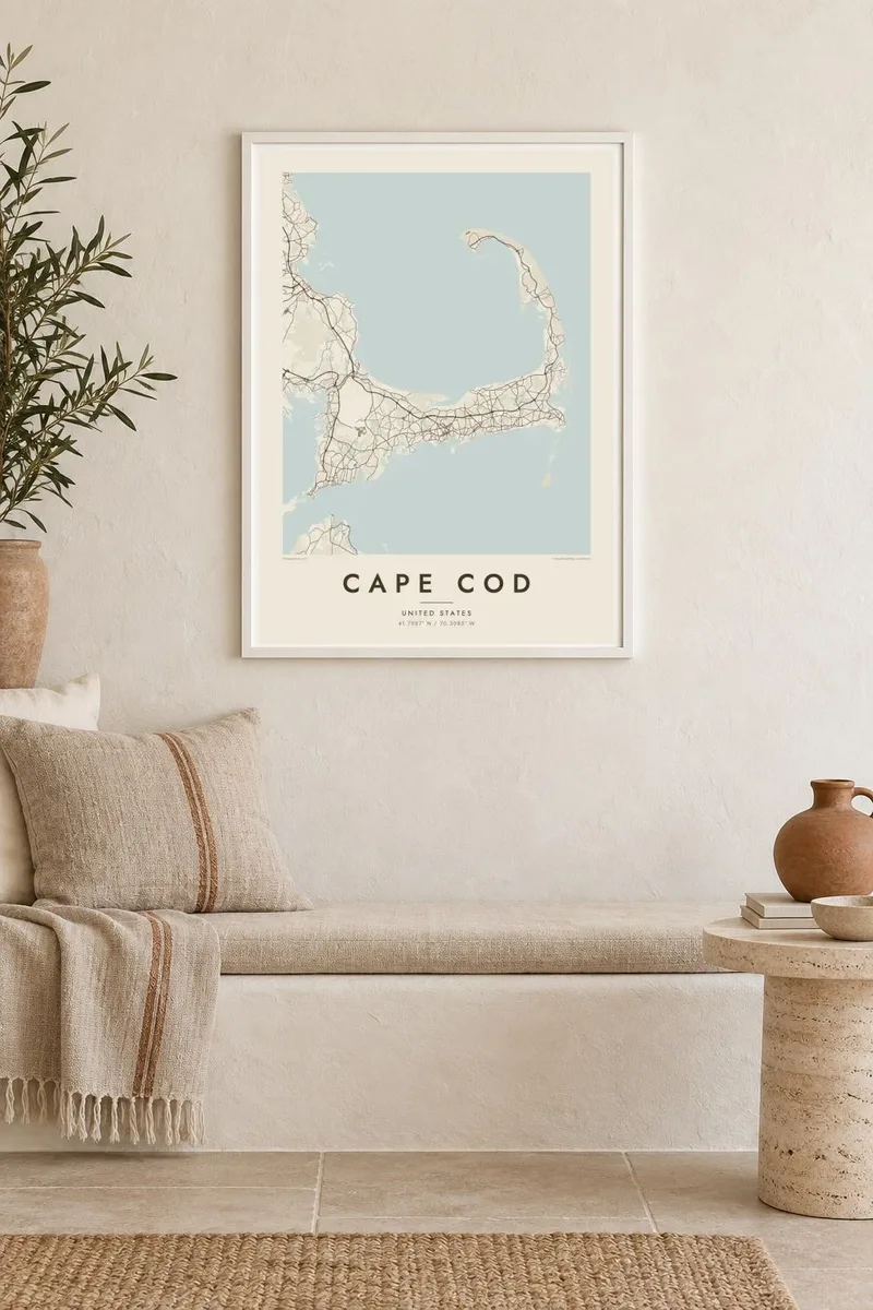
แผนที่
Cape Cod reaches into the Atlantic from southeastern Massachusetts, and its outline is one of the most recognisable on the American coast. The land runs east from the mainland, turns north at the elbow near Chatham and ends in a curled fist of dunes around Provincetown. The inner curve encloses Cape Cod Bay, while the outer shore faces the open ocean.
The Pilgrims first anchored in Provincetown Harbor in 1620 and signed the Mayflower Compact there before sailing on to Plymouth. The Cape Cod Canal opened across the base of the peninsula in 1914, and today two high bridges, the Bourne and the Sagamore, carry traffic over it. Much of the outer shore is protected as the Cape Cod National Seashore.
A Cape Cod map poster shows land dotted with ponds, many of them kettle ponds left behind by retreating glaciers, along with harbours, salt marshes and long barrier beaches. Route 6 runs the length of the Cape as its main spine, and the village centres on both shores appear as small street networks among winding lanes and inlets.
Provincetown sits inside the final hook of sand, its streets following the harbour in a long, thin strip with dunes behind them.
A straight channel cuts across the base of the peninsula, crossed by the Bourne and Sagamore bridges, visibly separating the Cape from the mainland.
Hundreds of small, rounded ponds are scattered across the interior, giving the land a speckled texture unlike any other stretch of the New England coast.
ออกแบบในแบบของคุณ
เพิ่มวันที่ ชื่อ หรือข้อความของคุณเอง เปลี่ยนสไตล์ ขนาด หรือแนวภาพได้ตามใจ
ตัวอย่างฟรีมีความละเอียดต่ำและมีลายน้ำ ส่วนงานพิมพ์และไฟล์ HD เรนเดอร์ที่ 300 DPI สูงสุดถึง 7,200 × 10,800 px โดยไม่มีลายน้ำ
ทำไมต้อง Cape Cod
For families with a summer cottage, a favourite beach or a long history of trips over the Sagamore Bridge, the whole Cape in one frame makes a natural keepsake. Personalise the title with a town or family name, and use the subtitle for a year or a date.
Pick from Classic black & white, Noir, Paper, Blueprint and Sand. A free 900 px watermarked preview shows the composition before you buy, and printed posters on matte paper can be ordered with a wooden frame from partners in more than 30 countries.
สั่งซื้อโปสเตอร์ Cape Cod| ขนาดพิมพ์ | ความละเอียด | ไฟล์ |
|---|---|---|
| 30 × 40 cm (11.8 × 15.7″) | 3,543 × 4,724 px | PNG · PDF |
| 29.7 × 42 cm (A3, 11.7 × 16.5″) | 3,508 × 4,961 px | PNG · PDF |
| 42 × 59.4 cm (A2, 16.5 × 23.4″) | 4,961 × 7,016 px | PNG · PDF |
| 45.7 × 61 cm (18 × 24″) | 5,400 × 7,200 px | PNG · PDF |
| 50 × 70 cm (19.7 × 27.6″) | 5,906 × 8,268 px | PNG · PDF |
| 61 × 91.4 cm (24 × 36″) | 7,200 × 10,800 px | PNG · PDF |
เพื่อการเปรียบเทียบ ตัวอย่างฟรีกว้าง 900 px มีลายน้ำ และเหมาะสำหรับดูบนหน้าจอ ส่วนไฟล์ HD มีความละเอียดสูงกว่าถึง 8 เท่าในแต่ละด้าน และพิมพ์ได้คมชัดเต็มขนาดโปสเตอร์
เลือกสไตล์ที่ด้านบนของหน้า จากนั้นเลือก Printed Poster — กำหนดขนาดและกรอบตามต้องการ — หรือเลือก Digital HD Files การชำระเงินทำได้ในขั้นตอนเดียว และหน้าคำสั่งซื้อของคุณจะอัปเดตทันทีที่การชำระเงินสำเร็จ
พิมพ์บนกระดาษด้าน 200 แกรมเกรดพรีเมียม มีให้เลือก 6 ขนาด ตั้งแต่ 30 × 40 ซม. ถึง 24 × 36″ โปสเตอร์แบบพิมพ์เริ่มต้นที่ {printFrom} รวมค่าจัดส่งแล้ว
ได้ เลือกกรอบไม้แท้ได้ทั้งสีดำ สีขาว โอ๊กธรรมชาติ หรือไม้เข้ม มาพร้อมกระจกนิรภัยกันแตกและพร้อมแขวนได้ทันที โปสเตอร์พร้อมกรอบเริ่มต้นที่ {framedFrom} รวมค่าจัดส่งแล้ว
จัดส่งฟรีทั่วโลก โปสเตอร์แต่ละใบจะพิมพ์โดยพันธมิตรโรงพิมพ์ที่ใกล้ที่สุดจากกว่า 30 ประเทศ และมักจะถึงมือคุณภายใน 3–7 วันทำการ ตรวจสอบสถานะและติดตามพัสดุได้ที่ My Orders
ส่งภาพถ่ายมาให้เราภายใน 14 วันหลังได้รับสินค้า เราจะพิมพ์ใหม่ให้ฟรีหรือคืนเงินให้
ได้ ในตัวแก้ไขบนหน้านี้ คุณสามารถเปลี่ยนชื่อเรื่อง ข้อความรอง และบรรทัดพิกัดได้ตามต้องการ พร้อมเลือกสไตล์และขนาด ไม่ว่าจะเป็นแบบพิมพ์ ใส่กรอบ หรือไฟล์ดิจิทัล ทุกคำสั่งซื้อจะใช้ดีไซน์ของคุณเป๊ะ
ในราคา $9 คุณจะได้ไฟล์ PNG ความละเอียด 300 DPI และไฟล์ PDF พร้อมพิมพ์ครบทั้ง 6 ขนาด ไม่มีลายน้ำ นำไปพิมพ์ที่ไหนก็ได้ ยังไม่แน่ใจ? ดาวน์โหลดตัวอย่างแบบมีลายน้ำฟรีก่อนได้
ใกล้เคียง
