Castries Harbour
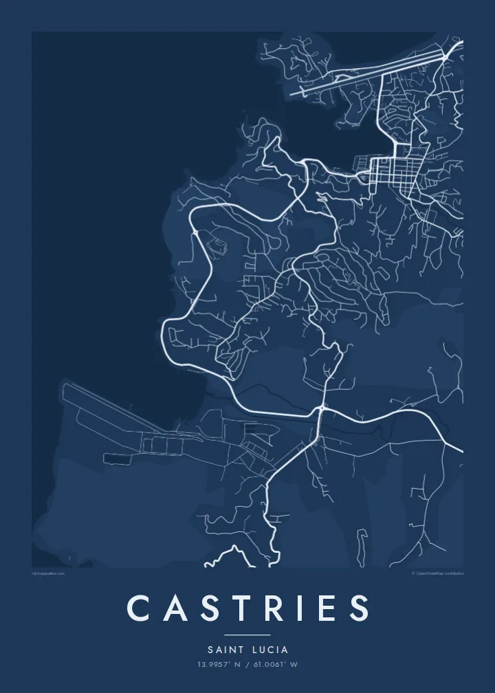
A long, sheltered inlet reaching deep into the island, its shores lined with quays and cruise berths. It gives the map a central, unmistakable form.
โปสเตอร์แผนที่มินิมอล · เซนต์ลูเซีย
13.9957° N / 61.0061° W
A deep, sheltered harbour on Saint Lucia's northwest coast, ringed by hills, a small airport and a compact rebuilt centre.



หนึ่งเมือง ห้าอารมณ์
แตะเลือกสไตล์เพื่อดูภาพบนผนัง ทุกสไตล์ราคาเท่ากัน ไม่ว่าจะเป็นแบบพิมพ์ ใส่กรอบ หรือไฟล์ HD
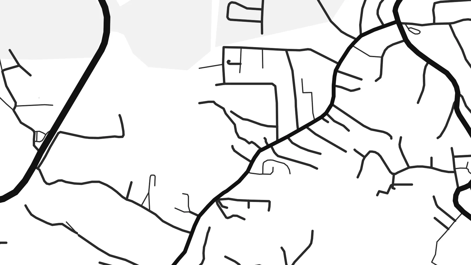 พิกเซลจริง · ไฟล์พิมพ์ขนาด 24 × 36″
คมชัดระดับงานพิมพ์
นี่คือภาพครอปจากไฟล์พิมพ์จริงแบบ 100% โปสเตอร์ทุกใบ ไม่ว่าจะพิมพ์ ใส่กรอบ หรือดาวน์โหลด จะถูกเรนเดอร์บนเซิร์ฟเวอร์ของเราที่ 300 DPI สูงสุดถึง 7,200 × 10,800 พิกเซล เพื่อให้แม้แต่ซอยเล็กที่สุดยังคมชัดบนงานพิมพ์ขนาด 24 × 36″
บนผนัง


แผนที่
Castries is built around one of the best natural harbours in the Caribbean, a long inlet on the northwest coast of Saint Lucia that reaches deep into the land. On a map, the water is the centre of everything. The town wraps around the head of the harbour, quays line both sides, and steep hills rise immediately behind the streets.
The downtown grid is compact and regular, partly because the town was rebuilt after a series of fires, the most destructive in 1948. At its heart is Derek Walcott Square, named after the Nobel Prize-winning poet who was born here. It forms an open block among the streets. Morne Fortune rises above the town to the south, with roads winding up its slopes.
On the northern side of the harbour, the Vigie peninsula carries the runway of George F. L. Charles Airport almost to the sea, and cruise ships berth along the quays. A Castries map poster shows the inlet, the grid and the surrounding high ground together. The result is a clear, balanced composition built around one strong shape of water.
A long, sheltered inlet reaching deep into the island, its shores lined with quays and cruise berths. It gives the map a central, unmistakable form.
The main square of the downtown grid, named after the poet. It appears as a small open block among the regular streets rebuilt after the fires.
North of the harbour, a low peninsula holds the city airport's runway and a stretch of coast. It forms a strong straight line in the upper part of the map.
ออกแบบในแบบของคุณ
เพิ่มวันที่ ชื่อ หรือข้อความของคุณเอง เปลี่ยนสไตล์ ขนาด หรือแนวภาพได้ตามใจ
ตัวอย่างฟรีมีความละเอียดต่ำและมีลายน้ำ ส่วนงานพิมพ์และไฟล์ HD เรนเดอร์ที่ 300 DPI สูงสุดถึง 7,200 × 10,800 px โดยไม่มีลายน้ำ
ทำไมต้อง Castries
Saint Lucians abroad, couples who married on the island and visitors who arrived by sea often want to keep Castries close. The harbour gives the poster a natural focus, and the hills around it add depth without clutter.
You can personalise the title and subtitle, add a wedding or travel date, and adjust the coordinates line. Choose one of five styles: Classic black & white, Noir, Paper, Blueprint or Sand. Download the $9 HD files or order a printed poster.
สั่งซื้อโปสเตอร์ Castries| ขนาดพิมพ์ | ความละเอียด | ไฟล์ |
|---|---|---|
| 30 × 40 cm (11.8 × 15.7″) | 3,543 × 4,724 px | PNG · PDF |
| 29.7 × 42 cm (A3, 11.7 × 16.5″) | 3,508 × 4,961 px | PNG · PDF |
| 42 × 59.4 cm (A2, 16.5 × 23.4″) | 4,961 × 7,016 px | PNG · PDF |
| 45.7 × 61 cm (18 × 24″) | 5,400 × 7,200 px | PNG · PDF |
| 50 × 70 cm (19.7 × 27.6″) | 5,906 × 8,268 px | PNG · PDF |
| 61 × 91.4 cm (24 × 36″) | 7,200 × 10,800 px | PNG · PDF |
เพื่อการเปรียบเทียบ ตัวอย่างฟรีกว้าง 900 px มีลายน้ำ และเหมาะสำหรับดูบนหน้าจอ ส่วนไฟล์ HD มีความละเอียดสูงกว่าถึง 8 เท่าในแต่ละด้าน และพิมพ์ได้คมชัดเต็มขนาดโปสเตอร์
เลือกสไตล์ที่ด้านบนของหน้า จากนั้นเลือก Printed Poster — กำหนดขนาดและกรอบตามต้องการ — หรือเลือก Digital HD Files การชำระเงินทำได้ในขั้นตอนเดียว และหน้าคำสั่งซื้อของคุณจะอัปเดตทันทีที่การชำระเงินสำเร็จ
พิมพ์บนกระดาษด้าน 200 แกรมเกรดพรีเมียม มีให้เลือก 6 ขนาด ตั้งแต่ 30 × 40 ซม. ถึง 24 × 36″ โปสเตอร์แบบพิมพ์เริ่มต้นที่ {printFrom} รวมค่าจัดส่งแล้ว
ได้ เลือกกรอบไม้แท้ได้ทั้งสีดำ สีขาว โอ๊กธรรมชาติ หรือไม้เข้ม มาพร้อมกระจกนิรภัยกันแตกและพร้อมแขวนได้ทันที โปสเตอร์พร้อมกรอบเริ่มต้นที่ {framedFrom} รวมค่าจัดส่งแล้ว
จัดส่งฟรีทั่วโลก โปสเตอร์แต่ละใบพิมพ์โดยพาร์ตเนอร์การพิมพ์ที่อยู่ใกล้คุณที่สุดจากกว่า 30 ประเทศ และมักจะถึงมือภายใน 3–7 วันทำการ คุณสามารถติดตามสถานะและเลขพัสดุได้ที่ "คำสั่งซื้อของฉัน" บางประเทศใช้เวลา 2–5 สัปดาห์ และหากประเทศไหนที่เรายังไม่จัดส่งไป เว็บไซต์จะแจ้งให้ทราบก่อนชำระเงิน
ส่งภาพถ่ายมาให้เราภายใน 14 วันหลังได้รับสินค้า เราจะพิมพ์ใหม่ให้ฟรีหรือคืนเงินให้
ได้ ในตัวแก้ไขบนหน้านี้ คุณสามารถเปลี่ยนชื่อเรื่อง ข้อความรอง และบรรทัดพิกัดได้ตามต้องการ พร้อมเลือกสไตล์และขนาด ไม่ว่าจะเป็นแบบพิมพ์ ใส่กรอบ หรือไฟล์ดิจิทัล ทุกคำสั่งซื้อจะใช้ดีไซน์ของคุณเป๊ะ
ในราคา $9 คุณจะได้ไฟล์ PNG ความละเอียด 300 DPI และไฟล์ PDF พร้อมพิมพ์ครบทั้ง 6 ขนาด ไม่มีลายน้ำ นำไปพิมพ์ที่ไหนก็ได้ ยังไม่แน่ใจ? ดาวน์โหลดตัวอย่างแบบมีลายน้ำฟรีก่อนได้
