Road network
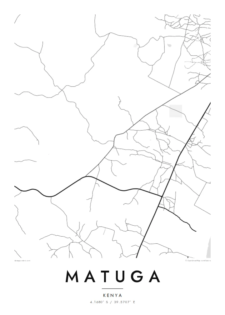
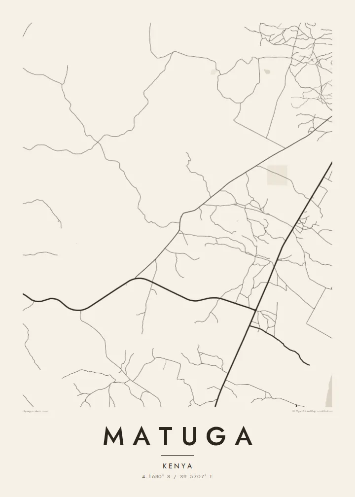
The map is defined by roads linking villages to one another and to routes running toward the coast, a branching pattern that shows how people and goods move across the county.
โปสเตอร์แผนที่มินิมอล · เคนยา
4.1680° S / 39.5707° E
Scattered villages and unpaved roads spread across the gentle coastal hinterland south-west of Mombasa, near the Shimba Hills.



หนึ่งเมือง ห้าอารมณ์
แตะเลือกสไตล์เพื่อดูภาพบนผนัง ทุกสไตล์ราคาเท่ากัน ไม่ว่าจะเป็นแบบพิมพ์ ใส่กรอบ หรือไฟล์ HD
 พิกเซลจริง · ไฟล์พิมพ์ขนาด 24 × 36″
คมชัดระดับงานพิมพ์
นี่คือภาพครอปจากไฟล์พิมพ์จริงแบบ 100% โปสเตอร์ทุกใบ ไม่ว่าจะพิมพ์ ใส่กรอบ หรือดาวน์โหลด จะถูกเรนเดอร์บนเซิร์ฟเวอร์ของเราที่ 300 DPI สูงสุดถึง 7,200 × 10,800 พิกเซล เพื่อให้แม้แต่ซอยเล็กที่สุดยังคมชัดบนงานพิมพ์ขนาด 24 × 36″
บนผนัง


แผนที่
Matuga lies in Kwale County on Kenya's south coast, in the rolling country between the Indian Ocean shoreline and the Shimba Hills. Rather than a compact town, it is a wide area of villages, farms and market centres, so from above the map shows a loose network of roads and footpaths instead of a single dense core. Settlements cluster along the main routes and thin out into cultivated land.
The population figure counts the whole area rather than one urban centre, which is typical of this part of the coast. The county town of Kwale is close by, and the slopes of Shimba Hills National Reserve rise to the south-west, where grassland and patches of coastal forest are protected from the farmland that surrounds them.
A Matuga map poster captures a landscape that is more about connection than density: roads threading between homesteads, streams cutting shallow valleys toward the coast, and the occasional crossroads where a market gathers. In black and white the pattern becomes delicate and open, closer to a drawing than a city plan.
The map is defined by roads linking villages to one another and to routes running toward the coast, a branching pattern that shows how people and goods move across the county.
To the south-west the land rises toward the Shimba Hills, a protected upland of forest and grassland. On the poster, the reserve appears as a quiet, road-free area beside the settled farmland.
Small watercourses drain the hinterland toward the Indian Ocean, carving shallow valleys between farms. Traced in fine lines, they add a gentle rhythm to an otherwise open, rural composition.
ออกแบบในแบบของคุณ
เพิ่มวันที่ ชื่อ หรือข้อความของคุณเอง เปลี่ยนสไตล์ ขนาด หรือแนวภาพได้ตามใจ
ตัวอย่างฟรีมีความละเอียดต่ำและมีลายน้ำ ส่วนงานพิมพ์และไฟล์ HD เรนเดอร์ที่ 300 DPI สูงสุดถึง 7,200 × 10,800 px โดยไม่มีลายน้ำ
ทำไมต้อง Matuga
For people from Kwale County, or anyone with family roots in the south coast villages, a map of Matuga is a way to keep the home area in view. Its open, rural layout makes a calm, uncluttered print that works well in a bedroom or office.
Add a title, subtitle or a coordinates line that points to a specific village or a family home, and select from five styles: Classic black & white, Noir, Paper, Blueprint or Sand. Sand gives the landscape a warm tone, while Noir turns the roads into fine light lines.
สั่งซื้อโปสเตอร์ Matuga| ขนาดพิมพ์ | ความละเอียด | ไฟล์ |
|---|---|---|
| 30 × 40 cm (11.8 × 15.7″) | 3,543 × 4,724 px | PNG · PDF |
| 29.7 × 42 cm (A3, 11.7 × 16.5″) | 3,508 × 4,961 px | PNG · PDF |
| 42 × 59.4 cm (A2, 16.5 × 23.4″) | 4,961 × 7,016 px | PNG · PDF |
| 45.7 × 61 cm (18 × 24″) | 5,400 × 7,200 px | PNG · PDF |
| 50 × 70 cm (19.7 × 27.6″) | 5,906 × 8,268 px | PNG · PDF |
| 61 × 91.4 cm (24 × 36″) | 7,200 × 10,800 px | PNG · PDF |
เพื่อการเปรียบเทียบ ตัวอย่างฟรีกว้าง 900 px มีลายน้ำ และเหมาะสำหรับดูบนหน้าจอ ส่วนไฟล์ HD มีความละเอียดสูงกว่าถึง 8 เท่าในแต่ละด้าน และพิมพ์ได้คมชัดเต็มขนาดโปสเตอร์
เลือกสไตล์ที่ด้านบนของหน้า จากนั้นเลือก Printed Poster — กำหนดขนาดและกรอบตามต้องการ — หรือเลือก Digital HD Files การชำระเงินทำได้ในขั้นตอนเดียว และหน้าคำสั่งซื้อของคุณจะอัปเดตทันทีที่การชำระเงินสำเร็จ
พิมพ์บนกระดาษด้าน 200 แกรมเกรดพรีเมียม มีให้เลือก 6 ขนาด ตั้งแต่ 30 × 40 ซม. ถึง 24 × 36″ โปสเตอร์แบบพิมพ์เริ่มต้นที่ {printFrom} รวมค่าจัดส่งแล้ว
ได้ เลือกกรอบไม้แท้ได้ทั้งสีดำ สีขาว โอ๊กธรรมชาติ หรือไม้เข้ม มาพร้อมกระจกนิรภัยกันแตกและพร้อมแขวนได้ทันที โปสเตอร์พร้อมกรอบเริ่มต้นที่ {framedFrom} รวมค่าจัดส่งแล้ว
จัดส่งฟรีทั่วโลก โปสเตอร์แต่ละใบจะพิมพ์โดยพันธมิตรโรงพิมพ์ที่ใกล้ที่สุดจากกว่า 30 ประเทศ และมักจะถึงมือคุณภายใน 3–7 วันทำการ ตรวจสอบสถานะและติดตามพัสดุได้ที่ My Orders
ส่งภาพถ่ายมาให้เราภายใน 14 วันหลังได้รับสินค้า เราจะพิมพ์ใหม่ให้ฟรีหรือคืนเงินให้
ได้ ในตัวแก้ไขบนหน้านี้ คุณสามารถเปลี่ยนชื่อเรื่อง ข้อความรอง และบรรทัดพิกัดได้ตามต้องการ พร้อมเลือกสไตล์และขนาด ไม่ว่าจะเป็นแบบพิมพ์ ใส่กรอบ หรือไฟล์ดิจิทัล ทุกคำสั่งซื้อจะใช้ดีไซน์ของคุณเป๊ะ
ในราคา $9 คุณจะได้ไฟล์ PNG ความละเอียด 300 DPI และไฟล์ PDF พร้อมพิมพ์ครบทั้ง 6 ขนาด ไม่มีลายน้ำ นำไปพิมพ์ที่ไหนก็ได้ ยังไม่แน่ใจ? ดาวน์โหลดตัวอย่างแบบมีลายน้ำฟรีก่อนได้
