The Beltway curve
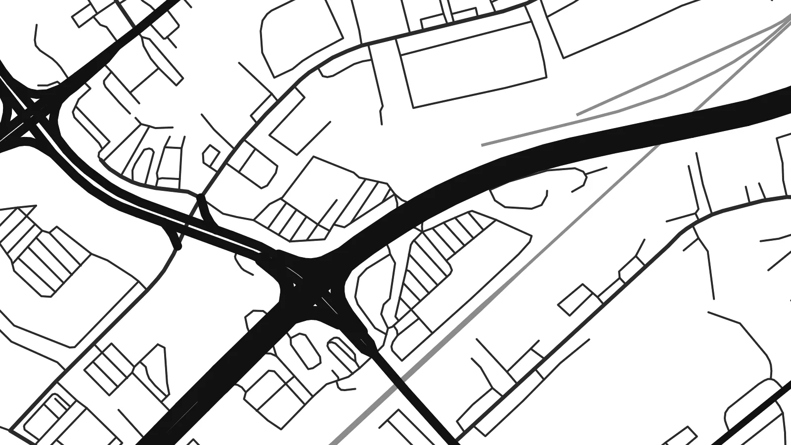
Interstate 695 passes through the community in a wide arc, its ramps and interchanges forming the boldest geometric shapes on the whole map.
โปสเตอร์แผนที่มินิมอล · สหรัฐอเมริกา
39.3384° N / 76.4797° W
A suburban pocket of Baltimore County where the Beltway sweeps broad curves through quiet residential streets.


หนึ่งเมือง ห้าอารมณ์
แตะเลือกสไตล์เพื่อดูภาพบนผนัง ทุกสไตล์ราคาเท่ากัน ไม่ว่าจะเป็นแบบพิมพ์ ใส่กรอบ หรือไฟล์ HD
 พิกเซลจริง · ไฟล์พิมพ์ขนาด 24 × 36″
คมชัดระดับงานพิมพ์
นี่คือภาพครอปจากไฟล์พิมพ์จริงแบบ 100% โปสเตอร์ทุกใบ ไม่ว่าจะพิมพ์ ใส่กรอบ หรือดาวน์โหลด จะถูกเรนเดอร์บนเซิร์ฟเวอร์ของเราที่ 300 DPI สูงสุดถึง 7,200 × 10,800 พิกเซล เพื่อให้แม้แต่ซอยเล็กที่สุดยังคมชัดบนงานพิมพ์ขนาด 24 × 36″
บนผนัง


แผนที่
Rossville is an unincorporated community in Baltimore County, just north-east of the Baltimore city line. On a map it is defined by movement. The Baltimore Beltway sweeps through in a long curve, and major routes towards White Marsh and the north-east corridor pass close by. Between these large roads sit neighbourhoods of houses on curving streets, pockets of garden apartments and the larger footprints of commercial and medical sites.
Its best-known landmark is the hospital campus at Franklin Square, a major medical centre that draws patients from across the eastern county. Around it, the street pattern mixes older roads that follow the terrain with newer postwar layouts. Small streams run south-east towards the rivers that feed the Chesapeake Bay, and the green strips along them give the plan a few softer lines.
For a place so often seen from a car window, the view from above is revealing. A Rossville map poster shows how the interchanges, arterial roads and residential streets fit together into one coherent picture. It is a good choice for people who grew up in eastern Baltimore County, work at the hospital or have made this corner of Maryland their home.
Interstate 695 passes through the community in a wide arc, its ramps and interchanges forming the boldest geometric shapes on the whole map.
The medical centre and its surrounding buildings and parking occupy a large block, one of the clearest landmarks in the local street pattern.
Narrow wooded strips follow small streams between neighbourhoods, breaking up the suburban pattern and hinting at the watershed that drains towards the Chesapeake Bay.
ออกแบบในแบบของคุณ
เพิ่มวันที่ ชื่อ หรือข้อความของคุณเอง เปลี่ยนสไตล์ ขนาด หรือแนวภาพได้ตามใจ
ตัวอย่างฟรีมีความละเอียดต่ำและมีลายน้ำ ส่วนงานพิมพ์และไฟล์ HD เรนเดอร์ที่ 300 DPI สูงสุดถึง 7,200 × 10,800 px โดยไม่มีลายน้ำ
ทำไมต้อง Rossville
Rossville is home to commuters, hospital staff and families who have lived in eastern Baltimore County for generations. A poster of the neighbourhood makes a grounded, personal gift, especially for a new homeowner or someone who has moved away.
Set your own title and subtitle, and keep or edit the coordinates line. Choose Classic black & white, Noir, Paper, Blueprint or Sand. The $9 digital download includes six print sizes as 300 DPI PNG and print-ready PDF files.
สั่งซื้อโปสเตอร์ Rossville| ขนาดพิมพ์ | ความละเอียด | ไฟล์ |
|---|---|---|
| 30 × 40 cm11.8 × 15.7″ | 3,543 × 4,724 px | PNG · PDF |
| 29.7 × 42 cm (A3)11.7 × 16.5″ | 3,508 × 4,961 px | PNG · PDF |
| 42 × 59.4 cm (A2)16.5 × 23.4″ | 4,961 × 7,016 px | PNG · PDF |
| 45.7 × 61 cm18 × 24″ | 5,400 × 7,200 px | PNG · PDF |
| 50 × 70 cm19.7 × 27.6″ | 5,906 × 8,268 px | PNG · PDF |
| 61 × 91.4 cm24 × 36″ | 7,200 × 10,800 px | PNG · PDF |
เพื่อการเปรียบเทียบ ตัวอย่างฟรีกว้าง 900 px มีลายน้ำ และเหมาะสำหรับดูบนหน้าจอ ส่วนไฟล์ HD มีความละเอียดสูงกว่าถึง 8 เท่าในแต่ละด้าน และพิมพ์ได้คมชัดเต็มขนาดโปสเตอร์
เลือกสไตล์ที่ด้านบนของหน้า จากนั้นเลือก Printed Poster — กำหนดขนาดและกรอบตามต้องการ — หรือเลือก Digital HD Files การชำระเงินทำได้ในขั้นตอนเดียว และหน้าคำสั่งซื้อของคุณจะอัปเดตทันทีที่การชำระเงินสำเร็จ
พิมพ์บนกระดาษด้าน 200 แกรมเกรดพรีเมียม มีให้เลือก 6 ขนาด ตั้งแต่ 30 × 40 ซม. ถึง 24 × 36″ โปสเตอร์แบบพิมพ์เริ่มต้นที่ $39 รวมค่าจัดส่งแล้ว
ได้ เลือกกรอบไม้แท้ได้ทั้งสีดำ สีขาว โอ๊กธรรมชาติ หรือไม้เข้ม มาพร้อมกระจกนิรภัยกันแตกและพร้อมแขวนได้ทันที โปสเตอร์พร้อมกรอบเริ่มต้นที่ $99 รวมค่าจัดส่งแล้ว
จัดส่งฟรีไปกว่า 60 ประเทศ โปสเตอร์แต่ละใบพิมพ์โดยพาร์ทเนอร์การพิมพ์ที่อยู่ใกล้คุณที่สุดจากกว่า 30 ประเทศ และมักจะถึงมือคุณภายใน 3–7 วันทำการ คุณสามารถติดตามสถานะและเลขพัสดุได้ที่ "คำสั่งซื้อของฉัน" บางประเทศใช้เวลา 2–5 สัปดาห์ และหากเรายังไม่จัดส่งไปยังประเทศของคุณ เว็บไซต์จะแจ้งให้ทราบก่อนชำระเงิน
ส่งภาพถ่ายมาให้เราภายใน 14 วันหลังได้รับสินค้า เราจะพิมพ์ใหม่ให้ฟรีหรือคืนเงินให้
ได้ ในตัวแก้ไขบนหน้านี้ คุณสามารถเปลี่ยนชื่อเรื่อง ข้อความรอง และบรรทัดพิกัดได้ตามต้องการ พร้อมเลือกสไตล์และขนาด ไม่ว่าจะเป็นแบบพิมพ์ ใส่กรอบ หรือไฟล์ดิจิทัล ทุกคำสั่งซื้อจะใช้ดีไซน์ของคุณเป๊ะ
ในราคา $9 คุณจะได้ไฟล์ PNG ความละเอียด 300 DPI และไฟล์ PDF พร้อมพิมพ์ครบทั้ง 6 ขนาด ไม่มีลายน้ำ นำไปพิมพ์ที่ไหนก็ได้ ยังไม่แน่ใจ? ดาวน์โหลดตัวอย่างแบบมีลายน้ำฟรีก่อนได้
ใกล้เคียง
