Grande Île
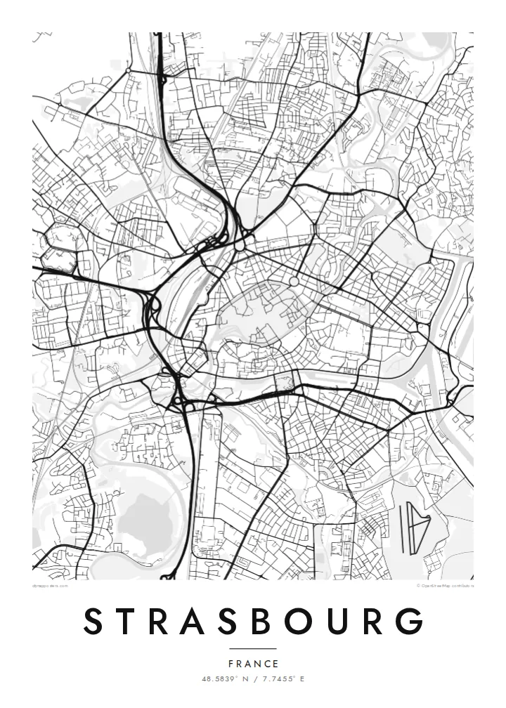
The historic centre sits on an island ringed by the Ill, a dense oval of streets around the cathedral that anchors the whole map.
โปสเตอร์แผนที่มินิมอล · ฝรั่งเศส
48.5839° N / 7.7455° E
An island old town wrapped by the Ill, with canals, a cathedral quarter and the Rhine's wide port to the east.


หนึ่งเมือง ห้าอารมณ์
แตะเลือกสไตล์เพื่อดูภาพบนผนัง ทุกสไตล์ราคาเท่ากัน ไม่ว่าจะเป็นแบบพิมพ์ ใส่กรอบ หรือไฟล์ HD
 พิกเซลจริง · ไฟล์พิมพ์ขนาด 24 × 36″
คมชัดระดับงานพิมพ์
นี่คือภาพครอปจากไฟล์พิมพ์จริงแบบ 100% โปสเตอร์ทุกใบ ไม่ว่าจะพิมพ์ ใส่กรอบ หรือดาวน์โหลด จะถูกเรนเดอร์บนเซิร์ฟเวอร์ของเราที่ 300 DPI สูงสุดถึง 7,200 × 10,800 พิกเซล เพื่อให้แม้แต่ซอยเล็กที่สุดยังคมชัดบนงานพิมพ์ขนาด 24 × 36″
บนผนัง


แผนที่
Strasbourg's historic centre is an island. The Grande Île, encircled by two arms of the Ill, holds the cathedral, the medieval lanes and the half-timbered quarter of La Petite France. There, the river splits into canals around covered bridges and locks. From above, this oval of dense streets ringed by water is the clearest shape on the map, and it has been a UNESCO World Heritage Site since 1988.
Beyond the island lies the Neustadt, built during the German period after 1871, with broad avenues and planned squares. It was added to the UNESCO listing in 2017. Further out, the European Parliament and other European institutions stand beside the water. To the east, the Rhine port and its long basins face Germany, with bridges crossing to Kehl.
A Strasbourg map poster combines several distinct cities in one frame: the medieval island, the German imperial district, the European quarter and the industrial harbour. Rivers and canals give the composition its structure, and tram lines thread across it. In black and white, the layers of different eras become especially easy to read.
The historic centre sits on an island ringed by the Ill, a dense oval of streets around the cathedral that anchors the whole map.
At the island's western tip, the river divides into canals, locks and covered bridges, producing a delicate tangle of water and lanes.
To the east, long port basins and the broad Rhine mark the border with Germany and add bold geometric shapes to the composition.
ออกแบบในแบบของคุณ
เพิ่มวันที่ ชื่อ หรือข้อความของคุณเอง เปลี่ยนสไตล์ ขนาด หรือแนวภาพได้ตามใจ
ตัวอย่างฟรีมีความละเอียดต่ำและมีลายน้ำ ส่วนงานพิมพ์และไฟล์ HD เรนเดอร์ที่ 300 DPI สูงสุดถึง 7,200 × 10,800 px โดยไม่มีลายน้ำ
ทำไมต้อง Strasbourg
Many people pass through Strasbourg to study, to work at the European institutions or to visit a winter market, and its island centre is instantly recognisable. A map makes a precise souvenir of a city that sits between two cultures.
Personalise the title, subtitle and coordinates line with a date or a neighbourhood. Choose Classic black & white, Noir, Paper, Blueprint or Sand, then download six print sizes for $9 or order a printed poster shipped from a print partner near you.
สั่งซื้อโปสเตอร์ Strasbourg| ขนาดพิมพ์ | ความละเอียด | ไฟล์ |
|---|---|---|
| 30 × 40 cm (11.8 × 15.7″) | 3,543 × 4,724 px | PNG · PDF |
| 29.7 × 42 cm (A3, 11.7 × 16.5″) | 3,508 × 4,961 px | PNG · PDF |
| 42 × 59.4 cm (A2, 16.5 × 23.4″) | 4,961 × 7,016 px | PNG · PDF |
| 45.7 × 61 cm (18 × 24″) | 5,400 × 7,200 px | PNG · PDF |
| 50 × 70 cm (19.7 × 27.6″) | 5,906 × 8,268 px | PNG · PDF |
| 61 × 91.4 cm (24 × 36″) | 7,200 × 10,800 px | PNG · PDF |
เพื่อการเปรียบเทียบ ตัวอย่างฟรีกว้าง 900 px มีลายน้ำ และเหมาะสำหรับดูบนหน้าจอ ส่วนไฟล์ HD มีความละเอียดสูงกว่าถึง 8 เท่าในแต่ละด้าน และพิมพ์ได้คมชัดเต็มขนาดโปสเตอร์
เลือกสไตล์ที่ด้านบนของหน้า จากนั้นเลือก Printed Poster — กำหนดขนาดและกรอบตามต้องการ — หรือเลือก Digital HD Files การชำระเงินทำได้ในขั้นตอนเดียว และหน้าคำสั่งซื้อของคุณจะอัปเดตทันทีที่การชำระเงินสำเร็จ
พิมพ์บนกระดาษด้าน 200 แกรมเกรดพรีเมียม มีให้เลือก 6 ขนาด ตั้งแต่ 30 × 40 ซม. ถึง 24 × 36″ โปสเตอร์แบบพิมพ์เริ่มต้นที่ $39 รวมค่าจัดส่งแล้ว
ได้ เลือกกรอบไม้แท้ได้ทั้งสีดำ สีขาว โอ๊กธรรมชาติ หรือไม้เข้ม มาพร้อมกระจกนิรภัยกันแตกและพร้อมแขวนได้ทันที โปสเตอร์พร้อมกรอบเริ่มต้นที่ $99 รวมค่าจัดส่งแล้ว
จัดส่งฟรีทั่วโลก โปสเตอร์แต่ละใบพิมพ์โดยพาร์ตเนอร์การพิมพ์ที่อยู่ใกล้คุณที่สุดจากกว่า 30 ประเทศ และมักจะถึงมือภายใน 3–7 วันทำการ คุณสามารถติดตามสถานะและเลขพัสดุได้ที่ "คำสั่งซื้อของฉัน" บางประเทศใช้เวลา 2–5 สัปดาห์ และหากประเทศไหนที่เรายังไม่จัดส่งไป เว็บไซต์จะแจ้งให้ทราบก่อนชำระเงิน
ส่งภาพถ่ายมาให้เราภายใน 14 วันหลังได้รับสินค้า เราจะพิมพ์ใหม่ให้ฟรีหรือคืนเงินให้
ได้ ในตัวแก้ไขบนหน้านี้ คุณสามารถเปลี่ยนชื่อเรื่อง ข้อความรอง และบรรทัดพิกัดได้ตามต้องการ พร้อมเลือกสไตล์และขนาด ไม่ว่าจะเป็นแบบพิมพ์ ใส่กรอบ หรือไฟล์ดิจิทัล ทุกคำสั่งซื้อจะใช้ดีไซน์ของคุณเป๊ะ
ในราคา $9 คุณจะได้ไฟล์ PNG ความละเอียด 300 DPI และไฟล์ PDF พร้อมพิมพ์ครบทั้ง 6 ขนาด ไม่มีลายน้ำ นำไปพิมพ์ที่ไหนก็ได้ ยังไม่แน่ใจ? ดาวน์โหลดตัวอย่างแบบมีลายน้ำฟรีก่อนได้
