Gore Creek corridor
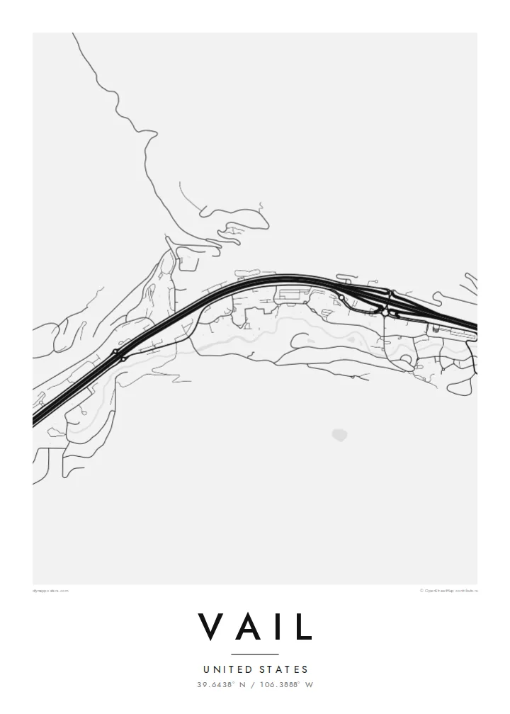
The creek runs the length of town beside Interstate 70, and the two lines together set the east-west grain of the whole map, from the Vail Pass approach down toward West Vail.
โปสเตอร์แผนที่มินิมอล · สหรัฐอเมริกา
39.6438° N / 106.3888° W
A long, narrow town pulled east to west along Gore Creek and the interstate, the ski mountain rising to its south.


หนึ่งเมือง ห้าอารมณ์
แตะเลือกสไตล์เพื่อดูภาพบนผนัง ทุกสไตล์ราคาเท่ากัน ไม่ว่าจะเป็นแบบพิมพ์ ใส่กรอบ หรือไฟล์ HD
 พิกเซลจริง · ไฟล์พิมพ์ขนาด 24 × 36″
คมชัดระดับงานพิมพ์
นี่คือภาพครอปจากไฟล์พิมพ์จริงแบบ 100% โปสเตอร์ทุกใบ ไม่ว่าจะพิมพ์ ใส่กรอบ หรือดาวน์โหลด จะถูกเรนเดอร์บนเซิร์ฟเวอร์ของเราที่ 300 DPI สูงสุดถึง 7,200 × 10,800 พิกเซล เพื่อให้แม้แต่ซอยเล็กที่สุดยังคมชัดบนงานพิมพ์ขนาด 24 × 36″
บนผนัง


แผนที่
From above, Vail barely has a width. The town follows the floor of the Gore Creek valley for several miles, squeezed between steep slopes, with Interstate 70 running the full length of it. Frontage roads, roundabouts and the thin line of the creek all run in parallel, so the map reads as a set of stretched bands rather than a grid, broken only where the village cores cluster at the base of the lifts.
Vail opened as a ski area in 1962 on what had been grazing land, founded by a group that included Pete Seibert, a veteran of the 10th Mountain Division, which trained at nearby Camp Hale during the Second World War. The pedestrian lanes of Vail Village were laid out with Alpine towns in mind, and they still show up on the map as a knot of short, curving streets among the straight valley lines.
A Vail map poster keeps that contrast legible: the dense little villages of Vail Village and Lionshead, the long parallel ribbons of road and water, and the empty space where the mountain climbs toward the Back Bowls. It is a quiet, graphic picture of a place most people remember in terms of snow and light, redrawn as lines on paper.
The creek runs the length of town beside Interstate 70, and the two lines together set the east-west grain of the whole map, from the Vail Pass approach down toward West Vail.
The original village core is a tight cluster of short, bending pedestrian streets and a covered bridge over Gore Creek, noticeably finer in texture than anything else in the valley.
South of the ridge the mountain opens into wide, treeless bowls. On a street map they appear as open ground, a calm counterweight to the busy valley floor below.
ออกแบบในแบบของคุณ
เพิ่มวันที่ ชื่อ หรือข้อความของคุณเอง เปลี่ยนสไตล์ ขนาด หรือแนวภาพได้ตามใจ
ตัวอย่างฟรีมีความละเอียดต่ำและมีลายน้ำ ส่วนงานพิมพ์และไฟล์ HD เรนเดอร์ที่ 300 DPI สูงสุดถึง 7,200 × 10,800 px โดยไม่มีลายน้ำ
ทำไมต้อง Vail
For many people Vail is tied to a specific week: a first trip, an annual family tradition, a season spent working the lifts. A map of the valley brings that back without resorting to a photo, and it sits comfortably in a hallway, a cabin or a city apartment far from the mountains.
You can set your own title and subtitle, adjust the coordinates line to mark a lodge or a year, and choose from five styles: Classic black & white, Noir, Paper, Blueprint or Sand. Download the HD files for $9 or order a matte print, framed in wood if you like.
สั่งซื้อโปสเตอร์ Vail| ขนาดพิมพ์ | ความละเอียด | ไฟล์ |
|---|---|---|
| 30 × 40 cm (11.8 × 15.7″) | 3,543 × 4,724 px | PNG · PDF |
| 29.7 × 42 cm (A3, 11.7 × 16.5″) | 3,508 × 4,961 px | PNG · PDF |
| 42 × 59.4 cm (A2, 16.5 × 23.4″) | 4,961 × 7,016 px | PNG · PDF |
| 45.7 × 61 cm (18 × 24″) | 5,400 × 7,200 px | PNG · PDF |
| 50 × 70 cm (19.7 × 27.6″) | 5,906 × 8,268 px | PNG · PDF |
| 61 × 91.4 cm (24 × 36″) | 7,200 × 10,800 px | PNG · PDF |
เพื่อการเปรียบเทียบ ตัวอย่างฟรีกว้าง 900 px มีลายน้ำ และเหมาะสำหรับดูบนหน้าจอ ส่วนไฟล์ HD มีความละเอียดสูงกว่าถึง 8 เท่าในแต่ละด้าน และพิมพ์ได้คมชัดเต็มขนาดโปสเตอร์
เลือกสไตล์ที่ด้านบนของหน้า จากนั้นเลือก Printed Poster — กำหนดขนาดและกรอบตามต้องการ — หรือเลือก Digital HD Files การชำระเงินทำได้ในขั้นตอนเดียว และหน้าคำสั่งซื้อของคุณจะอัปเดตทันทีที่การชำระเงินสำเร็จ
พิมพ์บนกระดาษด้าน 200 แกรมเกรดพรีเมียม มีให้เลือก 6 ขนาด ตั้งแต่ 30 × 40 ซม. ถึง 24 × 36″ โปสเตอร์แบบพิมพ์เริ่มต้นที่ {printFrom} รวมค่าจัดส่งแล้ว
ได้ เลือกกรอบไม้แท้ได้ทั้งสีดำ สีขาว โอ๊กธรรมชาติ หรือไม้เข้ม มาพร้อมกระจกนิรภัยกันแตกและพร้อมแขวนได้ทันที โปสเตอร์พร้อมกรอบเริ่มต้นที่ {framedFrom} รวมค่าจัดส่งแล้ว
จัดส่งฟรีทั่วโลก โปสเตอร์แต่ละใบจะพิมพ์โดยพันธมิตรโรงพิมพ์ที่ใกล้ที่สุดจากกว่า 30 ประเทศ และมักจะถึงมือคุณภายใน 3–7 วันทำการ ตรวจสอบสถานะและติดตามพัสดุได้ที่ My Orders
ส่งภาพถ่ายมาให้เราภายใน 14 วันหลังได้รับสินค้า เราจะพิมพ์ใหม่ให้ฟรีหรือคืนเงินให้
ได้ ในตัวแก้ไขบนหน้านี้ คุณสามารถเปลี่ยนชื่อเรื่อง ข้อความรอง และบรรทัดพิกัดได้ตามต้องการ พร้อมเลือกสไตล์และขนาด ไม่ว่าจะเป็นแบบพิมพ์ ใส่กรอบ หรือไฟล์ดิจิทัล ทุกคำสั่งซื้อจะใช้ดีไซน์ของคุณเป๊ะ
ในราคา $9 คุณจะได้ไฟล์ PNG ความละเอียด 300 DPI และไฟล์ PDF พร้อมพิมพ์ครบทั้ง 6 ขนาด ไม่มีลายน้ำ นำไปพิมพ์ที่ไหนก็ได้ ยังไม่แน่ใจ? ดาวน์โหลดตัวอย่างแบบมีลายน้ำฟรีก่อนได้
