Inner harbour
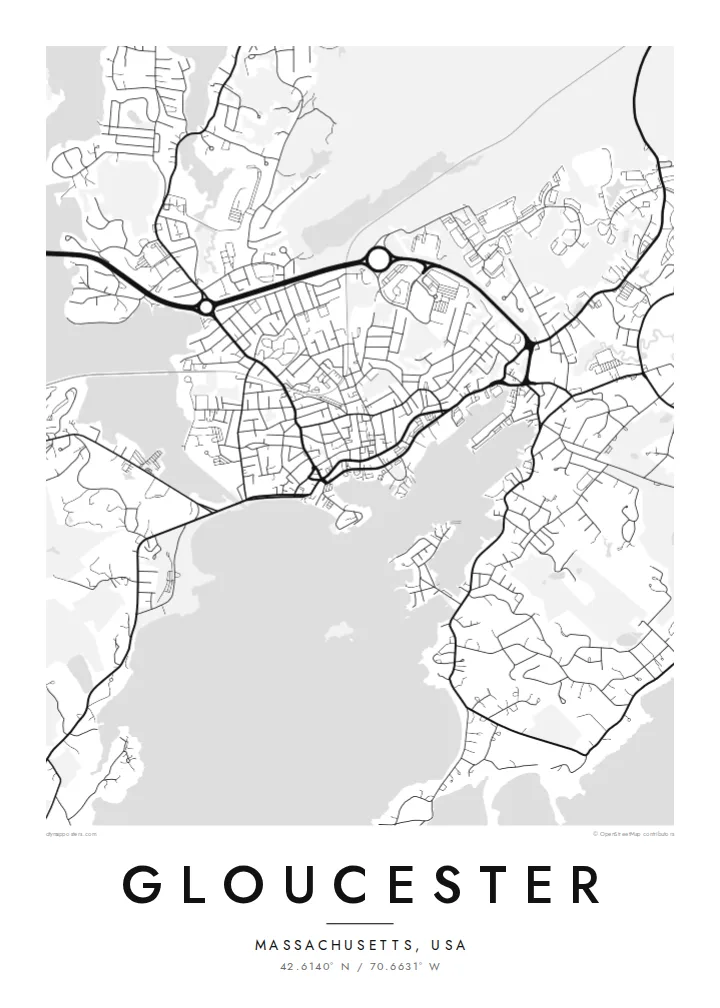
Wharves, piers and the harbour basin form the heart of the town. On the map, this is the densest area of streets and shoreline detail.
Minimalistik karta plakaty · Amerikanyň Birleşen Ştatlary
42.6140° N / 70.6631° W
A working harbour town on rocky Cape Ann, wrapped around a deep inner harbour, coves and a tidal river


Bir şäher, bäş keýp
Diwarda nähili görünjegini görmek üçin stile basyň. Ähli stiller bir bahadan — çap edilen, çarçuwaly ýa-da HD faýl görnüşinde.
 Hakyky pikseller · 24 × 36″ çap faýly
Çapda aýdyň
Bu hakyky çap faýlynyň 100% kesigi. Her poster — çap edilen, çarçuwaly ýa-da ýüklenen — serwerlerimizde 300 DPI, 7,200 × 10,800 piksele çenli işlenip taýýarlanýar, şonuň üçin iň kiçi köçeler hem 24 × 36″ çapda arassa görünýär.
Diwarda


Karta
Gloucester covers most of Cape Ann, the rocky headland north of Boston. Its coastline is complicated: a deep inner harbour with wharves and piers, Rocky Neck reaching into it, and Eastern Point stretching out to the lighthouse. The tidal Annisquam River and its canal cut across the town and separate the cape from the mainland.
Settled in 1623, Gloucester is widely described as America's oldest seaport. It is still a working fishing port and is known for the Fishermen's Memorial facing the harbour. Rocky Neck is one of the oldest continuously operating artists' colonies in the country.
A Gloucester map poster shows an almost continuous edge of coves, beaches and rocky points. The dense harbour streets give way to the wooded interior of the cape, and the Annisquam draws a line through it all. Few towns produce such an intricate coastal outline.
Wharves, piers and the harbour basin form the heart of the town. On the map, this is the densest area of streets and shoreline detail.
The tidal river and canal cut north through Cape Ann, with marshes and inlets along the way. They divide the map with a long, winding line of water.
Two peninsulas enclose the harbour from the south and east. Their shapes give the coastline its recognisable profile.
Özüňiziňki ediň
Sene, at ýa-da öz setiriňizi goşuň, stili, ölçegi ýa-da ugry üýtgediň.
Mugt deslapky görnüş pes durulykda we suw belgili. Çaplar we HD faýllar suw belgisiz, 300 DPI, 7,200 × 10,800 px çenli işlenip taýýarlanýar.
Näme üçin Gloucester
Gloucester means something to fishing families, summer visitors, painters and anyone who has spent time on Cape Ann's beaches. A map of the harbour and coves is a natural choice for a coastal home or a gift for someone who left.
Personalise the title, subtitle and coordinates line, perhaps with a boat's name or a date, and choose from Classic black and white, Noir, Paper, Blueprint and Sand. It comes as $9 HD downloads or as a printed poster shipped within the United States.
Gloucester posterini sargyt ediň| Çap ölçegi | Çözgüt | Faýllar |
|---|---|---|
| 30 × 40 cm11.8 × 15.7″ | 3,543 × 4,724 px | PNG · PDF |
| 29.7 × 42 cm (A3)11.7 × 16.5″ | 3,508 × 4,961 px | PNG · PDF |
| 42 × 59.4 cm (A2)16.5 × 23.4″ | 4,961 × 7,016 px | PNG · PDF |
| 45.7 × 61 cm18 × 24″ | 5,400 × 7,200 px | PNG · PDF |
| 50 × 70 cm19.7 × 27.6″ | 5,906 × 8,268 px | PNG · PDF |
| 61 × 91.4 cm24 × 36″ | 7,200 × 10,800 px | PNG · PDF |
Deňeşdirmek üçin: mugt nusga 900 px giňlikde, suw belgili we ekranlar üçin niýetlenen. HD faýllaryň çözgüdi her tarapa 8 esse çenli ýokary we doly plakat ölçeginde arassa çap edilýär.
Sahypanyň ýokarsyndan stili saýlaň, soňra Çap edilen Poster — ölçegini we isleseňiz çarçuwasyny — ýa-da Sanly HD Faýllary saýlaň. Töleg bir ädimde amala aşyrylýar, tölegiňiz geçen dessine sargyt sahypaňyz täzelenýär.
Ol ýokary hilli 200 gsm mat kagyza, alty ölçegiň birinde, 30 × 40 sm-den 24 × 36″-a çenli çap edilýär. Çap edilen posterler $39-dan başlaýar, eltip bermek bahasy girýär.
Hawa. Gara, ak, tebigy dub ýa-da garaňky agaç reňkinde tutuş agaç çarçuwany saýlaň. Ol döwülmeýän aýna bilen gelýär we asmaga taýýar. Çarçuwaly posterler $99-dan başlaýar, eltip bermek bahasy girýär.
60+ ýurda eltip bermek mugt. Her plakat 30+ ýurtdaky çap hyzmatdaşlarymyzyň iň ýakynynda çap edilýär we adatça 3–7 iş gününde gelýär. Ýagdaýyny we yzarlamany «Meniň sargytlarym» bölüminde görüp bilersiňiz. Käbir ýurtlara 2–5 hepde gerek, entek eltip bermeýän ýurtlarymyz üçin bolsa sahypa töleg etmezden öň habar berýär.
Eltilenden soň 14 günüň dowamynda bize surat iberiň, biz ony mugt gaýtadan çap ederis ýa-da puluňyzy yzyna gaýtararys.
Hawa. Bu sahypadaky redaktorda ady, kiçi ady we koordinatlar setirini islän zadyňyza üýtgediň, soňra stil we ölçeg saýlaň. Çap edilen, çarçuwaly we sanly sargytlaryň ählisi siziň dizaýnyňyzy takyk ulanýar.
$9 üçin ähli alty ölçegde, suw belgisiz, islendik ýerde çap edip bolýan 300 DPI PNG we çap etmäge taýyn PDF faýllaryny alýarsyňyz. Entek gutarnykly karara gelmediňizmi? Ilki mugt, suw belgili deslapky görnüşi göçürip alyň.
Golaýda
