Park an der Ilm
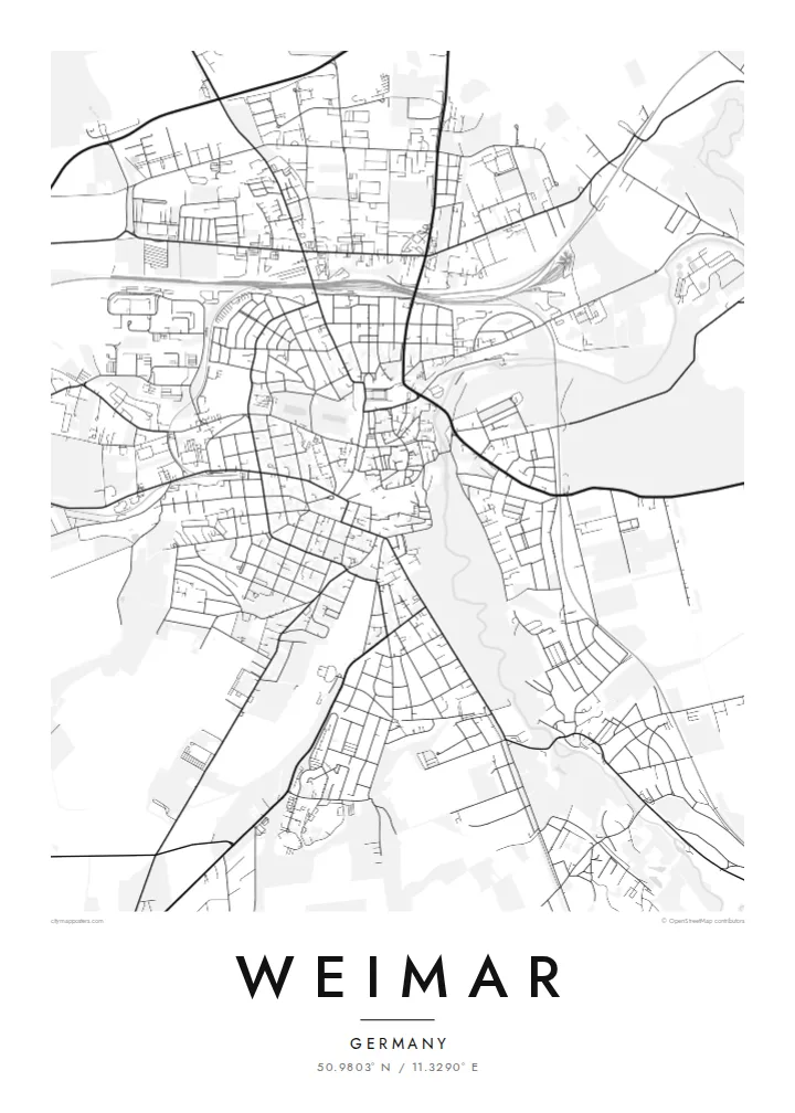
A landscaped park follows the river for a long stretch beside the old town, its winding paths and open meadows drawn as soft lines next to the denser streets.
Minimalistik karta plakaty · Germaniýa
50.9803° N / 11.3290° E
A small Thuringian city on the Ilm, where a riverside park runs beside the compact old centre of German classicism.


Bir şäher, bäş keýp
Diwarda nähili görünjegini görmek üçin stile basyň. Ähli stiller bir bahadan — çap edilen, çarçuwaly ýa-da HD faýl görnüşinde.
 Hakyky pikseller · 24 × 36″ çap faýly
Çapda aýdyň
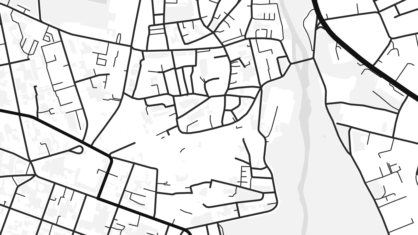
Bu hakyky çap faýlynyň 100% kesigi. Her poster — çap edilen, çarçuwaly ýa-da ýüklenen — serwerlerimizde 300 DPI, 7,200 × 10,800 piksele çenli işlenip taýýarlanýar, şonuň üçin iň kiçi köçeler hem 24 × 36″ çapda arassa görünýär.
Diwarda


Karta
Weimar lies in the valley of the Ilm in Thuringia, and from above its most distinctive feature is the long green ribbon of the Park an der Ilm, stretching along the river on the eastern side of the old town. The historic centre is compact and irregular, with squares, palace grounds and narrow streets packed within a short walk, while later districts climb the surrounding slopes.
Few towns of its size carry as much cultural weight. Goethe and Schiller lived and worked here, the Bauhaus was founded in Weimar in 1919, and the national assembly that drafted the constitution of the Weimar Republic met here the same year. Classical Weimar and the Bauhaus sites are both part of UNESCO World Heritage listings.
A Weimar map poster makes that density readable: the tight lanes around the market square, the grounds of the city palace, the curving paths of the park and the river beneath them. To the north-west rises the Ettersberg, site of the Buchenwald memorial, a reminder of darker history. The result is a quiet, detailed and deeply layered print.
A landscaped park follows the river for a long stretch beside the old town, its winding paths and open meadows drawn as soft lines next to the denser streets.
Around the market and Theaterplatz, streets form a compact, irregular web, the setting of the houses, theatres and libraries tied to Weimar's classical era.
The wooded ridge north-west of the city appears as a broad, quiet space on the map, the location of the Buchenwald memorial and a sobering part of Weimar's story.
Özüňiziňki ediň
Sene, at ýa-da öz setiriňizi goşuň, stili, ölçegi ýa-da ugry üýtgediň.
Mugt deslapky görnüş pes durulykda we suw belgili. Çaplar we HD faýllar suw belgisiz, 300 DPI, 7,200 × 10,800 px çenli işlenip taýýarlanýar.
Näme üçin Weimar
Weimar draws students, musicians, architects and readers of German literature, and many people leave with a strong attachment to its streets. A map of the town makes a thoughtful keepsake of a study year at the Bauhaus-Universität or of a memorable visit.
Set your own title, subtitle and coordinates, and choose between Classic black & white, Noir, Paper, Blueprint and Sand. Download HD files for $9, preview a free watermarked version first, or order a matte print with an optional wooden frame.
Weimar posterini sargyt ediň| Çap ölçegi | Çözgüt | Faýllar |
|---|---|---|
| 30 × 40 cm (11.8 × 15.7″) | 3,543 × 4,724 px | PNG · PDF |
| 29.7 × 42 cm (A3, 11.7 × 16.5″) | 3,508 × 4,961 px | PNG · PDF |
| 42 × 59.4 cm (A2, 16.5 × 23.4″) | 4,961 × 7,016 px | PNG · PDF |
| 45.7 × 61 cm (18 × 24″) | 5,400 × 7,200 px | PNG · PDF |
| 50 × 70 cm (19.7 × 27.6″) | 5,906 × 8,268 px | PNG · PDF |
| 61 × 91.4 cm (24 × 36″) | 7,200 × 10,800 px | PNG · PDF |
Deňeşdirmek üçin: mugt nusga 900 px giňlikde, suw belgili we ekranlar üçin niýetlenen. HD faýllaryň çözgüdi her tarapa 8 esse çenli ýokary we doly plakat ölçeginde arassa çap edilýär.
Sahypanyň ýokarsyndan stili saýlaň, soňra Çap edilen Poster — ölçegini we isleseňiz çarçuwasyny — ýa-da Sanly HD Faýllary saýlaň. Töleg bir ädimde amala aşyrylýar, tölegiňiz geçen dessine sargyt sahypaňyz täzelenýär.
Ol ýokary hilli 200 gsm mat kagyza, alty ölçegiň birinde, 30 × 40 sm-den 24 × 36″-a çenli çap edilýär. Çap edilen posterler {printFrom}-dan başlaýar, eltip bermek bahasy girýär.
Hawa. Gara, ak, tebigy dub ýa-da garaňky agaç reňkinde tutuş agaç çarçuwany saýlaň. Ol döwülmeýän aýna bilen gelýär we asmaga taýýar. Çarçuwaly posterler {framedFrom}-dan başlaýar, eltip bermek bahasy girýär.
Eltip bermek dünýäniň ähli ýerinde mugt. Her poster 30-dan gowrak ýurtdaky çap hyzmatdaşlarymyzyň iň ýakynynda çap edilýär we adatça 3–7 iş gününde gelýär. Ýagdaýyny we yzarlamany Sargytlarym bölüminde görüp bilersiňiz.
Eltilenden soň 14 günüň dowamynda bize surat iberiň, biz ony mugt gaýtadan çap ederis ýa-da puluňyzy yzyna gaýtararys.
Hawa. Bu sahypadaky redaktorda ady, kiçi ady we koordinatlar setirini islän zadyňyza üýtgediň, soňra stil we ölçeg saýlaň. Çap edilen, çarçuwaly we sanly sargytlaryň ählisi siziň dizaýnyňyzy takyk ulanýar.
$9 üçin ähli alty ölçegde, suw belgisiz, islendik ýerde çap edip bolýan 300 DPI PNG we çap etmäge taýyn PDF faýllaryny alýarsyňyz. Entek gutarnykly karara gelmediňizmi? Ilki mugt, suw belgili deslapky görnüşi göçürip alyň.
