Dwarakeswar River
The river winds through the town in loose curves. It is the strongest natural line on the map and the feature the older settlement grew around.
Pōhita mape faigofie · India
22.8833° N / 87.7833° E
A river town on the Dwarakeswar, where a compact centre gives way to the flat rice plains of Hooghly district.



Taone e tahi, lagona e lima
Pa'i se ata ke va'ai ai i luga o te pā. E tutusa te tau o ata uma — i lomiga, fakapipi'i i faleata, pe ko faila HD.
 Pixels mo'i · Faila lomiga 24 × 36″
Manino mo te lomiga
Ko se kupega 100% mai te faila lomiga mo'i. Poster uma — pe lomiina, fakapipi'i i faleata, pe download-ina — e fakaatagia i luga o a matou setula i te 300 DPI, e oo atu ki te 7,200 × 10,800 pixels, ina ia mautinoa e ma'ai pea auala tuai foki i luga o se lomiga 24 × 36″.
I luga o te pa


Te mape
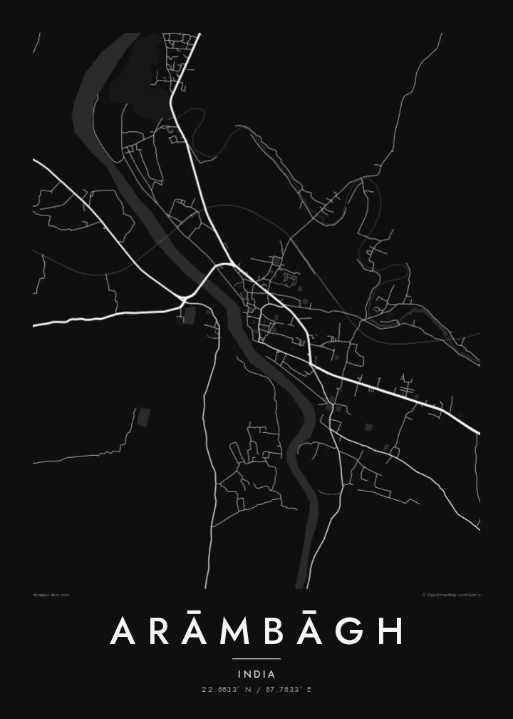
Arāmbāgh is a subdivisional town in the Hooghly district of West Bengal, on the banks of the Dwarakeswar River. On a map the river is the main organising line. It winds through the town while roads branch out toward the surrounding villages. The built-up core is dense and irregular, and beyond it the land opens into the level farmland typical of the lower Bengal plain.
The region is low and fertile, laced with streams, ponds and irrigation channels, and its rivers are known to rise sharply during the monsoon. That relationship with water shapes both the farmland and the way the town has grown, with houses clustered on firmer ground. Arāmbāgh is a market and administrative centre for the surrounding area and has good road links to Kolkata and Bankura.
An Arāmbāgh map poster reduces this landscape to its essentials: the curving river, the knot of streets in the centre, and the roads reaching out across the plain. Ponds and water bodies appear as small scattered shapes that give the composition a quiet rhythm. It is a thoughtful piece for anyone from the town or the wider Hooghly district who wants a clear picture of home.
The river winds through the town in loose curves. It is the strongest natural line on the map and the feature the older settlement grew around.
Many small ponds and water tanks dot the town and its outskirts, as in most Bengal settlements. On the map they show up as a scatter of pale shapes between the streets.
Main roads leave the centre in several directions and run across open, flat farmland. They link the town with Kolkata, Bankura and the surrounding villages.
Fai mo koe
Fakaopoopo he aho, he igoa pe he upu a koe, hui te faiga, te lahi pe te tūlaga.
Ko te va'aiga e leai se totogi e maualalo tona resolution ma iai se fakailoga vai. E fakaatagia lomiga ma faila HD i te 300 DPI, e oo atu ki te 7,200 × 10,800 px, e aunoa ma se fakailoga vai.
Aiheā Arāmbāgh
For families with roots in Arāmbāgh, including those who have moved to Kolkata or further afield, this map keeps the river and the old streets in view. It also works as a simple, graphic piece that fits a modern room.
Personalise the title, subtitle and coordinates line with a family name or an important date, and choose between Classic black & white, Noir, Paper, Blueprint and Sand. Digital HD files cost $9. Matte prints, with an optional wooden frame, ship from partners in over 30 countries.
Oka te poster Arāmbāgh| Lahi o te lomiga | Manino | Faila |
|---|---|---|
| 30 × 40 cm (11.8 × 15.7″) | 3,543 × 4,724 px | PNG · PDF |
| 29.7 × 42 cm (A3, 11.7 × 16.5″) | 3,508 × 4,961 px | PNG · PDF |
| 42 × 59.4 cm (A2, 16.5 × 23.4″) | 4,961 × 7,016 px | PNG · PDF |
| 45.7 × 61 cm (18 × 24″) | 5,400 × 7,200 px | PNG · PDF |
| 50 × 70 cm (19.7 × 27.6″) | 5,906 × 8,268 px | PNG · PDF |
| 61 × 91.4 cm (24 × 36″) | 7,200 × 10,800 px | PNG · PDF |
Mo te fakatatau, ko te fakaakoakoga e hē totogi e 900 px te lautele, e ihi te fakailoga ma mo te lau komipiuta. Ko nā faila HD e oko ki te 8× te manino i itū taki tahi ma e lomia lelei i te lahi kātoa o te pōhita.
Filifili se ata i te pito i luga o te itulau, ona filifili lea o te Poster Lomiina — se lapoa ma, ka manako ai koe, se faleata — pe ko Faila HD Fakaonaonaina. E tasi te laasaga o te ōkaina, ma ka fakafou loa lau itulau ōkaina pe a mae'a te totogi.
E lomiina i luga o se pepa matte kaliki maualuga e 200 gsm, i se tasi o ni lapoa e ono, mai le 30 × 40 cm ki te 24 × 36″. E kamata te tau o poster lomiina mai le $39, aofia ai te uta.
Ioe. Filifili se faleata lakau malō i te lanu uli, tea, oki masani pe lakau pouli. E aumai fakatasi mo se tioata e le gagamu ma ua sauni ke tautau. E kamata te tau o poster fakapipi'i i se faleata mai le $99, aofia ai te uta.
E leai se totogi o te ave i te lalolagi katoa. Ko te pepa ata taki tasi e lomi e te hoa lomi e latalata mai ki a matou i atunuku e 30+, ma e masani ona aulia i aso galuega e 3–7. E mafai ke e mulimuli i te tulaga ma te ala o tau poloaiga i lalo o Aku Poloaiga. E nai atunuku e 2–5 vaiaso te umi, ma i te mea e le i ave ai matou, e fakailoa atu e te initeneti a e le i totogi koe.
Auina mai se ata pikitia i loto o te 14 aso mai te taimi na oo mai ai, ka toe lomiina e matou e leai se totogi pe toe totogi atu lau tupe.
Ioe. I te mea fakasa'o i luga o lenei itulau, sui te ulutala, te ulutala lalo ma te laina fakamaoniga tulaga ki so se mea e manako ai koe, ona filifili lea o se ata ma se lapoa. Okaina lomiina, fakapipi'i i faleata, ma fakaonaonaina e fakaaogā uma i tau ata tonu.
Mo le $9 e maua e koe ni faila PNG 300 DPI ma PDF sauni-mo-lomiga i lapoa e ono uma, e aunoa ma se fakailoga vai, ke lomiina i so se mea. E le'i mautinoa? Download muamua se va'aiga fakailoga vai e leai se totogi.
