Indented coastline
Countless small bays, headlands and islets surround the island, producing an intricate edge that looks especially striking against open water on the map.
Pōhita mape faigofie · Japan
33.7829° N / 129.7209° E
An island city in the strait between Kyushu and Tsushima, low hills and small harbours tucked into a ragged coastline.


Taone e tahi, lagona e lima
Pa'i se ata ke va'ai ai i luga o te pā. E tutusa te tau o ata uma — i lomiga, fakapipi'i i faleata, pe ko faila HD.
 Pixels mo'i · Faila lomiga 24 × 36″
Manino mo te lomiga
Ko se kupega 100% mai te faila lomiga mo'i. Poster uma — pe lomiina, fakapipi'i i faleata, pe download-ina — e fakaatagia i luga o a matou setula i te 300 DPI, e oo atu ki te 7,200 × 10,800 pixels, ina ia mautinoa e ma'ai pea auala tuai foki i luga o se lomiga 24 × 36″.
I luga o te pa


Te mape
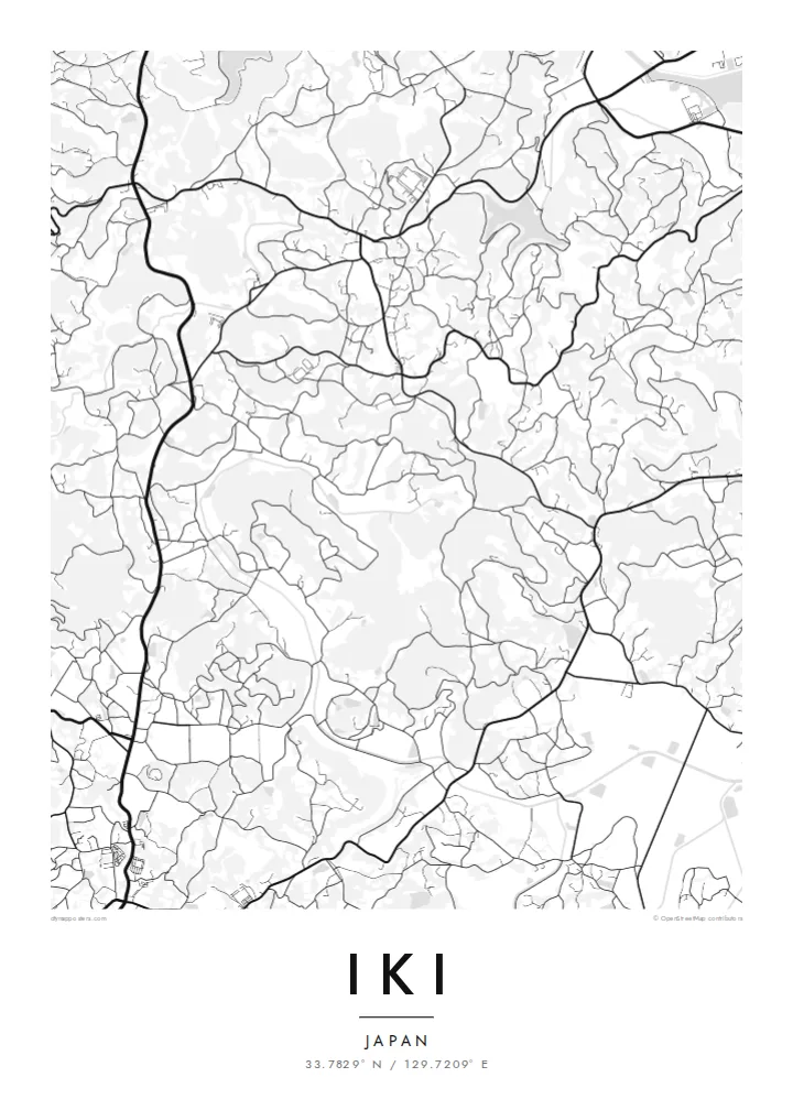
Iki is an island city in Nagasaki Prefecture, set in the strait between northern Kyushu and Tsushima. The whole island fits on a single map: a compact, roughly rounded landmass with a heavily indented coastline, small bays and offshore islets. Inland, low hills and a surprisingly broad central plain are covered in fields and scattered villages rather than steep mountains.
Towns cluster around the harbours. Gōnoura in the southwest is the main ferry port, while Ashibe and others sit on sheltered inlets elsewhere on the coast. Roads loop between them across the island, and the network of rural lanes connecting farms gives the interior a fine, branching texture.
Iki has a long history as a stepping stone between Japan and the Asian mainland. The Harunotsuji site on the island is thought to be the centre of Ikikoku, one of the states mentioned in ancient Chinese records. The island is also known for barley shochu. An Iki map poster frames an entire island in one clear, legible shape.
Countless small bays, headlands and islets surround the island, producing an intricate edge that looks especially striking against open water on the map.
The main port sits in a sheltered bay on the southwest coast, where the densest streets meet ferry terminals and fishing piers.
The interior is unusually flat for an island in the region, with fields, farm roads and small settlements spread evenly across it.
Fai mo koe
Fakaopoopo he aho, he igoa pe he upu a koe, hui te faiga, te lahi pe te tūlaga.
Ko te va'aiga e leai se totogi e maualalo tona resolution ma iai se fakailoga vai. E fakaatagia lomiga ma faila HD i te 300 DPI, e oo atu ki te 7,200 × 10,800 px, e aunoa ma se fakailoga vai.
Aiheā Iki
Island maps have a completeness that city maps rarely do, and Iki is a fine example. It suits islanders who moved to the mainland, frequent visitors, and anyone drawn to Japan's quieter coastal places.
Add a name, a date or a line in Japanese to the title, subtitle and coordinates line. Choose among five styles, with Blueprint and Noir working especially well for coastlines, and download HD files for $9 or order a printed poster.
Oka te poster Iki| Lahi o te lomiga | Manino | Faila |
|---|---|---|
| 30 × 40 cm (11.8 × 15.7″) | 3,543 × 4,724 px | PNG · PDF |
| 29.7 × 42 cm (A3, 11.7 × 16.5″) | 3,508 × 4,961 px | PNG · PDF |
| 42 × 59.4 cm (A2, 16.5 × 23.4″) | 4,961 × 7,016 px | PNG · PDF |
| 45.7 × 61 cm (18 × 24″) | 5,400 × 7,200 px | PNG · PDF |
| 50 × 70 cm (19.7 × 27.6″) | 5,906 × 8,268 px | PNG · PDF |
| 61 × 91.4 cm (24 × 36″) | 7,200 × 10,800 px | PNG · PDF |
Mo te fakatatau, ko te fakaakoakoga e hē totogi e 900 px te lautele, e ihi te fakailoga ma mo te lau komipiuta. Ko nā faila HD e oko ki te 8× te manino i itū taki tahi ma e lomia lelei i te lahi kātoa o te pōhita.
Filifili se ata i te pito i luga o te itulau, ona filifili lea o te Poster Lomiina — se lapoa ma, ka manako ai koe, se faleata — pe ko Faila HD Fakaonaonaina. E tasi te laasaga o te ōkaina, ma ka fakafou loa lau itulau ōkaina pe a mae'a te totogi.
E lomiina i luga o se pepa matte kaliki maualuga e 200 gsm, i se tasi o ni lapoa e ono, mai le 30 × 40 cm ki te 24 × 36″. E kamata te tau o poster lomiina mai le {printFrom}, aofia ai te uta.
Ioe. Filifili se faleata lakau malō i te lanu uli, tea, oki masani pe lakau pouli. E aumai fakatasi mo se tioata e le gagamu ma ua sauni ke tautau. E kamata te tau o poster fakapipi'i i se faleata mai le {framedFrom}, aofia ai te uta.
E leai se totogi o te ave i te lalolagi katoa. Ko te pepa ata taki tasi e lomi e te hoa lomi e latalata mai ki a matou i atunuku e 30+, ma e masani ona aulia i aso galuega e 3–7. E mafai ke e mulimuli i te tulaga ma te ala o tau poloaiga i lalo o Aku Poloaiga. E nai atunuku e 2–5 vaiaso te umi, ma i te mea e le i ave ai matou, e fakailoa atu e te initeneti a e le i totogi koe.
Auina mai se ata pikitia i loto o te 14 aso mai te taimi na oo mai ai, ka toe lomiina e matou e leai se totogi pe toe totogi atu lau tupe.
Ioe. I te mea fakasa'o i luga o lenei itulau, sui te ulutala, te ulutala lalo ma te laina fakamaoniga tulaga ki so se mea e manako ai koe, ona filifili lea o se ata ma se lapoa. Okaina lomiina, fakapipi'i i faleata, ma fakaonaonaina e fakaaogā uma i tau ata tonu.
Mo le $9 e maua e koe ni faila PNG 300 DPI ma PDF sauni-mo-lomiga i lapoa e ono uma, e aunoa ma se fakailoga vai, ke lomiina i so se mea. E le'i mautinoa? Download muamua se va'aiga fakailoga vai e leai se totogi.
