Ridge-following roads
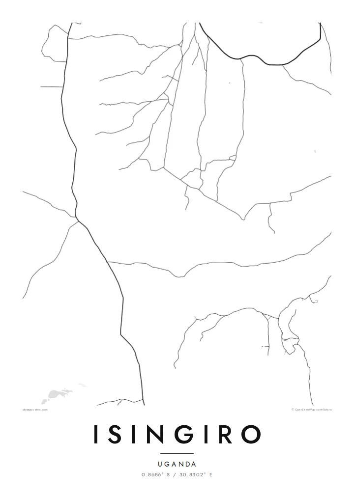
The main routes trace the higher ground and curve with the terrain, so the network looks organic, almost hand-drawn, rather than laid out on a drafting table.
Pōhita mape faigofie · Uganda
0.8686° S / 30.8302° E
A hill-country town in south-western Uganda, where winding roads follow ridges and valleys of banana farmland.


Taone e tahi, lagona e lima
Pa'i se ata ke va'ai ai i luga o te pā. E tutusa te tau o ata uma — i lomiga, fakapipi'i i faleata, pe ko faila HD.
 Pixels mo'i · Faila lomiga 24 × 36″
Manino mo te lomiga
Ko se kupega 100% mai te faila lomiga mo'i. Poster uma — pe lomiina, fakapipi'i i faleata, pe download-ina — e fakaatagia i luga o a matou setula i te 300 DPI, e oo atu ki te 7,200 × 10,800 pixels, ina ia mautinoa e ma'ai pea auala tuai foki i luga o se lomiga 24 × 36″.
I luga o te pa


Te mape
Isingiro sits in the rolling uplands of Uganda's Western Region, south-east of Mbarara and within reach of the border with Tanzania. From above, the town reads as a loose cluster of streets gathered along a main road, with smaller tracks branching off toward farms and homesteads. There is no rigid grid here. The pattern follows the land, bending around slopes and settling into the gentler ground between them.
The surrounding district is known for its banana plantations, and matooke grown here travels to markets across the country. On a map, that farming character shows up as a wide, quiet field of scattered lanes rather than dense urban blocks. Isingiro District is also home to Nakivale, one of the oldest refugee settlements in Africa, a reminder that this rural area has long played a larger role than its size suggests.
An Isingiro map poster captures that restraint well. The thin lines of the roads, the open spaces between them and the way the town fades gradually into countryside make for a composition that feels spacious and calm. It records a highland place drawn without decoration, where the geography does the talking and every curve in the road has a reason behind it.
The main routes trace the higher ground and curve with the terrain, so the network looks organic, almost hand-drawn, rather than laid out on a drafting table.
Beyond the centre, narrow tracks spread out toward plantations and homesteads, producing a fine, scattered texture that fills the outer edges of the frame.
The town lies in the far south of the Western Region, not far from the Tanzanian frontier, in a landscape of low hills and broad, cultivated valleys.
Fai mo koe
Fakaopoopo he aho, he igoa pe he upu a koe, hui te faiga, te lahi pe te tūlaga.
Ko te va'aiga e leai se totogi e maualalo tona resolution ma iai se fakailoga vai. E fakaatagia lomiga ma faila HD i te 300 DPI, e oo atu ki te 7,200 × 10,800 px, e aunoa ma se fakailoga vai.
Aiheā Isingiro
For people with roots in Isingiro, or who have worked or volunteered in the district, this map keeps a specific corner of Uganda close. It suits a hallway or study where something personal but understated belongs, a line drawing rather than a photograph.
You can add your own title, a subtitle such as a family name or a date, and a coordinates line. Choose from five styles, Classic black & white, Noir, Paper, Blueprint or Sand, then download the HD files or order a printed poster.
Oka te poster Isingiro| Lahi o te lomiga | Manino | Faila |
|---|---|---|
| 30 × 40 cm (11.8 × 15.7″) | 3,543 × 4,724 px | PNG · PDF |
| 29.7 × 42 cm (A3, 11.7 × 16.5″) | 3,508 × 4,961 px | PNG · PDF |
| 42 × 59.4 cm (A2, 16.5 × 23.4″) | 4,961 × 7,016 px | PNG · PDF |
| 45.7 × 61 cm (18 × 24″) | 5,400 × 7,200 px | PNG · PDF |
| 50 × 70 cm (19.7 × 27.6″) | 5,906 × 8,268 px | PNG · PDF |
| 61 × 91.4 cm (24 × 36″) | 7,200 × 10,800 px | PNG · PDF |
Mo te fakatatau, ko te fakaakoakoga e hē totogi e 900 px te lautele, e ihi te fakailoga ma mo te lau komipiuta. Ko nā faila HD e oko ki te 8× te manino i itū taki tahi ma e lomia lelei i te lahi kātoa o te pōhita.
Filifili se ata i te pito i luga o te itulau, ona filifili lea o te Poster Lomiina — se lapoa ma, ka manako ai koe, se faleata — pe ko Faila HD Fakaonaonaina. E tasi te laasaga o te ōkaina, ma ka fakafou loa lau itulau ōkaina pe a mae'a te totogi.
E lomiina i luga o se pepa matte kaliki maualuga e 200 gsm, i se tasi o ni lapoa e ono, mai le 30 × 40 cm ki te 24 × 36″. E kamata te tau o poster lomiina mai le {printFrom}, aofia ai te uta.
Ioe. Filifili se faleata lakau malō i te lanu uli, tea, oki masani pe lakau pouli. E aumai fakatasi mo se tioata e le gagamu ma ua sauni ke tautau. E kamata te tau o poster fakapipi'i i se faleata mai le {framedFrom}, aofia ai te uta.
E leai se totogi o te ave i te lalolagi katoa. Ko te pepa ata taki tasi e lomi e te hoa lomi e latalata mai ki a matou i atunuku e 30+, ma e masani ona aulia i aso galuega e 3–7. E mafai ke e mulimuli i te tulaga ma te ala o tau poloaiga i lalo o Aku Poloaiga. E nai atunuku e 2–5 vaiaso te umi, ma i te mea e le i ave ai matou, e fakailoa atu e te initeneti a e le i totogi koe.
Auina mai se ata pikitia i loto o te 14 aso mai te taimi na oo mai ai, ka toe lomiina e matou e leai se totogi pe toe totogi atu lau tupe.
Ioe. I te mea fakasa'o i luga o lenei itulau, sui te ulutala, te ulutala lalo ma te laina fakamaoniga tulaga ki so se mea e manako ai koe, ona filifili lea o se ata ma se lapoa. Okaina lomiina, fakapipi'i i faleata, ma fakaonaonaina e fakaaogā uma i tau ata tonu.
Mo le $9 e maua e koe ni faila PNG 300 DPI ma PDF sauni-mo-lomiga i lapoa e ono uma, e aunoa ma se fakailoga vai, ke lomiina i so se mea. E le'i mautinoa? Download muamua se va'aiga fakailoga vai e leai se totogi.
Latalata
